Belize Weather Forecast: January 3, 2020


 General Situation:
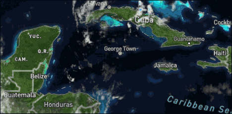
Ambergris Caye: Conditions this morning by Elbert just before or after this post!
Belize NMS:
Present Condition: Clear skies. Mainly fair, windy and warm conditions will continue today, then a cold front approaches tomorrow.
Advisories: *Small Craft Caution is in effect for gusty winds and locally rough seas.*
24-hour forecast:
Mostly sunny skies today with little or no rainfall expected and partly cloudy skies tonight with only isolated showers developing.
Winds: East-Southeast | 10-20 kts | Gusty
Sea State: Moderate-Rough
Sea Surface Temperature (°f): 82
Outlook:
For Saturday and Saturday night is for some cloudy spells with a few showers, periods of rain or isolated thunderstorms developing as a cold front crosses the country.
Tropical Weather Outlook:
Tropical cyclone formation is not expected in the North Atlantic, the Caribbean Sea or the Gulf of Mexico within the next 48 hours.
Click for more...
Marine Conditions:
| |
Winds |
Seas |
Waves |
Details |
| Today |
E-SE 10-20 kts |
Moderate-Rough |
5-7 ft |
LITTLE OR NO RAINFALL. |
| Tonight |
E-NE 10-20 kts |
Moderate-Rough |
5-7 ft |
ISOLATED SHOWERS. |
| Tomorrow |
N-NW 10-20 kts |
Moderate |
4-6 ft |
A FEW SHOWERS, ISOLATED THUNDERSTORMS OR PERIODS OF RAIN. |
| Outlook |
N-NW 10-20 kts |
Moderate-Rough |
4-7 ft |
A FEW SHOWERS OR PERIODS OF RAIN MOSTLY SOUTH. |
The Caribbean Sea
The GFS model shows large-scale anticyclonic wind flow that covers
the eastern half of the Gulf of Mexico, the Caribbean Sea, and
the Atlantic Ocean from 60W westward. The GFS model for 250 mb
shows an anticyclonic circulation center in the Windward Passage.
The anticyclonic circulation center is about 60 nm to the NE of
the SE Bahamas at 500 mb. The anticyclonic circulation center is
about 60 nm to the NE of the NW Bahamas at 700 mb.
Comparatively drier air in subsidence in water vapor imagery covers
the Caribbean Sea to the east of the line from 20N82W to 10N81W.
Comparatively drier air in subsidence also is in the Atlantic
Ocean from 15N southward from 50W westward, and from 10N to 15N
between 36W and 50W.
The latest scatterometer data, from 03/0200 UTC, show a trough
about 60 nm or so to the east and southeast of Puerto Rico. Broken
to overcast low level and middle level clouds and rainshowers are
within 60 nm to 75 nm on either side of the line that extends
from 20N60W to 17N67W to 16N70W to 16N73W.
High pressure to the north of the area will maintain fresh to
occasionally strong trade winds off Colombia through the next
several days. A cold front will move through the Yucatan Channel
into the northwest Caribbean Sea by Saturday. The cold front will
be followed by an increase in winds and seas. The cold front will
reach from eastern Cuba to Nicaragua on Sunday afternoon, and
dissipate by Monday afternoon.
| |
High |
Low |
| Coastal |
31° C
87° F
|
24° C
75° F
|
| Inland |
34° C
93° F
|
21° C
70° F
|
| Hills |
27° C
81° F
|
18° C
64° F
|
| TIDES: |
|
| Low: 10:18 AM |
High: 4:13 PM |
| Low: 11:20 PM |
High: 4:52 AM (Sat) |
| Sunrise: 6:23 AM |
Moonrise: 12:16 PM |
| Sunset: 5:30 PM |
Moonset: 12:46 AM (Sat) |

Four Day Weather Outlook:

For more information, check the Daily Tropical Weather Outlook.
Climate Prediction Center's Central America Hazards Outlook
Belize National Emergency Management Organization (NEMO)
Ambergris Caye:
https://www.wunderground.com/weather/bz/san-pedro
Philip S W Goldson International Airport:
https://www.wunderground.com/weather/bz/belize/MZBZ?cm_ven=localwx_today
Belmopan:
https://www.wunderground.com/weather/bz/belmopan/17.26%2C-88.78
Caye Caulker:
http://cayecaulkerweather.com/weatherdata/caye-caulker-belize-live-weather-data.htm
|


