From Belmopan...
There is a lot of activity around us at present. I nearly said there was enough activity and conditions to actually start up a rotation, it looked as if there was a good chance that might happen right off our coast. there has been a massive ITCZ swell-up just off our coast, but the rotation I was expecting has actually started further north, north of the Yucatan and west of Florida Cays, it has the speed of a Storm, but not the moisture, unless it sucks moisture up from the ITCZ activity off our coast. There are two massive ITCZ swell-ups right off our coast, caused overcast conditions and fog in central Belize, must be producing a lot of rain at sea, the radar is still not working, despite me telling them yesterday, :'(.
Looks like this morning will be very cloudy, probably rain along the coast, may clear later, then more ITCZ activity this afternoon, evening.

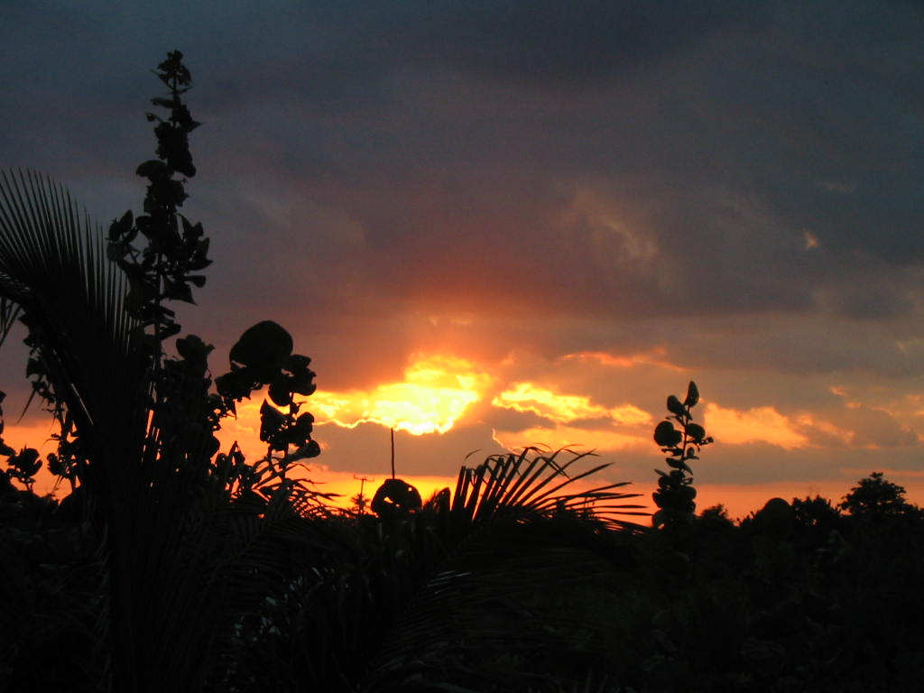
You can see the very large area ITCZ swell-up out at sea, to the east of most of central and north Belize, and another one even further away, near Roatan Island. The out-spill is putting high and medium cloud out over most of Belize, causing low temperatures and has resulted in Fog in many parts.

Temperatures in Belmopan :
( Coast usually cooler, hills even cooler )
Fri max. 32°C 89°F Last night min. 24°C 75°F
Ambergris Caye:
https://www.wunderground.com/q/locid:BHXX0104;loctype:1
Belmopan:
https://www.wunderground.com/personal-weather-station/dashboard?ID=MD1029#history
Caye Caulker:
https://www.wunderground.com/personal-weather-station/dashboard?ID=IBELIZED2#history
Monthly Weather Summary, September 2017
National Meteorological Service of Belize
SEPTEMBER 2017 WAS THE MOST ACTIVE MONTH ON RECORD FOR THE ATLANTIC HURRICANE SEASON WITH THIRTEEN NAMED STORMS AND EIGHT HURRICANES, FIVE OF WHICH WERE MAJOR HURRICANES. THE PROXIMITY OF HURRICANE IRMA INFLUENCED WEATHER CONDITIONS FOR A FEW DAYS, HOWEVER NO TROPICAL CYCLONES TRAVERSED THE COUNTRY. THREE TROPICAL WAVES CROSSED THE COUNTRY PRODUCING MOIST AND UNSTABLE CONDITIONS BUT MOST AREAS RECEIVED BELOW AVERAGE RAINFALL DURING SEPTEMBER.
THE MONTH STARTED OUT FAIR WITH LIGHT SHOWERS ONLY OVER THE NORTHERN BELIZE DISTRICT AS AMODERATE EAST-SOUTHEASTERLY AIRFLOW PREVAILED. BY THE SECOND DAY A WEAK TROPICAL WAVE CROSSED THE COUNTRY PRODUCING A FEW SHOWERS AND ISOLATED THUNDERSTORMS OVER NORTHERN AND CENTRAL AREAS WITH INCREASED ACTIVITY OVER THE SOUTH AND COAST OVERNIGHT. SOME SHOWERS AND THUNDERSTORMS CONTINUED TO AFFECT THE SOUTH AND COAST ON THE THIRD MORNING AS A MID TO UPPER LEVEL TROUGH SYSTEM OVER THE NORTHERN BAY OF CAMPECHE INTERACTED WITH THE TROPICAL WAVE. FROM THE FOURTH TO THE SIXTH A SLACK PRESSURE GRADIENT OVER THE NORTHWEST CARIBBEAN AND THE YUCATAN PENINSULA DOMINATED THE AREA SUPPORTING LIGHT EASTERLY WINDS AND FAIR CONDITIONS WITH SHOWERS CONFINED TO THE MAYA MOUNTAINS IN THE AFTERNOON AND ALONG THE SOUTH COAST AT NIGHT. ON THE SEVENTH AND EIGHTH WINDS REMAINED LIGHT AND CONDITIONS CONTINUED MOSTLY FAIR WITH ONLY A FEW EARLY MORNING SHOWERS ALONG THE COAST AND OVER THE INTERIOR DURING THE AFTERNOON. A BROAD CIRCULATION ASSOCIATED WITH HURRICANE IRMA OVER NORTHERN CUBA SUPPORTED WEST TO NORTHWESTERLY WINDS ON THE NINTH ALONG WITH SHOWERS AND ISOLATED THUNDERSTORMS OVER ROCKVILLE, DANGRIGA AND THE MAYA MOUNTAINS. THIS SYSTEM CONTINUED TO AFFECT THE COUNTRY ON THE TENTH PRODUCING A FEW SHOWERS AND ISOLATED THUNDERSTORMS OVER THE SEA IN THE MORNING AND OVER THE NORTH IN THE AFTERNOON SHIFTING BACK TO THE SEA AND SOUTH DURING THE NIGHT.
CLOUDY SKIES ALONG WITH SHOWERS AND ISOLATED THUNDERSTORMS AFFECTED MAINLY NORTHERN AND WESTERN PARTS OF THE COUNTRY ON THE ELEVENTH THEN THE SOUTH AND COAST OVERNIGHT AS HURRICANE IRMA APPROACHED FLORIDA. ON THE EVENING OF THE TWELFTH SHOWERS AND THUNDERSTORMS INCREASED OVER CENTRAL, COASTAL AND SOUTHERN AREAS AS A FEEDER BAND FROM HURRICANE IRMA MOVED OVER THE AREA. BY THE THIRTEENTH MAINLY FAIR CONDITIONS PREVAILED WITH ONLY A FEW SHOWERS OVER THE CAYO DISTRICT IN THE AFTERNOON AND OVER THE NORTH COAST DURING THE NIGHT. ON THE FOURTEENTH A 1011MB LOW PRESSURE WAS OVER THE COUNTRY AND SEVERAL SHOWERS AND THUNDERSTORMS DEVELOPED OVER NORTHERN AND CENTRAL AREAS IN THE MORNING AND OVER WESTERN AREAS IN THE AFTERNOON WITH MOST OF THE ACTIVITY DIMINISHED BY NIGHTFALL. DURING THE FIFTEENTH AND SIXTEENTH A SLACK PRESSURE GRADIENT DOMINATED THE AREA WITH MOSTLY FAIR CONDITIONS EXCEPT FOR INTENSE THUNDERSTORM ACTIVITY OVER THE SOUTHERN TOLEDO DISTRICT OVERNIGHT ON THE FIFTEENTH. ON THE SEVENTEENTH A TROPICAL WAVE WAS EAST OF THE AREA AND SUPPORTED CLOUDY SPELLS ALONG WITH A FEW SHOWERS AND ISOLATED THUNDERSTORMS ESPECIALLY SOUTH. THE TROPICAL WAVE TRAVERSED THE COUNTRY ON THE EIGHTEENTH WITH MODERATE SHOWERS AND ISOLATED THUNDERSTORMS OVER MOST AREAS DURING THE MORNING THEN MOSTLY INLAND IN THE AFTERNOON AND OVER CENTRAL AND SOUTHERN AREAS OVERNIGHT. ON THE NINETEENTH AND TWENTIETH A RIDGE OF HIGH PRESSURE OVER THE CARIBBEAN SUPPORTED A LIGHT EAST TO SOUTHEAST AIRFLOW AND MOSTLY FAIR WEATHER WITH ONLY ISOLATED THUNDERSTORMS AND A FEW SHOWERS OVER THE MAYA MOUNTAINS IN THE AFTERNOON AND SOUTH AT NIGHT.
DURING THE TWENTY-FIRST TO THE TWENTY-FOURTH A SLACK PRESSURE PATTERN REMAINED OVER THE AREA THAT SUPPORTED LIGHT EAST-SOUTHEASTERLY SURFACE WINDS AND MAINLY FAIR CONDITIONS ACROSS THE COUNTRY WITH MOST OF THE SHOWER ACTIVITY CONFINED TO THE MAYA MOUNTAINS IN THE AFTERNOON AND OVER THE SOUTH AND COAST AT NIGHTTIME. ON THE TWENTY-FIFTH LOW PRESSURES OVER MEXICO EXTENDED TO BELIZE AND SUPPORTED A MODERATE EAST TO SOUTHEASTERLY AIRFLOW AND WARM CONDITIONS WITH A FEW MORNING SHOWERS OVER THE ORANGE WALK DISTRICT THEN IN THE WEST DURING THE AFTERNOON AND ALONG THE SOUTH COAST AFTER SUNSET. THE CENTRAL AMERICAN MONSOON TROUGH EXTENDED ACROSS SOUTHERN BELIZE ON THE TWENTY-SIXTH WHILE CONDITIONS CONTINUED FAIR AND WARM WITH ONLY ISOLATED SHOWERS OVER THE EXTREME NORTH. A VERY WEAK SURFACE TROUGH WAS ANALYSED ALONG THE COAST ON THE TWENTY-SEVENTH BUT THE WEATHER REMAINED MOSTLY FAIR WITH A FEW SHOWERS AND ISOLATED THUNDERSTORMS OVER THE NORTHWEST PORTION OF ORANGE WALK IN THE AFTERNOON AND LIGHT SHOWERS ALONG THE COAST INCLUDING BELIZE CITY AND LADYVILLE OVERNIGHT. ON THE TWENTY-EIGHT ANOTHER TROPICAL WAVE CROSSED THE COUNTRY THAT PRODUCED A FEW SHOWERS AND ISOLATED THUNDERSTORMS OVER INLAND AREAS IN THE AFTERNOON THEN CENTRAL AND NORTHERN AREAS DURING THE EVENING AND NIGHT. THE INTERACTION BETWEEN A BROAD SURFACE TROUGH OVER THE NORTHWEST CARIBBEAN AND AN UPPER LEVEL TROUGH OVER THE EASTERN GULF OF MEXICO ALONG WITH MOISTURE ADVECTED FROM THE MONSOON TROUGH SUPPORTED VERY MOIST AND UNSTABLE WEATHER CONDITIONS ACROSS THE COUNTRY ON THE TWENTY-NINTH THAT RESULTED IN SEVERAL SHOWERS AND THUNDERSTORMS ESPECIALLY OVER NORTHERN AND CENTRAL AREAS, WHERE THE ACTIVITY OCCURRED MOST OF THE NIGHT INTO THE EARLY MORNING. BOTH TOWERHILL AND BELMOPAN RECEIVED MORE THAN AN INCH OF RAINFALL DURING THE TWENTY-FOUR HOUR PERIOD. THE LAST DAY OF THE MONTH CONTINUED CLOUDY AND SHOWERY AS A SURFACE TROUGH OVER THE YUCATAN PENINSULA EXTENDED TO NORTHERN BELIZE PRODUCING HEAVY SHOWERS AND THUNDERSTORMS MAINLY ALONG THE COAST IN THE MORNING AND ALONG THE SOUTH COAST IN THE AFTERNOON WITH MOST OF THE ACTIVITY CONFINED TO OFFSHORE AREAS BY EVENING.


![[Linked Image]](http://Ambergriscaye.com/art6/fdf9dsfsjdfosiufsd.jpg)

![[Linked Image]](https://Ambergriscaye.com/art6/dfslfjdksjfldkfsdlfjlsdf9999.jpg)


