The National Hurricane Center is issuing advisories on Hurricane Epsilon, located over the west-central Atlantic a few hundred miles southeast of Bermuda.
Epsilon is a Major Category 3 hurricane on the Saffir-Simpson Hurricane Wind Scale and is centered about 310 miles southeast of Bermuda and is moving to the west-northwest at about 8 mph. Sustained winds are near 115 mph.
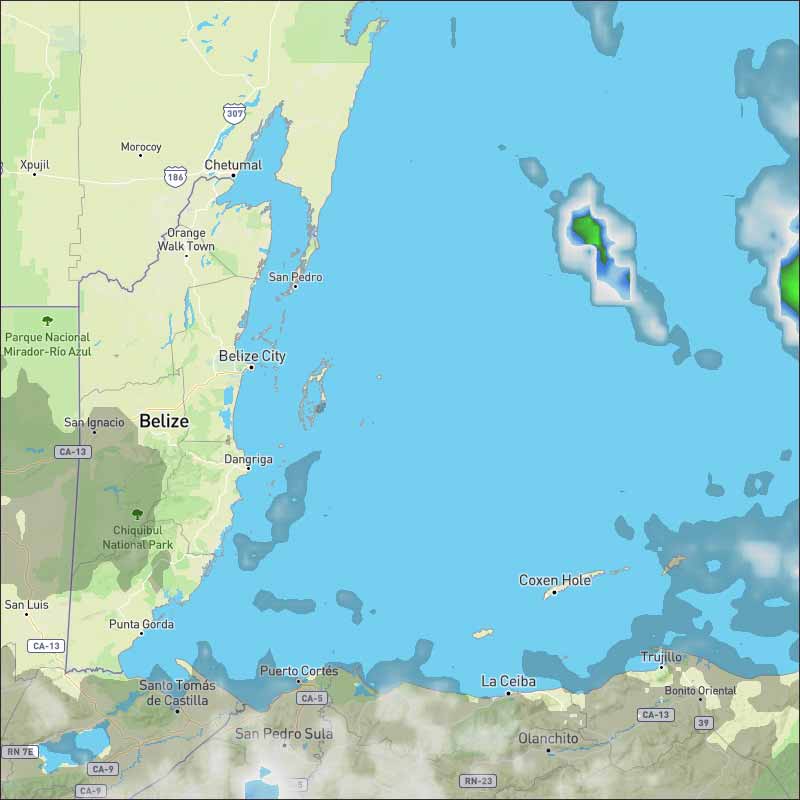
A trough of low pressure located over the western Caribbean Sea is producing a large area of disorganized showers and thunderstorms which primarily extend near Jamaica, the Cayman Islands, and Cuba. Development of this system is unlikely to occur during the next few days as it passes near western Cuba and moves over the Straits of Florida. By late this weekend or early next week, however, some slow development is possible while the system moves generally northeastward from near the northwestern Bahamas toward the western Atlantic. Regardless of development, locally heavy rainfall is possible over portions of Cuba, South Florida, and the Bahamas through early next week.
* Formation chance through 48 hours...low...near 0 percent.
* Formation chance through 5 days...low...20 percent.
A broad but disorganized area of low pressure continues to swirl over the western Caribbean Sea. Strong wind shear will prevent this low from developing any further, and tropical development is no longer likely with this feature. However, as this feature drifts northward this weekend, locally heavy rain can fall over western Cuba and the Bahamas. Tropical development is not expected elsewhere in the basin through at least the weekend.
In the longer range, a cold front will reach the southern Gulf of Mexico or northwestern Caribbean early next week. An area of low pressure may try to develop by midweek in the southwestern Gulf of Mexico or far northwestern Caribbean Sea near the tail end of this front. This area will be monitored for possible tropical development next week.
![[Linked Image]](//Ambergriscaye.com/art8/hurricaneoutlook201022.jpg)
![[Linked Image]](//Ambergriscaye.com/art8/hurricaneglobe201022.jpg) For more information, check the daily Tropical Weather Outlook, click here
For more information, check the daily Tropical Weather Outlook, click here


 General Situation:


![[Linked Image]](http://Ambergriscaye.com/art8/hurricaneoutlook201022.jpg)
![[Linked Image]](http://Ambergriscaye.com/art8/hurricaneglobe201022.jpg)


![[Linked Image]](http://Ambergriscaye.com/art8/eehcdfknfecddgnk.jpg)
![[Linked Image]](http://Ambergriscaye.com/art8/dlmlbijgeampghgk.jpg)
![[Linked Image]](http://Ambergriscaye.com/art8/dailywx201022b.jpg)


