General Situation:
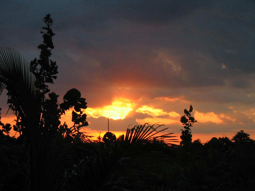
Ambergris Caye: Conditions this morning by Elbert just after this post!
Belize NMS:
Present Condition: Cloudy skies with rain throughout the country this morning, including in San Pedro, where there was rain last night! And it's a a very grey morning. Moist and unstable conditions continue across the country.
Advisories: Small craft caution is in effect for gusty winds and locally rough seas near heavy showers or thunderstorms. A flood watch is in effect for the possibility of flooding over low-lying and flood prone areas across the country.
24-hour forecast:
Cloudy with a few showers, periods of rain and isolated thunderstorms mainly over the northern and central coast and cayes, over the orange walk and corozal districts this morning, then over inland areas this afternoon. Showers, periods of rain and thunderstorms will increase across the country tonight.
Winds: E-SE, 10-20 kts Gusty
Sea State:
Moderate - Rough
Waves: 4-7 ft
Sea Surface Temperature (°f): 85
Outlook:
For Wednesday and Wednesday night is for showers, periods of rain and thunderstorms to continue around the country.
Sargassum Forecast from May 25 to June 1:
There continues to be a medium to high chance of more sargassum landing on beaches across the country during the next few days. San Pedro has a high probability with a moderate impact.
Tropical Weather Outlook:
Models are not showing cyclonic development in Caribbean waters for the month of May.
Click for more of the tropical weather outlook...
Marine Conditions:
Phoenix Resort in San Pedro
The Caribbean Sea
Precipitation: numerous strong is in the Isthmus of Tehuantepec
of southern Mexico, between 93W and 96W, with Tropical Storm
Agatha, downgraded from a hurricane, at 31/0300 UTC. Widely
scattered to scattered moderate, and isolated strong, are in
Central America from Honduras and Guatemala to the Yucatan
Peninsula of Mexico, in a broad area of surface low pressure.
Broad upper level anticyclonic wind flow, and multilayered
moisture, cover the area that is to the west of the line that
is from Hispaniola to Panama.
The surface pressure gradient, between subtropical high pressure
and lower pressure in Colombia, is supporting fresh to strong
trade winds in the central Caribbean Sea. Fresh to strong winds
also are in the far western Caribbean Sea. Moderate to fresh
trade winds are elsewhere. The wave heights range from 6 feet to
8 feet in the central Caribbean Sea; from 5 feet to 7 feet in
the far western Caribbean Sea; and from 4 feet to 6 feet
elsewhere.
The subtropical ridge north of the area will support fresh to
strong trade winds in the central Caribbean Sea through Wed
evening. Moderate to fresh trades will prevail across much of
the remainder of the Caribbean into late week. A large area of
low pressure may form in the northwestern Caribbean by mid-week.
A tropical depression could form in the southeastern Gulf or
northwestern Caribbean Sea late in the week. There is
uncertainty with this expected system, however, shower and
thunderstorm activity as well as winds will be on the increase
for the northwestern Caribbean late this week and into the
upcoming weekend.
On this Tuesday morning, NHC is highlighting a large and complex area of low pressure that is expected to develop near the Yucatan Peninsula and the northwestern Caribbean Sea in a couple of days, partially related to the remnants of Agatha from the eastern Pacific. Despite strong upper-level winds over the area, this system could become a tropical depression while it moves northeastward over the northwestern Caribbean Sea and southeastern Gulf of Mexico late this week. It has a low (10 percent) chance of formation during the next 48 hours and a medium (60 percent) chance during the next five days. Regardless of development, locally heavy rainfall is likely across portions of southeastern Mexico, the Yucatan Peninsula, Guatemala, and Belize during the next few days, spreading across western Cuba, South Florida, and the Florida Keys by the end of the week
For further information on tropical conditions, check the daily Tropical Weather Outlook, click here
On Ambergris Caye this morning the sea around our barrier reef is rough from a 16 mph wind. The evenings hard rains are still with us. The expected high temperature for today is 86 f.
Rain worked its way down over much of the country last night and is now moving back up northwards. So presently only raining in north Corozal, but most of the country under cloud, some heavy cloud. We are still right in the middle of very significant ITCZ activity.
Looks as if it will be dry for most of the country this morning, but cloudy and little or no wind. Rain patches are likely to redevelop this afternoon and or evening.
Last Night 24 °C 76 °F Yesterday max. 33 °C 92 °F Yesterday Rain 4.9 mm ( 0.2 " ) Over Night Rain 0 mm ( 0 " )
Present Condition: Partly cloudy on the mainland, more so in the north. Cloudy in San Pedro. Moist and unstable conditions will continue across the country. A flood watch remains in effect for the possibility of localized flooding over low-lying and flood prone areas across the country, especially in the north. A small craft caution remains in effect for gusty winds and rough seas near heavy showers or thunderstorms.
24hr Forecast: Cloudy spells with a few showers, periods of rain and isolated thunderstorms mainly over northern and inland areas this afternoon. Some showers, periods of rain and thunderstorms will increase across the country tonight and early tomorrow morning, especially over northern, coastal and offshore areas, with activity being isolated on the mainland during the daytime.
Outlook: For Wednesday afternoon is for cloudy spells with a few showers, periods of rain and isolated thunderstorms mostly north, then north and coastal areas Wednesday night and early Thursday morning, decreasing.
REGION 7 - On the RIO HONDO at Blue Creek North, and downstream at Santa Cruz, San Antonio, San Roman, and Douglas, all levels are above normal and continues increasing slowly. The NEW RIVER at Tower Hill and Caledonia are above normal and increasing slowly.
REGION 9 - On the MACAL RIVER, reservoir levels at all BECOL facilities remain below the spillways; and at San Ignacio, levels remain below the low-level bridge. The MOPAN RIVER at Benque Viejo Town is normal and steady.
On the BELIZE RIVER at Double Run, levels are normal and steady; lagoon levels on the CROOKED TREE LAGOON are below the causeway and increasing slowly.
REGION 11- On the SIBUN RIVER at Freetown Sibun, levels are above normal and steady. The SOUTHERN LAGOON at Gales Point Village is above normal and steady.
In watersheds on the EASTERN SLOPES OF THE MAYAN MOUNTAINS, levels are above normal and increasing slowly. The SITTEE RIVER at Kendal Bridge is above normal.
On the Swasey and Bladen branches of the MONKEY RIVER, levels above normal and increasing. On the RIO GRANDE at San Pedro Columbia, levels remain below normal and steady; and Big Falls South, above normal levels and decreasing levels exist. The DEEP RIVER at Medina Bank is above normal and increasing.
On the MOHO RIVER at Blue Creek South and Jordan, levels are above normal and increasing. On the TEMASH RIVER at Crique Sarco, below normal and steady levels continue. REGION 13 - The SARSTOON RIVER is above normal and receding.
FLOOD FORECAST
RESIDENTS ARE ADVISED THAT A FLOOD WATCH IS IN EFFECT FOR THE REGIONS 7 AND REGION 9
REGION 7 - On the RIO HONDO at Blue Creek North, and downstream at Santa Cruz, San Antonio, San Roman, and Douglas to the coast, above normal levels expected to continue. On the NEW RIVER, at Tower Hill, increasing levels expected; and at Caledonia, above normal and increasing levels expected to continue.
REGION 9 - On the MACAL RIVER, at all BECOL facilities, reservoir levels are expected to increase; and at San Ignacio, increasing levels are expected.
On the MOPAN RIVER at Benque Viejo Town, above normal levels expected. On the BELIZE RIVER at Double Run, levels are expected to increase to above normal levels. On the CROOKED TREE LAGOON, levels are expected to increase but remain below the causeway.
RESIDENTS ARE ADVISED THAT THE POSSIBILITY OF FLOODING IS IN EFFECT FOR REGION 11 AND REGION 13
REGION 11 - On the SIBUN RIVER at Freetown Sibun, above normal and increasing levels expected. Above normal levels expected on the SOUTHERN LAGOON near Gales Point Village.
In watersheds on the EASTERN SLOPES OF THE MAYAN MOUNTAINS, and on the SITTEE RIVER at Kendal Bridge, levels are expected to APPROACH FLOOD STAGE.
On the Swasey and Bladen branches of the MONKEY RIVER, increasing levels are expected to APPROACH FLOOD STAGE; On the RIO GRANDE at San Pedro Columbia and Big Falls South, INCREASING LEVELS EXPECTED. On the DEEP RIVER at Medina Bank, FLOOD LEVELS expected
On the MOHO RIVER at Blue Creek South and Jordan, levels are expected to reach FLOOD STAGE. The TEMASH RIVER at Crique Sarco, is expected to increase.
REGION 13 - On the SARSTOON RIVER, above normal and increasing levels expected.
The next Flood Report and Forecast will be issued as necessary.
REMNANTS OF HURRICANE AGATHA CROSSING INTO THE GULF OF MEXICO /NORTHWESTERN CARRIBBEAN SEA TUESDAY, 31st MAY, 2022 As at 1:00 PM
The National Meteorological Services of Belize and the National Emergency Management Organization (NEMO) hereby inform the general public that Hurricane Agatha, the strongest hurricane on record in May made landfall as a strong Category 2 hurricane about 5 miles west of Puerto Angel in Southern Mexico. Agatha has since dissipated, but remnants might emerge in the northwest Caribbean Sea with torrential rains over parts of Central America, specifically over Belize. The system may redevelop at that point and it is not forecasted to make landfall on Belize. Just over four inches of rainfall has affected northern parts of Belize and another 2 to 4 inches is likely within the next couple of days. Heavy rainfall and thunderstorms are expected in most areas of the country especially at night, a flood watch is in effect for areas prone to flooding.
NEMO hereby advises the general public to be alert and to pay attention to the weather situation which is likely to get worse over the next couple days. People in the cayes, along rivers, creeks, and low-lying areas, farmers and fisher folks, are cautioned to be alert and take the necessary actions to save life. Drivers are asked to drive slow and put on their hazard lights when driving in the rain.
Stay alert, be prepared. NEMO staff countrywide are on alert.
The opinions and views expressed on this board are the subjective opinions of Ambergris Caye Message Board members and not of the Ambergris Caye Message Board its affiliates, or its employees.


 General Situation:


![[Linked Image]](http://Ambergriscaye.com/art8/285433521_5447106575342176_3789682923580494314_n.jpg)


![[Linked Image]](http://Ambergriscaye.com/art8/284541243_1728723590802707_8826987022318909060_n.jpg)
![[Linked Image]](http://Ambergriscaye.com/art8/dailywx220531b.jpg)
![[Linked Image]](http://Ambergriscaye.com/art8/dailywxB220531.jpg)
![[Linked Image]](http://Ambergriscaye.com/art8/285310072_3293037294310999_8724467887012088760_n.jpg)
![[Linked Image]](http://Ambergriscaye.com/art8/pppppfi.jpg)


