Driving directions from San Ignacio to Placencia, Belize
Driving directions from San Ignacio to Placencia, Belize
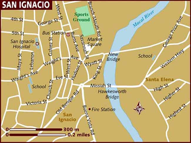
Follow the signs to the Western Highway. You can go on either bridge, as you can see on the right of this map. You can see the road marked Western on the far right.
Follow the Western highway headed east, towards Belmopan. You will turn right onto Hummingbird highway. Hummingbird Highway is by far the prettiest part of the drive. You will wind through hills and towns, up and over bluffs, and through the Mayan mountains.
As you approach Dangriga, you will see a Shell Gas station on your right. The turn off of the Hummingbird Highway and onto the “Southern Highway” is just ahead. Turn Right onto the Southern Highway. You should see signs for “Punta Gorda” and/or “Placencia”.
Follow the Southern Highway for about 35 minutes, and then you’ll approach a round-a-bout. Here, follow the signs to Placencia. It’s the “left turn” in the round-a-bout. You are now on the road to the Peninsula.
There are no turns off of this road, just lots and lots of speed “humps.” The only “turn” that appears is a turn off to Riversdale. Don’t make that left, but rather stay on the road to Placencia. After you drive through Maya Beach and the somewhat rough looking (but relatively safe) village of Seine Bight, you will be closer to the tip of the peninsula, where the village is.
You will pass Turtle Inn on the left, and Chabil Mar, you will soon see an orange grocery store called Top Value.
Two points:
- The total drive can take from 2 ½ hours to 3 ½ hours. The speed humps, traffic and familiarity with turns and roads can greatly affect your drive. If you are able to feel patient and enjoy the drive – it’s very pretty.
- If you put the drive into Google Maps – it may take you through unpaved roads. These can be treacherous. It can be done, but because it’s a dirt road, it will unlikely save you time, but definitely cause you headaches.