AmbergrisCaye.com Home
Posted By: Marty Tropical Storm Franklin near Yucatan Peninsula - 08/06/17 11:26 PM

Tropical storm warning flags are flying for the Yucatan Peninsula, with a tropical storm watch for the Belize coast, as Potential Tropical Cyclone 7 could become a named storm before it sloshes ashore late Monday. Models agree the system will likely strengthen more dramatically in the Bay of Campeche before an expected second landfall later this week in northeast Mexico.

The NOAA/NWS National Hurricane Center (NHC) upgraded the wave known as Invest 90L to PTC 7 at 5:00 pm EDT Sunday. PTC is a new "potential tropical cyclone" designation, which was introduced this year, tracking systems that are not yet tropical storms but that could affect land as tropical storms within 48 hours.

An area of low pressure that is located over the northwestern Caribbean continues to lack a well-defined center of circulation, however, it does have a broad area of circulation. Because of this, it is not yet a Tropical Depression. With that said, however, it is very likely that this system will become a tropical storm sometime on Monday before it reaches the coast of the Yucatan Peninsula and thus Tropical Storm Warnings have been issued for the Yucatan Peninsula.

Satellite estimated winds and buoy reports indicate that winds with Potential Tropical Cyclone 7 are near 35 mph. Satellite loops indicate that a majority of the thunderstorm activity is occurring on the northern and eastern sides of this system and this is likely due to westerly wind shear of 20 to 25 knots occurring on the northern and eastern quadrants of it.

So, it is very likely that this system will be a tropical storm by the time it reaches the eastern Yucatan Peninsula on Monday night. Potential Tropical Cyclone 7 will then cross the Yucatan Peninsula on Tuesday and then emerge in the Bay of Campeche on Tuesday night. From there, I think that there is a very high chance that Invest 90-L will become a hurricane in the Bay of Campeche on Wednesday.

I continue to think that Potential Tropical Cyclone 7 will come ashore very near Tampico, Mexico on Thursday afternoon as a 80-100 mph hurricane.

For Everyone On The Yucatan Peninsula & Belize: Tropical storm conditions are likely across the Yucatan Peninsula beginning on Monday afternoon and continuing through Monday night and part of Tuesday. Up to 60 mph winds, heavy rain with amounts of 4 to 8 inches and very rough seas are expected. Weather conditions are likely to improve starting late Tuesday.


Crown Weather

Updated Daily Tropical Weather page...

NOAA expects a rapid spin up very soon, very quickly. - Potential Tropical Cyclone Seven: "...Disturbance expected to become a tropical storm overnight..."

http://www.nhc.noaa.gov


NEMO Issues Tropical Storm Watch - Emergency Operations Centers Convene Countrywide

NEMO Emergency Operations Centers (EOC's) have been convening countrywide since this morning, Sunday August 6, 2017, in the face of threats from a tropical system in the Caribbean which has been showing signs of organization and development.

At 8:00 A.M today, the National Emergency Management Organization (NEMO) issued its first official advisory on the tropical system, stating: "The National Emergency Management Organization (NEMO), in collaboration with the National Meteorological Service, hereby informs the general public that a strong tropical wave over the west-central Caribbean Sea continues to show some signs of organization as it moves west-north westward at 10-15mph."

Since then, Emergency Operations Centers have met in every region of the country to assess the threat from the tropical system and fine-tune plans for effective response in the event of any impact to any part of the country. Such meetings occurred this morning in Rural Belize District (North and Central); Cayo District; Stann Creek and Toledo Districts; the Northern Region consisting of Orange Walk and Corozal Districts; and San Pedro, Ambergris Caye (Belize Rural South). And, this afternoon at 2:00 PM, Emergency Management Committees that make up the Belize City Emergency Management Organization (CEMO) convened at City Hall.

In its second official advisory on the tropical system disseminated at 3:30 P.M today, NEMO issued a Tropical Storm WATCH, as a precaution, for a potential Tropical Storm. The area of the watch includes the Belize District, Belize City, the Cayes, and parts of the Orange Walk and Corozal districts. The NEMO advisory states, "The strong Tropical Wave in the west-central Caribbean Sea has an 80% chance of becoming a Tropical Depression or a Tropical Storm overnight...The center of the potential Tropical Storm is forecasted to make landfall sometime between Belize and Mexico border on Monday or Tuesday morning of this week. The forecast is for heavy rainfall over Belize which is likely to cause flash floods."

The National Emergency Management Organization (NEMO) says it will continue, in collaboration with the National Meteorological Service, to monitor the system and issue official advisories as necessary. It advises the general public to keep informed and stay alert.
NEMO ADVISORY NO. 2: A Tropical Storm WATCH is being issued

The National Emergency Management Organization (NEMO) in collaboration with the National Meteorological Service hereby informs the general public that the strong Tropical Wave in the west-central Caribbean Sea has an 80% chance of becoming a Tropical Depression or a Tropical Storm over night. The system with maximum sustained winds near 35mph is moving to the West-North-West at 12mph. The current position is near 15.6 North Latitude and 82.0 West Longitude or some 90 miles East-North-East of Cabo Gracias a Dios, off the Nicaraguan/Honduras border. The center of the potential Tropical Storm is forecasted to make landfall sometime between Belize and Mexico border on Monday or Tuesday morning of this week. The forecast is for heavy rainfall over Belize which is likely to cause flash floods. We can expect as much 6 inches of rainfall with possible higher amounts of up to 12 inches, gusty winds, and severe thunderstorms late Monday evening into Tuesday morning.

A Tropical Storm WATCH is being issued, as a precaution, for the potential Tropical Storm. The area of the watch includes the Belize District, Belize City, the cayes, and parts of the Orange Walk and Corozal districts.

� The general public is advised to make necessary arrangements to protect life and property. If you are at risk to bad weather conditions and flooding be prepared to move to a shelter or higher grounds, with family or friends. At risk families, the elderly, women, children are encouraged to voluntarily move away from the coast to weather the storm in a safe, dry place. Check up on family members and neighbours who are in need of assistance. Do not wait until it's too late to take action.

� Fishers, seagoing members of the public and people on the cayes are encouraged to take the necessary actions to protect life and property.

� Farmers are encouraged to attend to their crops and animals to reduce losses.

� When it is raining, drivers are urged to drive with extreme caution to avoid accidents due to slippery road conditions.

NEMO emergency coordinators can be reached as follows:

i. Corozal, Mr. Williard Levy at 623 0237;
ii. Orange Walk, Ms. Suliema Celiz at 605 5046, or Mr. Aragon at 636 6094;
iii. Belize District, Mr. Lionel Tillett at 6154834 and Mr. Kevin Pollard at 621 2275;
iv. San Pedro, Ms. Vanessa Parham at 632 3698;
v. Belize City, Ms. Timrose Augustine at 600 8672, or Councillor Willoughby (BZCC) at 6309793
vi. Belmopan, Ms. Clare Moody at 630 9791;
vii. Cayo, Mr. Al Westby at 630 3224 or Mr. Johnny Ramclam at 625 2526;
viii. Stann Creek, Mr. Keith Emmanuel at 615 9711; and
ix. Toledo, Mr. Kenton Parham at 630 9787.
x. The NEMO Emergency Hotline is 936.

The public is asked to pay attention to the official reports and advisories from the National Meteorological Service and NEMO as we continue to report on the potential Tropical Storm.

From Belmopan...

I still can't say I can see any rotation in that area. Actually, I have just looked at the very latest satellite image, and, like last night, it appears to have broken up somewhat, but it is likely to pull together over night into more significant swell-ups. But right now, they have been reducing. There has been very little lightning activity in that area, there was far more lightning in those clouds close to Belize, than in the so called potential storm area. I can't see the rain on the Belize radar yet, still too far away. We will have to wait until tomorrow morning to see what has happened over night. But if there is a lot of rain from it on late Monday, Tuesday or Wednesday, then note what NEMO says below.

" The center of the potential Tropical Storm is forecasted to make landfall sometime between Belize and Mexico border on Monday night or Tuesday morning of this week. The forecast is for heavy rainfall over Belize which is likely to cause flash floods. We can expect as much 6 inches of rainfall with possible higher amounts of up to 12 inches, gusty winds, and severe thunderstorms late Monday evening into Tuesday morning. "


NEMO Advisory 3: TROPICAL STORM FRANKLIN FORMS IN THE WESTERN CARIBBEAN SEA

The National Emergency Management Organization (NEMO) in collaboration with the National Meteorological Service hereby informs the general public that Tropical Storm Franklin has formed. Franklin is located near 16.4 North Latitude and 83.0 West Longitude or some 100 miles north of the Nicaraguan/Honduras border. Franklin is moving to the West-North-West at 13mph with maximum sustained winds near 40 miles per hour. The projected tracks from the different models suggest that this system could impact anywhere from northern Belize to areas along the Yucatan Peninsula late Monday evening or Tuesday morning. The forecast is for heavy rainfall over Belize which is likely to cause flash floods. We can expect as much 3-6 inches of rainfall with possible higher amounts, gusty winds, and severe thunderstorms.

A tropical storm watch remains in effect for Belize City, and effective first light (5:30 a.m.) tomorrow a tropical storm warning will be in effect for all communities north of Belize City up to the Corozal district.

Tropical Storm Franklin

Tropical Storm Franklin formed about 400 miles to the east-southeast of the Yucatan Peninsula late Sunday evening and threatens to strike Mexico twice this week.

The combination of very warm water and lessening wind shear will allow Franklin to become an even more robust tropical storm before reaching the Yucatan Peninsula later on Monday.

Wind shear is the changing of speed and direction of winds at different layers of the atmosphere. Strong wind shear can prevent tropical development or shred apart mature tropical storms or hurricanes.

"Franklin will at least graze the northern coast of Honduras through Monday morning before hitting the Yucatan," AccuWeather Meteorologist Brett Rossio said.

"Downpours will first reach the eastern Yucatan on Monday afternoon with the worst impacts across the peninsula on Monday night into Tuesday," he said.

The risk for flooding rain, damaging winds and rough seas across Mexico's Yucatan Peninsula and neighboring Belize will increase as Franklin strengthens.

"Franklin will bring flooding rainfall with totals of 4-8 inches in some locations, along with damaging wind gusts of 40-60 mph to the Yucatan Peninsula Monday night into Tuesday," according to AccuWeather Meteorologist Kyle Brown. "Landfall is expected over the Peninsula on Monday night."

During this time, localized flooding downpours will also target the northern Central American countries.


Updated Daily Tropical Weather page...


The Belize Tourism Board hereby advises Stakeholders and Industry Partners to continue to closely monitor the current tropical wave and keep abreast of the advisories from NEMO, the Met Office and other international sources.

We encourage you to activate your emergency preparedness plans and ensure that you take all possible actions for your safety and the safety of your guests. If required, please take heed to all evacuation notices and ensure that guests are aware of actions to be taken at all times.

The BTB will remain in touch with NEMO and other relevant Agencies and will provide you with further updates or precautionary measures, as they become available.

NEMO Advisory #4

The National Emergency Management Organization (NEMO) in collaboration with the National Meteorological Service hereby informs the general public that Tropical Storm Franklin is now located near17.1 North Latitude and 84.2 West Longitude or some 266 miles east south east of Belize City; 255 miles away from San Pedro and 290 miles from Corozal Town. The barometric pressure is 1005 milibars (mb) Franklin is continues to move to the West-North-West at 13 mph with maximum sustained winds near 45 miles per hour. There is a possibility that Franklin could strengthen and reach Hurricane strength just before making landfall.

The projected tracks suggest that this system could impact anywhere from northern Belize to areas along the Yucatan Peninsula late this evening or tomorrow morning. The forecast remains heavy rainfall over Belize which is likely to cause flash floods. We can expect as much 3-6 inches of rainfall with possible higher amounts, gusty winds, and severe thunderstorms.

A tropical storm warning is now in effect from Belize City up to the Corozal district with effect from 6:00 a.m., today. Signal centres commanded by the Police must fly 2 red flags with black centre for all areas under tropical storm warning.
NEMO ECO San Pedro Press Release:

The National Emergency Management Organization (NEMO) - Emergency Operations Committee (EOC) in San Pedro Town and Caye Caulker, have been fully activated as of 10AM on Sunday August 6st.

Residents of Ambergris Caye and Caye Caulker are being advised to start making preparations to secure properties. Boat operators and owners are being advised to review their plan of action and start taking necessary steps to secure their vessels. Contractors and hardware store owners are being asked to remove any and all items above their building that can be flying missiles during a storm.

Hotel and resort owners are being asked to please review their emergency preparedness plan and be ready to put in place measures to secure their guests and employees.

San Pedro Belize Express and Belize Ocean Ferry remain on standby if and when evacuation is necessary. IF evacuation off the island is necessary, shelterees will be transported to the Belmopan UB gymnasium in Belmopan City.

Residents are being advised to review their emergency preparedness plan and know what to do in case of a hurricane. In addition, residents must continue to be keen and be prepared to relocate or evacuate if necessary. Residents living in flood prone areas are being asked to start securing their properties and to protect all important belonging including personal documents.

The San Pedro and Caye Caulker EOC have secured locations on the islands that will act as shelters IF necessary. Those places are the San Pedro High School in the Boca del Rio Area, the San Pedro Roman Catholic School in the downtown area, New Horrizon Seventh Day Adventist School in the DFC area and the Caye Caulker Roman Catholic School.

Those people who will be moving from low-lying areas into the shelters are being advised to adhere to the shelters rules. Shelterees are asked to take along ample supply of water, food, basic first-aid kit, battery powered radio, flashlights and extra batteries, sanitary supplies, personal documents, blankets, extra change of clothes for a maximum of three days. Pet owners are responsible to make plans to secure pets since they are not allowed in hurricane shelters.

The San Pedro Town Council would advises that all liquor license holders, that no alcohol will be sold as of 9AM (Monday, August 7th) until the all clear is declared. Police Officers will be conducting checks at all establishments that are holders of liquor license to enforce this notice.

NEMO also advises store owners that it is against the law to increase their prices in times of an emergency.

Golf cart and vehicle owners are advised to use off street parking to avoid any possible traffic congestion before, during and after the storm.

All public officers working on the cayes are advised to contact the NEMO coordinator of Ambergris Caye and Caye Caulker.

NEMO in San Pedro and Caye Caulker continue to advise everyone to listen to their local radio and television for official NEMO advisory and to heed to all warnings when issued. The last meeting of the San Pedro EOC was at 7:00 AM. For any information or question, the San Pedro EOC can be contacted at (501) 226-4821and located on the second floor of Wings Store on Coconut Drive.

The Caye Caulker EOC is situated at the Island Magic Hotel. The NEMO Cooridnator for the two cayes is Vanessa Parham and can be contacted at (501) 632-3698.
Projecting 55-65 knot winds (65-75mph) at landfall... Which is now projected north of San Pedro in Quintana Roo at around 3am Tuesday morning... This track from Navy.........


GOES-16 captured this 1-minute visible imagery of Tropical Storm Franklin approaching the Yucatan earlier today, August 7, 2017.

From Belmopan...

A 11:00 update : There are many, generally small areas of rain showers, most out at sea, which reduce before getting to land. I am not seeing this as a Tropical Storm. It has a hole in its middle, where I can see cloud moving in a different direction. No that hole is not a storm eye. It just looks like a whole large area of heavy cloud and ITCZ swell-ups in it, as there are also many presently in the Pacific


A small craft warning is in effect for the country and vessels in the north should seek safe harbour. Alert for flash flooding and localized flooding remains in effect. Tropical storm warning in effect from Belize City northward.

NEMO ADVISORY NO. 5 10:00 A.M. MONDAY, 7TH AUGUST 2017

TROPICAL STORM FRANKLIN

The National Emergency Management Organization (NEMO) in collaboration with the National Meteorological Service hereby informs the general public that Tropical Storm Franklin with maximum sustained winds of 60mph is now located near 17.7 North Latitude and 85.1W West Longitude or some 205 miles East of Belize City and 165 miles north east of Half Moon Caye. The barometric pressure is now at 999 milibars (mb). Franklin continues to move to the West-North-West at 14 mph. The cayes and Corozal district can expect Tropical Storm force winds. There is a possibility that Franklin could reach Hurricane strength just before making landfall this evening or tonight. We can expect as much 3-6 inches of rainfall with possible higher amounts, gusty winds, and severe thunderstorms. The forecast is for heavy rainfall over Belize which is likely to cause flash floods, particularly in the south. Also expected is damage to properly built structures, poorly constructed signs, radio/TV masts and antennas. Minor pier damage disruption to transportation, water, electricity, and telephone can be expected. We should also be prepared for some loss of livelihood, mudslides and rock falls.

A tropical storm warning remains in effect from Belize City up to the Corozal district. Shelters will be opened in San Pedro, Caye Caulker, Belize City, Orange Walk and Corozal. NEMO will be providing a dry safe place to shelter so people are expected to bring along their own food and water. Bus runs continue from Belize City to northern, central and southern Belize. Water taxis are still providing service. The cut off time for water taxis is expected to be about 4 p.m. An update will be provided before then. Bus runs will continue until 6 p.m. except for the north, the cut off time is 3:00 p.m. today, all subject to change based on the situation. Flight delays and cancellation will be sent out shortly.

The general public are advised to make the necessary arrangements to protect life and property. At risk families are encouraged to voluntarily move away from the coast to weather the storm in a safe, dry place. If you are exposed to bad weather conditions and flooding move to a shelter or higher grounds, with family or friends. Check up on family members and neighbours who are in need of assistance. Do not wait until it's too late to take action. People in those areas under a Tropical Storm Watch and Warning are strongly encouraged to put their family emergency plan into action. Secure water and food, loose objects, school books and uniforms in plastic. Never underestimate a tropical cyclone due to its category or strength and where it's projected to make landfall. People in places like Gungulung, Afghanistan, Belama and Vista del Mar, Port and Lake I use your experiences from Hurricane Earl.
Current satellite view....

[Linked Image]

[Linked Image]

Just updated the Daily Tropical Report...
San Pedro Belize Express Water Taxi Boat Schedules for Today!

Kindly note our schedule changes due to weather conditions for today Aug 7th. Stay safe everyone!

[Linked Image]

============

Ocean Ferry Belize Limited NOTICE on Water Taxi Schedule in preparation for Tropical Storm Franklin

LAST BOAT BELIZE CITY TO CAYES - 1:30
LAST BOAT SAN PEDRO TO BELIZE CITY - 3:30
LAST BOAT CAYE CAULKER TO BELIZE CITY - 4:00

please check in early, as once the boat is full, it will need to leave (even if a few minutes early)

-------

San Pedro, Corozal and Orange Walk Belize Bank Branchs will close at 12:00 noon due to approaching Tropical Storm Franklin.

=========

From SAGA: 226-3266

HELP NEEDED NOW! All Fort Dog animals MUST BE RELOCATED before the storm hits

Fort Dog is located in a low lying area and will flood when this forcasted storm hits San Pedro.

All dogs must be relocated to a safe place until Wednesday. Saga will provide food and crates, you provide a safe home

ALL HANDS ON DECK. Come to Saga now!

==============

The San Pedro Town Council hereby advises the general public that its offices will be closing at 12:00 noon, today, August 7th, 2017, due to the threat of tropical storm Franklin.

We apologize for any inconveniences caused.

The SPTC strongly suggests you take the necessary measures to be safe. Locate your nearest shelter and have all necessary items at hand.

=======

Belize Electricity Limited advises its customers that BEL offices in Corozal Town, Orange Walk Town, San Pedro Town and Caye Caulker that will be closed at 12:00 noon today, August 7, and the Belize City office will be closed at 3:00 p.m., due to the approaching Tropical Storm Franklin, which is projected to impact Northern Belize tonight.

BEL offices in the Cayo, Stann Creek and Toledo Districts will remain open as per regular business hours.

================

BEL Storm/Hurricane Safety Tips

Turn off the main breaker if the water level rises above or near the outlets and ensure that the entire premise is disconnected from any electrical source.

Do not walk into any area or water that is perceived to be connected to any electrical source.

If the power goes off do not attempt to reinstate the power supply. Turn off all power at your switch box and unplug all electrical appliances.

If you are leaving your premises and suspect that there will be flooding, turn off Main Switch before you leave.

In the event of a storm or hurricane, remember to obtain batteries for your radio so that you can listen to updated advisories.

=================

ATTENTION: Motorists and pedestrians are hereby advised that the Swing Bridge will be swung at 4 p.m today to give access to boaters.

==================

NOTICE OF AIRPORT CLOSURE:

Due to the approaching Tropical Storm Franklin, BTB hereby advises the general public and all industry partners that the Department of Civil Aviation has reported that the Phillip Goldson International Airport will close operations at 5pm today.

They will resume operations when the All Clear is given. Note that the second United Airlines and Southwest flight have been cancelled for today.

The BTB takes this opportunity to advise all to take every effort to ensure their personal safety, that of their family and guests and also of their properties.

===================

The Corozal Free Zone will be closed at 3:00 pm today, Aug 7, 2017. This has become necessary as Tropical Storm Franklin approaches our nation. CFZ Investors and employees are asked to stay tuned to the news casts and weather updates.

The Corozal Free Zone will resume normal activities until the "all clear" has been given by the relevant authorities.

===================

Security Message
Information for Travelers and Residents
U.S. Embassy Belmopan, Belize
August 7, 2017

Update on Tropical Storm Franklin

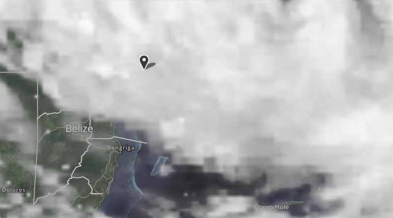
The Government of Belize's tropical storm warning remains in effect for Tropical Storm Franklin from Belize City up to the Corozal district. Shelters will be opened in San Pedro, Caye Caulker, Belize City, Orange Walk and Corozal.

Tropical Storm Franklin continues to move to the west-north-west at 13 mph with maximum sustained winds near 60 mph. Heavy rainfall is expected over Belize, which may lead to flash floods, particularly in the south. Rainfall of 3-6 inches is anticipated, with gusty winds and severe thunderstorms. There is a possibility that Franklin could strengthen and reach hurricane strength just before making landfall tonight.

Be sure to locate a shelter, monitor media reports, and follow all official instructions. Carry your travel documents at all times (e.g., U.S. passport, birth certificate, picture ID's, etc.) or secure them in a safe, waterproof location. You should also contact friends and family in the United States with updates on your whereabouts.

For any emergencies involving U.S. citizens, please contact the American Citizens Services (ACS) Unit in the U.S. Embassy at [email protected] or by calling 501-822-4011.

For further information:

� See the State Department's travel website for the Worldwide Caution, Travel Warnings, Travel Alerts, and Belize Country Specific Information.

� Enroll in the Smart Traveler Enrollment Program (STEP) to receive security messages and make it easier to locate you in an emergency.

� Contact the U.S. Embassy in Belize, located at 4 Flora Park Road, Belmopan at +501-822-4011, 8:00 a.m. to 5:00 p.m. Monday through Friday. After-hours emergency number for U.S. citizens is +501-610-5030.

� Call 1-888-407-4747 toll-free in the United States and Canada or 1-202-501-4444 from other countries from 8:00 a.m. to 8:00 p.m. Eastern Standard Time, Monday through Friday (except U.S. federal holidays).

From Rebecca at the San Pedro Scoop....


Tropical Storm Franklin Intensifies Over Night: Warning Issued in Northern Belize

Alcohol sales have been banned! Many business are closing at mid-day Monday - the gas station in town at 4pm and south of town 7pm.

So far, on North Ambergris Caye, we have been getting heavy bands of rain and lightning. The resort next to us is packing up all the beach furniture and anything loose that is around. Many are moving their boats to the lagoon side of the island - to stay away from potential surge and high winds. One resort, that I know of, is moving guests to the units in the back of the property - away from those units close to the ocean.

Click here to read the rest of the article in the San Pedro Scoop

Tropical Storm Franklin is about 205 miles east of Belize City and moving west-northwest at 14 miles per hour. Tropical Storm Franklin according to the National Hurricane Center is carrying maximum sustained winds of 60 miles per hour. **Tropical Storm Franklin is expected to become Cat-1 hurricane by nightfall**

Below from Tacogirl:


Wrong Timing Franklin

Tropical Storm Franklin is rearing his ugly self at the exact wrong time - although there is never a good time for a storm. The island is preparing fast for the oncoming storm, businesses are moving boats to the back side of the island, alcohol ban is in effect and some are boarding up.

We are now in the middle of preparing for what has now been up graded from a Tropical Depression to Tropical Storm Franklin early this morning. The winds are strengthening and by Tuesday morning should reach 65 mph as it makes landfall more likely over the Yucatan.

Right now it's looking like we will get very wet. If you live on the island remember to have spare batteries and flash lights on hand and charge all your devices asap just in case.

Click here to read the rest of the article in Tacogirl's Blog


From Belmopan...

2:30pm Update :
As you can see, parts of this so called storm are clearing just to the top of the centre or rotation, there are several other swell-ups just south of that clear area and to the east of it. It is not acting like any normal Tropical Storm, much more like a bunch of ITCZ swell-ups. It is been feed and helped to rotate by regular Pacific winds and cloud from the SW coming in under this area. The whole mass of cloud and its swell-ups is moving to the NW, still causing some patches of rain in many parts of Belize and will continue to do so for the rest of the day. This whole cloud area has been breaking up during the days, then reforming at night time, and so I expect it will do so this afternoon and tonight, by which time, it will be more up near the Yucatan. I have not been able to contact anyone up north to get any real reports. Here in Belmopan we have no wind and only some normal type of winds, when we get those scattered rain showers.


Images of San Pedro Town as Tropical Storm Franklin edges towards the Yucat�n Peninsula. Many businesses have closed for the day. Those looking to get off the island, the last boat at San Pedro Belize Express leaves at 4:30PM. In the meantime, a tropical storm warning is in effect for the northern coast of Belize and the entire Mexican State of Quintana Roo. Heavy rain is expected in Belize!

NEMO ADVISORY NO. 6

3:30 p.m. MONDAY, 7TH AUGUST 2017

TROPICAL STORM FRANKLIN

Tropical Storm Franklin continues to move to the West-North-West at 13 mph with maximum sustained winds of 60mph. Franklin is now located near 18.6 North Latitude and 85.9 West Longitude or some 170 miles East of Belize City and 143 miles East-Northeast of San Pedro. The Cayes and Corozal district may experience Tropical Storm force winds. Franklin could reach Hurricane strength before making landfall tonight. Three to six (3-6) inches of rainfall is expected. A tropical storm warning remains in effect from Belize City up to the Corozal District.

Designated Shelters will be opened in San Pedro, Caye Caulker, Belize City, Orange Walk and Corozal. NEMO will be providing a dry safe place to shelter so people are expected to bring along their own food and water.

- Bus runs continue from Belize City to northern, central and southern Belize. Bus runs will continue until 6 p.m. except for the north, the cut off time is now 5:00 p.m.

- Fishers from Saretenja bus will leave at 4:00 p.m.

- Belize City Swing Bridge will be Swung at 4:00 p.m.

- Six shelters will be open in the Corozal District as at 4:00 p.m.; Sarteneja R.C School, Chuox Community Center, Copper Bank Inn, Progresso R.C, Church of Christ and Guadalupe R.C.

- Water taxis are still providing service. The cut off time for water taxis is 4:30 p.m.

- Flight delays and cancellation will be sent out shortly.

Fuel stations in Belize City, Orange Walk, will remain open to the public during normal hours of operations and in Corozal Sol in Ranchito will be open throughout the night. Fuel station will close as follows: 6:00-One Stop Orange Walk; 7:00 p. m.-One Stop Belize Shell Ladyville Shell Xabel; 09:00 PM Shell San Ignacio, Shell Belmopan, Buca Belize. All will open on the All Clear.

Toledo District Emergency Committee will suspend 24 hours operations and revert to standby mode.

The public is asked to remain vigilant, listen carefully to your radios and take actions based on the advice given by NEMO and the National Meteorological Service

From Belmopan... 4:50pm

Last Cloud update, before the sun gets too low. I can not see any cause for 60mph winds as mentioned by NEMO, except under those swell-ups when they cause rain and what is called "Micro-bursts" But the movement is now resulting in thicker cloud over northern Belize, which is moving further south. This is resulting in significantly more rain in the north


Navy track and visual.... landfall Quintana Roo 3am, winds 70-85mph....

If it stays on this track and winds stay around 60mph we'll be in the SW quad and might get the beaches cleaned... sargassum and debris pushed out to sea....


It's so quiet out there... pic by Brittaany Munson. This was taken in the Boca del Rio area by Wayo's

Satellite view and track at landfall, about 2:45am this morning...


Tropical Storm Franklin made landfall on the eastern coast of the Yucatan Peninsula near Pulticub, Mexico, around 11:45 pm ET Monday night, according to an advisory from the National Hurricane Center. Franklin moved inland with maximum sustained winds around 60 mph, the center's advisory said.

The storm continues to batter Belize and the Yucatan Peninsula with heavy rain and strong winds and flash flooding is still a major concern. Tropical storm-force winds currently extend outward up to 140 miles from the storm's center, according to the National Weather Center.

Expected rainfall amounts vary between three and six inches, with some areas across the Yucatan Peninsula and Belize may receive as much as 12 inches of rain through Wednesday, according to the center's advisory.

The storm will continue to move toward the west-northwest and should move out into the Bay of Campeche over the next 24 hours, according to the National Weather Center. On the current track, Franklin will move across the Yucatan Peninsula Tuesday and will gather strength as it moves over the Bay of Campeche. Further strengthening is expected when it gets into the warm waters as it heads toward the Mexican coastline for a second landfall sometime early Thursday morning as a Category 1 hurricane between Tampico and Veracruz.

Belize's National Meteorological Service issued a small craft warning Monday night, and advised vessels north of Belize City to seek safe harbor. They expect very rough seas with 8- to 10-foot waves overnight into Tuesday. The National Weather Center advises that water levels could rise as much as two feet above normal tide levels along the eastern Yucatan Peninsula early Tuesday morning.


Radar display from the Philip Goldson Airport at Belize City, Belize, at 0501Z (1:00 am EDT) Tuesday, August 8, 2017, a little more than two hours after Franklin made landfall north of Belize. Image credit: National Meteorological Service of Belize.

NEMO Issues the "ALL CLEAR"

The National Emergency Management Organization (NEMO), in collaboration with the National Meteorological Service, hereby informs the public that around 10:45 last night Tropical Storm Franklin made landfall with maximum sustained winds of 60 mph on the eastern coast of the Yucatan Peninsula, north of Chetumal near Pulticub, Mexico.

Tropical Storm Franklin was centered over the southeast Yucatan Peninsula near 19.3North Latitude and 88.5West Longitude or about 63 miles Northwest of Corozal Town. Franklin was moving to the West-North-West at 14 mph with maximum sustained winds of 50 mph and gusts of 65mph. The minimum pressure is 998 millibars. Further weakening is expected as the center moves over land today.

A tropical storm warning has been discontinued for the coast of Belize from Belize City to the Corozal District. NEMO hereby issues the "All Clear" as Franklin is no longer a direct threat to the country. According to information gathered from the District and City Emergency Committees there are no reports of injuries. A total of 330 persons took to shelters mainly in Corozal, on the cayes, and in Belize City. Approximately 2,157 persons voluntarily relocated from the islands to the mainland.

The public is advised to stay on alert for possible flooding due to rainfall associated with the system as it moves slowly due northwest of the country over southern Mexico. Rainfall totals of 2-4 inches with isolated higher amounts are possible.

==========================
A weakened Tropical Storm Franklin chugged across Mexico's Yucatan Peninsula Tuesday, dumping heavy rain after coming ashore on the Caribbean coast.

The National Hurricane Center said the storm's center was 75 miles northwest of Chetumal and moving west-northwest at 14 mph (22 kph) Tuesday morning after making landfall overnight.

Franklin's maximum sustained winds had decreased to 45 mph (75 kph), but it was expected to strengthen again Wednesday as it crossed the bay of Campeche.

Three to six inches (7.5 to 15 centimeters) of rain were forecast across the Yucatan, with localized amounts of up to 12 inches (35 centimeters). Franklin was expected to make landfall again Thursday, threatening flash floods and mudslides in mountainous central Mexico.

The Quintana Roo state government had moved people from the most vulnerable coastal communities, Adrian Martinez, coordinator for the state's Civil Protection agency, told Milenio television.

Shelters were prepared across the area, with one specifically designated for the residents of Mahahual, a popular beach destination. Officials had urged all businesses and gas stations to close early to help clear the streets. The state government closed the Chetumal airport near the border with Belize overnight.

A tropical storm warning was posted for the Mexican coast from Chetumal to Sabancuy. Tropical storm-force winds extended up to 140 miles (220 kilometers) from the center.

======================

Aug 8 (Prensa Latina) The states of Quintana Roo, Campeche, Oaxaca, Puebla, Chiapas, Veracruz and Tabasco are coordinating actions today due to the lashing of Tropical Storm Franklin.

Classes have been suspended today in several municipalities of Quintana Roo, in the Mexican Caribbean region, and the Chetumal International Airport closed operations due to the impact of Tropical Storm Franklin in that area.

The Secretariat of Education in Quintana Roo confirmed the suspension of classes in high schools and universities in the municipalities of Othon P. Blanco, Bacalar, Felipe Carrillo Puerto, Jose Maria Morelos and Tulum.

That entity said that in case of basic education, the beginning of the school year will be on August 21.

School facilities and other public entities are under safe.

Flights from Mexico City and other sites were suspended due to the closure of the Chetumal International Airport, capital of Quintana Roo and one of the main tourist destinations in the country.

The Federal Electricity Commission (CFE) reported that an operation is being prepared to fight the effects of the tropical storm in the states of Quintana Roo, Yucatan, Campeche and Veracruz.
from NEMO :

" A total of 330 persons took to shelters mainly in Corozal, on the cayes, and in Belize City. Approximately 2,157 persons voluntarily relocated from the islands to the mainland. "
Notice to friends and families ....... as a result of Franklin many of us are really tired today. Please be patient if we don't reach out as much or as often as we might otherwise do. Time to unpack and also rest.

Thanks for your support!
Piers okay?
Originally Posted by Katie Valk
Piers okay?


Yes - piers are fine thank goodness!

On Ambergris Caye, no 'I survived Franklin' t-shirts today - and that's OK
Upon waking up almost exactly one year ago to shredded and twisted bits of around a half-dozen piers littering what was left of our beachfront, this morning's sight was a joy to behold. As they say in boxing, Franklin was a contender but he didn't lay a glove on us. A change in wind here and a rise in barometric pressure there and this could be a whole other kind of story. A lot was learned last year from the abrupt changes in Hurricane Earl that spelled disaster for Ambergris Caye and The Cloisters/Tres Cocos Resort, where we live.

Tropical Storm Franklin Bypasses Belize - WHEW!
Late Sunday and definitely Monday preparation had started�Tropical Storm Franklin was heading through the Caribbean and northwest along the Central American coast. Northern Belize was in the dreaded CONE OF UNCERTAINTY. With only a year between us and unexpectedly powerful Hurricane Earl, preparation began. Boats were moved or pulled from the water, beach furniture and loose items cleared from outdoor space - a ban was put on alcohol sales and the country's National Emergency Management team issued a Tropical Storm Warning. (See pictures from yesterday) But late afternoon yesterday, the path shifted more aggressively northward. And last night - around 9pm, Franklin made landfall in Pulticub, Mexico. What? You haven't heard of it? I hadn't either. It's a village of 37 people in Quintana Roo. 85 miles from San Pedro town, Belize; only about 25 miles north of Mahahual - the town frequented by many cruise ships and called the "Costa Maya Port". (Pulticub is about 80 miles south of Tulum and 150 miles south of Cancun)


Tropical Storm Franklin

Franklin Faked Out Belize

Last night, in our coverage of Tropical Storm Franklin, we told you how the 6th named storm for this season might end up not affecting Belize. That's because Franklin started shifting away from Northern Belize a few hours before it made landfall.

So, when the storm finally came ashore on the south - central Yucatan Peninsula, Belize - from Corozal, to San Pedro, to Orange Walk - was completely spared, except for a few scattered showers. Today, Daniel Ortiz took a closer look at the storm which faked west and went north. Here's his story:

Daniel Ortiz reporting
For most of yesterday, Belizeans diligently prepared for the possible landfall of Tropical Storm Franklin. The forecasts say that it would make landfall near the Belize Mexico border, and so a Tropical Storm warning was activated from The Northern border to Belize City. Yet, even though the authorities locked down the northern heal of the country to brace for a storm, none came to Belize.

There were no real effects of Franklin felt in this country. In fact, most people went to bed with very little rainfall, if any. The Chief Meteorologist says that the relief came as a consequence of a last minute shift in the storm's path.

Catherine Cumberbatch - Chief Meteorologist
"Tropical Storm Franklin had a track that it was traveling west northwest, with a projection to make landfall just north of the Belize Mexico Border. However, what happened at around 6 p.m., that track changed. The motion - it took up a motion going - rather from west to northwest, it took up a more northwest track, and by taking the northwest track, it ultimately meant that Tropical Storm Franklin would be farther away from the country. And that is exactly what happened."

So, while Belize was spared, the storm slammed into the Eastern coastal communities along Mexico's Yucatan Peninsula. Franklin's eye landed near to the Mexican town of Pulticub, in the State of Quintana Roo. Pulticub is approximate 63 miles northeast of Chetumal, and 78 miles south of Tulum - as the bird flies. Nearby vacation spots of Cozumel, and Playa Del Carmen also felt the force of the storm's 60 mile per hour winds and rain.

Catherine Cumberbatch - Chief Meteorologist
"At around 10 o'clock last night, Franklin made landfall at the East Coast of the Yucatan Peninsula, just out of Punta Allen, it made land fail. It made landfall as a tropical storm, with winds up to 60 miles per hour. The impact as it pertains to Tropical storm Franklin, on Belize, was minimal. As I said from the beginning, we were expecting most of the feeder bands, and the stronger of the feeder bands to hit over the north of the country. But as I said before, as it shifted to a northwest track, rather than west to northwest track, that kept the system farther away from us, which is actually a blessing for us."

Now that the storm is no longer a threat to Belize, what were its actual effects on the country?

Catherine Cumberbatch - Chief Meteorologist
"Tropical Storm Franklin was expected to produce 3 to 6 inches of rain, that's from the system, and Belize was supposed to be impacted by the spiral bands. Some spiral bands did impact Belize earlier. Like in Belize City, earlier during the day, we had spiral bands cause rain almost 1 and a half, to almost 2 inches of rainfall in Belize City and at the Airport, and also later down south, due to the feeder band from the Tropical Storm. They got only an inch of rainfall. In the extreme north, we got minimal rainfall."

Nemo reports that 330 persons from Corozal, the Cayes, and Belize City went into hurricane shelters. Approximately 2,157 persons volunteered to relocate from the islands to the mainland.

In Mexico, news reports are that the damage has been minimal. There are downed trees, and the power was out in some areas, but there are no reports of major structural damage or flooding. There are concerns that the rain associated with the storm could still cause flash floods, however.

The storm has now crossed over the Yucatan Peninsula, and it is back in open water in the southern Gulf of Mexico. After crossing over land, it has weakened to 40 miles per hour.

Weather experts believe that the conditions are favorable for it to regain the strength, and by late Thursday, early Friday, it could make a second impact in Mexico as a stronger storm. The forecasted path is for the coastal communities between Tampico and Veracruz.

Channel 7


Tropical Storm Franklin spares Belize

In Belize, residents in northern Belize and the Cayes took the necessary precautions as the storm was approaching. Many businesses on the island closed early on Monday, August 8th and a few persons decided to spend the night at the available hurricane shelters. Supermarkets ran out of bread and other basic goods as islanders prepared for the worst. But throughout the night, there was little to no rain and wind was normal.

On Tuesday morning, August 8th, residents woke up to cloudy skies and a few showers. Along the beach minimal erosion was observed, and most importantly, no serious damages. At 8AM, the National Emergency Management Organization (NEMO) issued an 'All Clear' notice, discontinuing the tropical storm warning for the coast of Belize, from Belize City to the Corozal District.

Click here to read the rest of the article in the San Pedro Sun


Click photos for more pictures!

AFTERMATH OF TROPICAL STORM FRANKLIN

After being under the threat of Tropical Storm Franklin and NEMO gave the ALL CLEAR for Belize, members of the NEMO ECO in San Pedro made assessments of the few damages made by TS Franklin, which was minor erosion of beaches and collapsed coconut tree at the Mar de Tumbo area. The SPTC work crew were out early cleaning up the sargasso that washed ashore on Boca del Rio Drive.

This storm is now HURRICANE FRANKLIN and going into Mexico, aiming towards Mexico City, but it is unlikely to go up that high into the mountains. Belize is now well clear of it.


Preparation for Tropical Storm Franklin, San Pedro, Ambergris Caye, Belize

© Ambergris Caye Belize Message Board