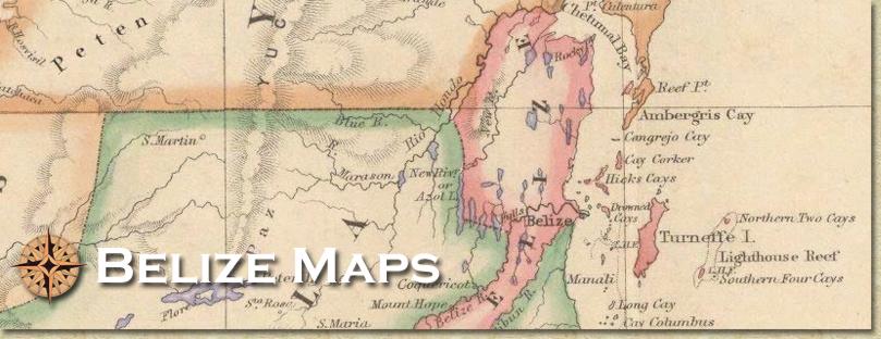
Old exercise book map
Not every single village is on this map, it's the inside cover of a very old exercise book. No Belmopan, the international airport was "Stanley Field," Stann Creek Town (now Dangriga) and Monkey River Town (now a village), no Spanish Lookout, no Southern Highway listed, it was not paved yet. This map predates Hattie, so Monkey River was a major town whereas Belmopan did not exist. Needless to say, neither did Hattieville! The Northern Highway went via Maskall, San Pedro was not a Town yet, no Southern Highway, no Hattieville or Belmopan thus this has to be before 1961, but what is interesting is the name of the Country is stated as Belize and not British Honduras so this is saying that the book is after 1974, interesting. Coastal towns (Consejo, Gales Point, Mullins River, Barranco, Monkey River Town, etc) are still prominent so travel by boat was probably still happening. Hill Bank and Gallon Jug were important settlements and San Pedro and Placencia were not heavily populated. No new Northern Highway (the northern road curves to the right) and no Southern Highway. Only named cayes are Ambergris and St George's Cayes.
|


|