Click the image above to see a chart of Maya chronology
|
Click here for photographs of Maya Sites in Belize |
Several archaeological sites, described below, are open to the public. Four are visited widely by the public, and are soon to be made official archaeological reserves with the supporting facilities. Many other sites are located on private land and can only be visited if prior permission is obtained. Additional information about the ruins can be had by visiting or corresponding with the Department of Archaeology in Belmopan or with the Association for Belizean Archaeology(ABA) at the Center for Environmental Studies on Eve Street in Belize City.
It is generally thought that the population of what is now Belize was considerably greater during the Classic Maya Period than it is today; the plethora of Maya sites in the country today is testimony to this.
Click here for maps for nine Maya sites in Belize.
|
Click the image above to see a chart of Maya chronology |
Belize clearly lay in the Maya heartland: not only are some of the earliest sites, like that of Cuello in Orange Walk, found in the country, but the recent discovery of glyphs at Caracol, Cayo District, apparently portraying a military victory over Tikal suggests that some of the Belizean centres were supreme in the region.
This webspace describes the major, excavated sites in Belize.
Some, like those of Altun Ha and Xunantunich, are
located close to major roads. Others, like Lamanai and
Caracol, are more difficult of access. Yet it is this
difficulty which makes an excursion to Lamanai
unforgettable, for its remoteness and its partially
uncovered state heighten its splendour and mystique.
Lamanai again is just one of many examples of the beauty
not only of the temple-pyramids themselves but of their
surroundings: while the Maya warlords and priests
surveyed, from the pyramids' summits, their domain
stretching around them, we see below us the length of
New River Lagoon, silver blue and pristine. Likewise,
climbing the main temple itself is only part of the trip to
 Xunantunich- the village of San Jose Succotz lies next to
the Mopan River, at the foot of Xunantunich; its people
are of predominantly Yucatecan Maya origin and the
village is famous for its fiesta and traditional dances; it
was also the base camp for one of the greatest Maya
archaeologists, Eric Thompson. The green river, rushing
over shallow rapids is a superb place to bathe (and to
wash clothes) after you've trekked or driven the mile or
so uphill to the temples and plazas themselves, from
whose summits Succotz and Benque Viejo lie below you,
the hills of Peten forming the western horizon.
Xunantunich- the village of San Jose Succotz lies next to
the Mopan River, at the foot of Xunantunich; its people
are of predominantly Yucatecan Maya origin and the
village is famous for its fiesta and traditional dances; it
was also the base camp for one of the greatest Maya
archaeologists, Eric Thompson. The green river, rushing
over shallow rapids is a superb place to bathe (and to
wash clothes) after you've trekked or driven the mile or
so uphill to the temples and plazas themselves, from
whose summits Succotz and Benque Viejo lie below you,
the hills of Peten forming the western horizon.
Before we look at the major sites themselves, it's to be remembered that other supremely spectacular sites were utilized by the Maya but now show no trace of that history: the Rio Frio cavern, from which Mayan remains have been excavated, is now purely nature's domain -the river has formed an immense tunnel through the limestone, opening the mountain spur at both ends; stalactites are still in dripping formation and petrified limestone waves form the floor. Close by, the Rio On cascades through some of the oldest rocks in Central America, forming natural pools. These superb sites are just an hour's drive from San Ignacio up into the Pine Ridge.

You need light-weight, comfortable clothing and shoes with a good grip. Long trousers are more suitable than shorts as they give more protection from insects and weather.
The rainy season lasts from June to November, but it can
rain at any time of the year. The rains are interspersed
with long periods of hot, dry weather. You need,
therefore, to have a hat and sunscreen available year
round and a light-weight raincoat is often useful. Insect
repellant is a must and a container of drinking water is
advisable, as several sites are remote from any facilities.
Santa Rita The modern town of Corozal is built over the ancient Maya center of Santa Rita. This site was important during
the Late Post Classic Period (c.a. A.D. 1350-1530), and was occupied up to the time of Spanish contact in the
1500's. The largest building in the central core has been excavated and consolidaced. Archaeological
investigations there have shown Santa. Rita to be the ancient province of Chetumal where a large part of the Post
Classic civilization once thrived.
Corozal is easily accessible by public transportation, and hotel accomodations are available in town.
The Book of Chilam Balam of Chumayel
by Ralph L. Roys [1930]
The Book of the People: Popol Vuh
Maya Hieroglyphic Writing (excerpts)
The Popul Vuh
excerpt from
The Mythic and Heroic Sagas of the Kichés of Central America,
by Lewis Spence; London [1908] 79,023 bytes
ancient Chetumal
Historical context
Mayan texts:
Yucatan Before and After the Conquest
by Diego de Landa, tr. William Gates [1937]
The best primary source on the Maya, ironically by the monk who burned most of their books.
by Delia Goetz and Sylvanus Griswold Morley
from Adrián Recino's translation
from Quiché into Spanish
[1954, copyright not registered or renewed]
by J. Eric S. Thompson [1950]
The site's strategic location attracted the
Conquistadores, who attempted to take the city and
establish a base there. Anthropologist Grant Jones has
traced the events that followed: "In 1531 Alonso Davila
set off by land to the province of Chetumal and travelled
southward through the Cochua and Uaymil provinces
with 50 men and 13 horses, hoping to discover gold
along the way. Part of his party eventually reached
Chetumal by canoe, carrying horses in double canoes
lashed together, finding it completely abandoned. The
Spaniards eventually attacked those who had abandoned
Chetumal for the site of Chequitaquil, several leagues up
the coast. Here they found their first gold, evidence of
the importance of long-distance trade for the Chetumal
economy. After this event armed rebellion broke out
throughout the region." Nachancan was the Maya
warlord who, during that rebellion, re-took Chetumal from
Davila.
Although they were driven out of Chetumal/Santa Rita, the Spaniards established an outpost at Bacalar and were successful in their attempts to conquer Northern
The site
The formation of Santa Rita dates from c. 2000 B.C. -from the beginning of Maya history; this is evinced by burial at the site which yielded pottery of the Swasey style, some of the earliest found in the Maya area. From c. 300 B.C. to c. 300 A.D. the settlement expanded but continued to be based primarily on agriculture.
The Classic Period at Santa Rita is marked by the site's only extant structure, a complex series of interconnected doorways and rooms with a central room containing a niche in front of which offerings were burned. Two important burials were unearthed there, the earliest dating to the Early Classic, containing an elderly woman with elaborate jewelry and polychrome pottery. A second burial dated to c. 500 A.D. was discovered inside an unusually large tomb and is probably that of a warlord who was interred with the symbols of his rule -a ceremonial flint bar and stingray spine used in blood-letting rituals. Many of the artifacts found in this tomb show similarities to those from Kaminaljuyu, Guatemala and Teotihuacan in Central Mexico, attesting to the international character of the site; Classic Period artifacts even include pottery of Andean origin.
The amateur and explosive archaeologist Thomas Gann discovered fabulous Mixtec influenced frescoes at Santa Rita at the turn of the century; these do not survive, but fortunately Gann's meticulous copies do. The most systematic series of excavations at the site was the Corozal Postclassic Project led by A. and D. Chase from 1979 to 1985.
The town of Corozal, founded in the mid 1800's, has slowly encroached on Santa Rita destroying large parts of the site, many of which disappeared into the streets of Corozal. In ancient times Santa Rita extended from present-day Paraiso in the north to the south end of Corozal and San Andres. The site, bordered on the east by the sea, is situated on the limestone plateau of which Northern Belize is composed and which supports a low forest in which game abounds. Just north of the site is the Rio Hondo, along whose banks are large areas of swampland in which the Maya created raised fields. These supported the cacao plantations for which the province was famous. The sea coast gave the site access to a wide variety of marine resources.
Santa Rita is located on the outskirts of Corozal Town just off the main road leading to Santa Elena and the Mexican border. Frequent buses between Belize City and Corozal pass by the site. There are two flights a day from Belize City. Accommodation is available in Corozal Town.
Chronology of the Ancient MayaThe following is the classification used in this text:
|
Located on a peninsula across from the town of Corozal and in the Bay of Chetumal, this site was important as a coastal trading center during the Late Preclassic Period (C.a 350 B.C. to A.D. 250). Its tallest temple rises 21 meters above the plaza floor and residences of the past elite are now being washed by the, bay waters. The name is Spanish for "hill" and the translation is "Maya Hill".
Cerros can be reached by a short boat ride from Corozal. Boats can be hired in town where hotel accomodations are also available. During the dry season, between January and April, one can reach Cerros by road in a rented vehicle passing such picturesque towns as Chunox, Progresso and Copper Bank and their beautiful lagoons.
Historical context
 Cerros is a Late Preclassic centre with virtually no later
additions to its structures, indicating an early demise.
David Freidel's 1973-1979 excavations revealed that the
site underwent a transition "from local resource
dependency during its initial occupation to regional
interaction of goods and services during its final
occupation." It was, then, a trading centre probably
based on the sea-borne import of jade and obsidian. Its
early decline was possible due to the "general shift of
trade routes connecting the highlands and lowlands in
the Early Classic. "
Cerros is a Late Preclassic centre with virtually no later
additions to its structures, indicating an early demise.
David Freidel's 1973-1979 excavations revealed that the
site underwent a transition "from local resource
dependency during its initial occupation to regional
interaction of goods and services during its final
occupation." It was, then, a trading centre probably
based on the sea-borne import of jade and obsidian. Its
early decline was possible due to the "general shift of
trade routes connecting the highlands and lowlands in
the Early Classic. "
The site
The Cerro Maya ("Maya Hill") Archaeological Reserve consists of 52.62 acres and includes three large acropolises dominating several plazas flanked by pyramidal structures. Two structures are known to possess facades with 2 - 4 metre (6.5 - 13 ft.) high masks. Tombs and ball courts have been excavated and many artifacts found, demonstrating the importance of the site during the 400 B.C. - 100 A.D. period. The civic- ceremonial centre covers an area of .75 km. (.5 sq. mile) with the tallest structure rising 22 metres (72 ft.) above plaza level. The site's adjacency to the sea has meant that the two large structures are being eroded; the rate of erosion and lack of funding for maintenance has unfortunately necessitated covering the masks with plaster.
Thomas Gann was among the first to recognize the existence of a Maya site at Cerros, but it was not until 1969 that Peter Schmidt and Joseph Palacio visited it and registered the site with the Department of Archaeology.
The land on which the site is located was acquired by Metroplex Properties Inc., a Texas operation and a development foundation called the Cerro Maya Foundation was formed in Dallas as a nonprofit organization to excavate, consolidate and reconstruct the ceremonial centre as a tourist attraction: plans were made for a research centre, on-site museum, hotel and swimming pool. The Cerro Maya Foundation under Metroplex Properties Inc. subsequently went bankrupt and the large-scale development of the site was never realized.
The site was eventually surveyed, excavated and
partially consolidated from 1973 to 1979 by David Freidel
of Southern Methodist University; Freidel focused on
the ceremonial centre, its outliers and on the importance
of trade at Cerro Maya. In 1983 Cathy Crane, a doctoral
student at the same university tested ancient canals and
associated structures at the site for pollen and other
organic remains. Since then no further work has been
carried out. Cerros was a thriving community in the Late Formative Period due to its location on the circumpeninsula trading route. A fishing village for its first 300 years, Cerros covered about seven acres and consisted of approximately 38 pole and thatch buildings which would have housed approximately 500 people. Occasionally built on low clay platforms, these huts were rethatched every 30 years much as they are today. Burial and storage pits were sunk into the trash accumulations (midden) in the adjacent patio areas. The importance of trade at this early period is indicated by a large low platform and jetty on the water, west of the village. Cerros was the main distributor of salt from the north coast mining communities and is known to have traded chert tools from nearby Colha, up the New River, to Lamanai. There is evidence of non-local materials such as volcanic hematite and greenstone. Obsidian and jade materials came from as far away as Guatemala and El Salvador. The cerros ceramics combine foreign artistic elements and firing techniques with local ones.
The fluorescence of the lowland Maya centers and their demand for trade goods triggered a new phase of development at Cerros which transformed the village to an urban center. A 3600 foot canal, 18 feet wide and 6 feet deep, was built to surround 91 acres and served as part of the drainage system for the maize, squash, bean and cotton crops. Within this structure was built a ceremonial center which included four pyramids, their associated plazas and buildings, 103 public and private structures, two ball courts and accommodations for approximately 400 people. House mounds decrease ,in density outside the canal perimeter. All of the pyramids were decorated with stucco images but have been temporarily covered by the Belizean government to prevent the limestone from weathering.
The Mesoamerican ball game was both recreational and ceremonial in nature. Often the game was played to determine the outcome of future events (the losers being sacrificed) but it was also played for recreational pleasure. The ball game was played with a solid rubber ball in a formal court. The object was to score by propelling the ball through rings on the side walls. Some courts, lacking rings, have markers on the sides or center of the court floor.
The two ball courts at Cerros are an interesting feature. A common occurrence at preColombian Mesoamerican sites and often found at Late Classic Maya sites, it is rare that they appear during the Early Classic Period. It is assumed the game originated in the lowlands (the ball was made of rubber, a lowland plant) but only two ball courts from the Early Classic Period have been reported, at Palenque and Copan. It is interesting that both cities are located on the periphery of the Maya area, as is Cerros.
Dr. Freidel suggests that a change in the way the game was played would affect the court construction and perhaps evidence from this period remains unrecognized. Perhaps the reasons the game was played did not exist throughout the Early Classic.
The open-ended ball courts consist of a raised playing alley flanked by two parallel buildings. These buildings have broad, low benches that face the alley and have battered, sloped surfaces, indicating they were within fair play. The central court markers have been removed. There were summit access stairs at the backs of the buildings.
Construction technique generally followed that of the other major buildings at Cerros. An initial layer of white lime, followed by a layer of dark grey marl and trash (habitation debris), then by brownish/red dirt with cobbles which was then covered by a thick hard plaster floor over the playing area (the alley and walls).
At the close of the Formative Period trade routes changed. Overland routes controlled by the other Maya centers came into primary usage while the coastal routes became less frequented. Cerros declined and the main buildings were ritualistically abandoned. Pottery was smashed and deposited in front of the facades, fires were set against the masks and the stone markers in the ball courts were removed A dispersed population continued to live outside the ceremonial districts until the Early Classic Period, but Cerros never regained its position of importance.
Cerro Maya's location on the shore of Corozal Bay permits a range of water sports; part of the site remains under forest coverage, with the panorama of the Bay below.
New River empties into the Bay 2 kilometres (1.5 miles) southwest of Cerro Maya. The river, with its rain- forested banks and associated wildlife formed an important link with Lamanai when the site was flourishing.
Cerros is a short boat ride from Corozal Town, where boats can be hired and accommodation is available. During the dry season, January to April, Cerros can be reached in a rented vehicle by the road which passes through Chunox, Progresso and Copper Bank villages with their beautiful lagoons. No facilities are available at the site itself and insect repellent is needed.
 "Submerged Crocodile "
This is one of Belize's largest ceremonial centers. In addition to its display of the more exotic features of the ancient Maya in art and architecture, Lamanai (corruption of "Lama'an/ayin", Maya) also had one of the longest occupation spans dating from 1500 B.C. to the 19th century, which includes the contact period. Historical occupation is represented in the remains of two Christian Churches and a sugar mill. The name of the site was recorded in historical accounts and is Maya for "submerged crocodile".
At present Lamanai can only be reached by road from San Felipe Village in a strong vehicle during the dry season. However, the more popular route is by the New River Lagoon, a waterway rich in the natural history of the country Boats can be hired from Guinea Grass or Shipyard.
There is no public transportation from Orange Walk Town to Guinea Grass or Shipyard but taxies and rental vehicles are available both in Belize City and Orange Walk Town. Hotel accomodations are also available in these two locations, the nearest being Orange Walk Town, some 30-45 minutes away.
Click here for photos.
Click here for a rotating panorama of the view from the top of the largest temple at Lamanai.
Lamanai: A great place to visit

It's that time of year when nearly every airplane that leaves Belize City is packed full. And this year is no exception...but there is one difference. Where traditionally the passengers were mostly Belizeans headed for summer holidays in Miami, New York, L.A. or Chicago, the majority now seems to be foreign tourists returning from happy holidays in Belize. And what about the Belizeans? It seems that a growing number are beginning to discover what the tourists found out long ago: Belize is a great place for a vacation. We've been singing that song for almost a decade and over the next few months we'll be revisiting some of our favourite places that make great day or weekend getaways. Tonight we travel to the Orange Walk District and the magnificent Maya site of Lamanai. William Neal is our host and you can be the judge of whether his looks and talents have improved since this story first aired in 1993.
William Neal The trip up the river takes approximately one hour and the pristine environment adds to the mystique and adventure of Lamanai. The boat journey comes to an end as you enter into the New River Lagoon and the anticipation begins as the main temple can be seen towering above the forest.
Nazario Ku, Lamanai Curator Nazario Ku has been the curator at Lamanai for a year, but has worked at different sites around the country for over ten years.
Nazario Ku "Maya here started as a settlement around 1500 B.C. and they flourished as a city state around the 2nd century B.C., which is a long time between. This is one of the uniqueness of Lamanai because it was inhabited for around 3,000 and over. The highest peak of the Lamanai was about the 6th to the 7th century A.D. even though at the 10th century A.D., they were performing sacrificial rites. There were still offerings to the Gods and what makes Lamanai unique, is that when other city states were falling into decline, Lamanai was still going on strong." Lamanai is located on 950 acres of archeological reserve and features more than a hundred minor structures and over a dozen major ones. This ruin called the Temple of the Mask, houses a stucco mask of an Olmec God, which some believe to be of Kinich Ahau, the Sun God. The size of this temple seems impressive until you approach the one next door, which is one of the tallest buildings in the country, believed to be the temple of sacrifice at Lamanai.
William Neal Although not half as fantastic as it must have been in ancient times, when men, women, and children crowded the market place exchanging exotic goods from all over the Maya world.
William Neal In the game, warriors competed to win the honour of being sacrificed on the high altar, so that their blood could renew the life of the Sun God. Life at Lamanai was highly organised and the people were self sufficient, though shells, jade and clay found in the area indicate plenty of outside contact.
William Neal
Nazario Ku
William Neal In its own way, the ornate craftsmanship of the brick and ironwork is as much a wonder as the limestone and mortar ten centuries earlier. The English mill, the Spanish church and the Maya temples have created an attraction for tourists that is among Belize's best. A number of companies operate tours to Lamanai. Most boats leave from the vicinity of the Tower Hill Bridge. For lots of pictures, see:
|
 Lamanai has a special place in Maya history because of
its early greatness -structure NIO-43 is the largest
Preclassic structure known in the Maya area- and
because of its longevity: the site was occupied
throughout the Postclassic until at least the mid-
seventeenth century.
Lamanai has a special place in Maya history because of
its early greatness -structure NIO-43 is the largest
Preclassic structure known in the Maya area- and
because of its longevity: the site was occupied
throughout the Postclassic until at least the mid-
seventeenth century.
Lamanai is an ancient Maya center known to have been occupied continuously for two millennia (approximately 300 B.C. - AD. 1680). Narrowly stretched along the west bank of the New River Lagoon, Lamanai illustrates an unusual settlement pattern among Maya sites. Usually built as one or more ceremonial plazas encircled by residential clusters, Lamanai ceremonial areas are close to the river with residential areas to the north, west, and south. To date, only 5% of the site has been investigated (by Dr. David M. Pendergast of the Royal Ontario Museum). As most of these buildings are ceremonial structures, research is weighted on the side of the ritual. How ever, these structures are the foundations of social edifice and therefore tell us much about Maya society.
Because of the late occupation, the site's name -
"Lamanay" or "Lamayna"- was recorded by Franciscan
missionaries in the seventeenth century and is thus the
original Maya name. In 1978 it was realized that
Lama'an/ayin means "Submerged Crocodile", a fact
which, as archaeologist David Pendergast points out,
helps to explain the numerous crocodile representations
at the site, including figurine headdresses, vessel
decorations and the headdress of a four metre-high
limestone mask on the platform of a 6th century temple.
 The site centre occupies .75 sq. km. (.5 sq. mile) with
residential and minor structures distributed over an area
of 950 acres, the present-day extent of the official reserve.
Pollen evidence shows that maize was being cultivated at
the site c. 1500 B.C. but we know little of what happened
between then and c. 500 B.C., the time from which the
earliest pottery fragments found at the site derive.
The site centre occupies .75 sq. km. (.5 sq. mile) with
residential and minor structures distributed over an area
of 950 acres, the present-day extent of the official reserve.
Pollen evidence shows that maize was being cultivated at
the site c. 1500 B.C. but we know little of what happened
between then and c. 500 B.C., the time from which the
earliest pottery fragments found at the site derive.
From that time the story of the site has been revealed by archaeologists digging through the layers of the past to unearth early structures beneath later ones: buried deep within the 6th century masked temple mentioned before was a small, superbly preserved Late Preclassic temple dating from c. 100 B.C. with plaster masks resembling those from Cerros. The massive NIO-43 is of the same date but it too had been modified several times, the last being in the Late Classic, c. 600 A.D.
Late in the Classic Period the northern parts of the site
appear to have been de-sacralized: areas of formerly
ceremonial ground were converted for residential use,
while the southern sector became the focus of ceremonial
activity. In the southern sector, Classic structures were
surmounted by Postclassic ceremonial buildings and new
religious structures were erected. Plausibly the smaller,
less spectacular nature of the Postclassic structures
reflects a lessening supply of labour and a less
hierarchical society than that of the Classic.
In addition to its Maya structures Lamanai also has
historic archaeological remains including two 16th
century Christian churches, a 19th century sugar mill
intact with flywheel and boiler, and a sunken, bricklaid
reservoir. Occupation of Lamanai over the centuries thus
includes Maya of all periods, British sugar cane growers
and sugar manufacturers, Spanish clergy and Chinese
factory workers. European, North American and Maya
materials were used here so that Lamanai artifacts are of
stone, clay, wood, bone, shell, jade, gold, copper, glass,
iron and even liquid mercury.
Generally, site occupation during the Protoclassic Period was developed and extensive. Residential and ceremonial concentration was in the northern precinct and the lagoon shore. The Protoclassic is characterized by diversity in architectural form in contrast to the rigidity of control shown in ceramics and the general nature of dedicatory offerings.
The Classic Period ceremonial constructions are concentrated more toward the central area; however, there was continued construction in the northern precinct and new construction in the southern area. The residential area in the northern precinct continued to be in use.
It appears that many were leaving these northern centers toward the end of the Late Classic Period, but there was continued Classic Construction in the southern precinct. Motifs developed here before the 12th century were later adopted at Mayapan, a large Yucatan Maya center occupied from 1200 - 1750 A.D.
The Postclassic Period was generally a time of gradual decline, however, the population at Lamanai was ceremonially active and in communication with other areas of the Maya lowlands. This indicates that the complete breakdown of Classic societies, as is characteristic of neighboring centers, was not the case here. Lamanai stability may be a result of strong community leaders or due to the resources of its location; such as food supplier and trade.
In the early 16th century, Spanish missionaries arrived and built a church south of the southern precinct. The community also moved south either before or after the Spanish came. Modem squatters live in scattered settlements along the lagoon.
N9-56, the dominant structure of the central ceremonial precinct, stands 56 feet high. This is the most thoroughly investigated of the larger buildings at Lamanai and spans a longer period of time than most. The primary structure, built during the Early Classic Period, is exceptionally well-preserved with architectural features such as corner stairs and molding free terraces. Dating is based on a vessel in the interment at the base of the structure, at the front of the stairs. Although not unique to Lamanai construction or grave content, it represents a major deviation from typical Maya tombs which usually consisted of a vaulted chamber with or without a bench on which the body was lain. A grave of similar construction was found at Cuello and was dated 200-300 A.D., much earlier than the 400700 A.D. date indicated at Lamanai.
The tomb at Lamanai was constructed on the floor atop a pile of burned wooden artifacts. The body was positioned upon the pile so that the hips rested in a larger redware basalridge dish, while stones and earth supported the upper body in the unburned area. A wall of stone and clay underlaid the burned material and surrounded the body to a height of 11 inches. A red pigment was applied to the corpse and then layered with clay. The area was then filled with such artifacts as wooden-backed jade ear ornaments carved with human faces, wooden figurines with jade ear ornaments, and platted and corded textiles. A wooden framework was built atop the foundation and covered with lime plaster bandages made of a course textile, creating a cocoon effect. Fine red textiles overlay the courser material. Mortar and stone was then built around the cocoon with a row of capstones, covered in a mass of chert chips, obsidian flake blades and cores.
It was customary to raze structures before modification. The two-chambered building that once stood atop this structure was destroyed, leaving only the building layout in black paint on the platform surface, a feature seen at Tikal but not previously encountered in the central lowlands.
When razed, certain parts of units were destroyed or left in place, often creating problems for engineers of the new structure. The remaining units, in this case, are large, unusual masks on the stairside outsets on the south side of the structure. Unfortunately, the upper mask was removed during construction, so only the back panel remains. The lower mask resembles Olmec (an influential Gulf Coast culture of the 1st millennium B.C.) iconography though the treatment of the mask is not in that style. Usually masks are made of stucco laid over a basic framework but this one is made of stone with a grey stucco coating of ash, charcoal and plaster. Lacking part of the frontal headdress which was removed to build the small stair, the mask originally had crocodilian features.
Masks partially excavated on the north side closely resemble those at Cerros. These features reinforce the theory that the correct name of the site is "Lama'an/ayin."
Crocodiles occupied an exalted place in the Maya pantheon and it is believed they were protected rather than offered in religious rites since no interment has included crocodilian remains.
Use of N9-56 during the Late Classic Period was inferred by Mayapan type figurine censers, broken and scattered over the front, sides and back of the mound in the customary ritual manner. This debris overflowed in front of this structure, onto a group of small low platforms (N9-56) built during the Late Classic Period. The platforms were faced with vertical stones and coated in stucco. The central platform was built to support a Classic Period stela (a dedicatory monolith), relocated here from an unknown location in the Late Classic Period. Its carved side once faced an uncarved, relocated stela to its south.
9-2 is an isolated major building on the lagoon north of the N9-56 group, and has expanded our information concerning Protoclassic use for the area. The platform contained two offerings resembling those from N9-56 platform and indicate a 1st century A.D. date. The P9-2 platform itself does not appear to have supported a chambered structure.
similar to P9-2, in that there was no chambered building atop its center. Unlike P9-2 there was a building on the extension which overlooked the harbor.
P9-25 is the largest complex at the northern end of the site. A platform 297 x 363 x 59 feet supported buildings 30 feet high. Final modification occurred around 400 A.D. but earlier constructions are indicated; a project for future excavations.
The harbor is now seen as a large depression. The rational behind calling this a harbor rests partly on its shape and that it holds water during the rainy season. (Excavation is now, under consideration.) In areas bordering the harbor, there is ceramic evidence of Late Protoclassic construction.
N10-43 is the tallest structure at Lamanai. Reaching 33 meters, its building sequence is the most securely dated Preclassic structure in the Maya area. Plastered surfaces and hearths indicate residential use of N10-43 before it was chosen as a ceremonial site.
A second century B.C. construction offering from within the building contained a redware dish with flaring sides. Inside the vessel was a juvenile bird skeleton with its beak and frontal skull missing as well as the bones from one or more other birds. The bulk of construction was completed in the Protoclassic Period. An early version of the Lamanai building type is characterized by a large multi-terraced platform, without a chambered building at its summit. Masks flank the lower center and side stairs where there is a large landing that supported a platform which served as a base for a chambered structure. Three sets of stairs (referred to as a tripartite pattern) were built both at the lower and upper levels to scale the side of the building. Atop the upper stairs were two small chambered buildings built upon double terraced platforms which face inward toward a third unit. This unit also has a tripartite pattern of steps flanked by masks, but there is no structure at its summit. This upper structure arrangement is unique at Lamanai though the tripartite stairs are typical Classic innovations. An offering of ceramic vessels within the building suggests a date of 100 B.C.
During the Late Classic Period, N10-43 was drastically reconstructed. A long, single room building which spans the first landing replaced the small structure mentioned above. The tripartite stairs on all three levels were made one and the summit structure was removed.
An offering consisted of obsidian cores, thousands of blades and chips, jade, shells, and a large black on red bowl probably related to those found in N10-9. N10-43 continued to be used during the Postclassic Period as was most other parts of the southern ceremonial area. An offering in the debris at the base of the structure contained a vessel and a single jade bead over which is a fair amount of Postclassic ceramics.
The ball court lies south of N10-43 and. was built during the Late Classic Period, a time when the northern district reflects diminishing use. It is in poor condition and its open ended playing area is rather small. Underneath the gigantic marker disc which covers most of the floor surface was an offering of a lidded vessel. Inside were miniature vessels and small shell and jade objects. These latter objects rested upon a pool of mercury, an element previously known only from the Maya highlands.
10-7 The initial construction for N10-7 is a low platform built during the Middle Classic Period. Overlying a burial cut into the platform, the major construction was a single effort at the end of the Classic Period. Intrusive burials into the upper core indicate continued use to Middle Postclassic times. The building was in ruins by the end of the 14th century A.D., indicated by the age of the midden mound covering its south side.
N10-2 is a small ceremonial building located on the west side of the southern plaza and was the focal point of Postclassic construction. Two Early Classic structures are modified by a sequence of four buildings. Since razing was customary, most of the information is in reference to the second modification. This Postclassic effort resembles northern Yucatan structures in that the front looked like a columned portico, but the building materials are different. The building sat upon a platform faced with small, rough stones. The single room had a plaster floor and thin, wattle and daub walls. Two rows of wooden columns supported a roof of timber, matting and other materials. A small square altar was set in the center, toward the back of the room.
Fifty burials were found in the building core, 17 unaccompanied by artifacts. Twenty-six were typical Postclassic internments with one or more ceramic vessels smashed and strewn over the graves. In most cases, only one piece of each vessel was missing, suggesting that retention of fragments was of ceremonial value. There were 26 burials associated with the second building effort including a double-pit inhumation. An adult male was seated in the pit with a pyrite mirror, a copper bell and gold sheet coverings from perishable objects such as wooden disks or staffs. The copper objects associated with N10-2 burial include simple bells and strapwork rings which are likely clothing or ornaments with cruciform or single strap attachments. Two-bell headed pins to which cloth fragments adhered were found in situ indicating use as a fastener of a warrior's garment at the hip. Three censers were found in the upper pit, one containing a pair of chile-grinding vessels. The surface north of N10-2 was littered with Tulum (a Postclassic site on the Yucatan coast) shards.
N10-9 is the primary structure of the southern precinct and was probably built in the Early Classic Period. This is an estimate based on Late Classic ceramics found at higher stratigraphic levels and an absence of them at lower levels. A cache of jade and obsidian found within included large quadrangle-shaped jade earrings of Classic style which lends this estimate credibility.
In general, the form of a construction offering varies not only in size and content, but also in its location within the structure. They are commonly found beneath the stairs, inside the chambered buildings. Protoclassic and Early Classic offerings typically contained two vessels with objects inside. Obsidian and jade caches are typical of the Late Classic Period.
Late Classic building modifications, characteristic throughout this site, show a definite pattern of replacing a tripartite stair with a broad single stair. The strict following of architectural cannon is in contrast with the diversity of building types found at Altun Ha dating to this same period. Modification of N10-9 included new stairs and stairside outsets leaving the terraces of the primary structure exposed. The building followed architectural cannon with a new chambered building across the center of the stairs and it had no building at its summit. Within the new building was found offerings of a large dish with an animal motif, a large black on red bowl, and a mosaic jade mask.
During the Postclassic Period, Lamanai continued to flourish while other centers such as Altun Ha showed sharp decline. This is evidenced from the periodic repair of the exposed platform and stairs mentioned above, which indicate that ritual continued throughout this period.
Abandonment of N10-9 is signaled by the large amount of pottery deposited on the front stairs at the close of the Postclassic Period. Midden mound was begun in the plaza on the east side of N10-9 and eventually covered its base, the south side of N10-7 and overflowed along the rear side of N10-2.
N10-1 is a small platform in the center of the southern plaza. The primary structure contained two burials. The interned ceramics found here filled in gaps of the ceramic sequence for the 12th century A.D. Ceramics from the earlier internment included domestic wares and a Chicken (X) Fine Orange vase. The later internment included a large lidded censer which contained an adult male skeleton placed on a pile of 18 broken censers, bowls and jars. It is inferred that this was a person bearing high status since burial in No10-1 or N10-4 would have been prestigious. This is due to their proximity to N10-2, a focal point of Postclassic ceremony.
The ceramic style here and in N10-2 resembles those of Mayapan (1250 A.D.); i.e., serpent motifs and segmented basal flanges, commonly with border lines and vertical-line ornamentation or center notches. However, the radiocarbon dates (from N10-2) indicate an earlier date of 1140 A.D., pointing not only to a fully developed ceramic complex in Lamanai in the Early Postclassic Period, which effected change in ceramic styles at the important Late Classic centers.
N10-4 borders the plaza to the east. The primary structure is Classic. Razing demolished the building atop it, which was soon replaced by a single unit of Postclassic modification containing forty-seven burials, interned at varying times, all placed in a single unit. One of these is dated to the 15th or 16th century, a period not well evidenced elsewhere at the site. Grave goods included Tulum Red tripod dishes, carved redware censers and uniquely styled bowls, a large pierced stucco columnar censer, a copper bell and two carved bone tubes; one pictures a person in ornate dress complete with a bird headdress.
In the early 16th century the Spanish missionaries arrived and built a church one half mile south of the Postclassic district. Two mounds adjacent to the church may indicate the community had also moved south. A Postclassic ceremonial building was modified with front and back stairs and used as a burial mound for Christian converts over a period of 70 years. Though the bodies are interned haphazardly, it is a chance to observe for the first time in the Maya lowlands a population of a definite period. The statistics gleaned from such a find can answer many questions about mortality curves, sex ratios and pathologies. The major grave items were bone rosaries. The church itself was abandoned in 1640-41, known from the reports of Fathers Orbita and Fuensalida. The Maya took up residence in the building for approximately 50 years as indicated by midden refuse and a burial. The ceramics are indistinguishable from those of the Postclassic indicating that 16th to 17th century occupation at the other sites may also be indistinguishable.
Thomas Gann, the British medical officer and notorious amateur archaeologist was the first, in 1917, to visit the site in modern times; he excavated a stuccocovered and painted stela at the site of the 16th century church. J. Eric Thompson passed by the site in the mid-1930's and William Bullard Jr. explored it and made surface collections in the early 1960's. Thomas Lee of the New World Archaeological Foundation made another small surface collection in 1967.
Aside from looters and a few visiting archaeologists, no one did any substantial work at the site until David Pendergast of the Royal Ontario Museum, Canada, began a long-term programme of excavation in 1974. A four-year restoration and consolidation programme was expected to commence in 1988.
Lamanai lies on New River Lagoon, suitable for swimming and water sports. The 950-acre Archaeological Reserve is now the only jungle for miles around the flora is once again of the primary rain forest typ with massive trees, forest canopy and humid atmosphere. As a result, wildlife is already on the increase in 1986 it was estimated that at least three families of howler monkeys were residing in the central portio of the reserve alone. Many species of water birds live along the lagoon and are easily viewed by those travelling from Shipyard to the site -a route of delight in itself. A second route, not accessible during the rainy season, is by road from Orange Walk Town via San Felipe.
Lamanai lies at the centre of the tourist zone in Orange Walk District and its links with the Crooked Tree Wildlife Sanctuary 8 miles east of the reserve, place it at the heart of Belize's natural history.
Lamanai has restrooms and a picnic area. There is no public transport from Orange Walk to Shipyard or Guinea Grass but taxis and rental vehicles are available in Belize City and Orange Walk Town. Hotel accommodation is also available in those locations, the nearest being Orange Walk Town, some 30-40 minutes away.
For an incredible on-line resource on Lamanai, CLICK HERE.
Related Links:
Nohmul is located in the sugar cane fields behind the village of San Pablo. The site entrance is one mile down the road going west from the center of the village. Public transportation from Belize City, Orange Walk and Corozal passes through the village of San Pablo several times daily. Accomodations can be found in Orange Walk Town 8 miles away.
Historical context
Nohmul's early extensive occupation -during the Late Formative- was associated with drained fields (in the Pulltrouser Swamp area, this association being amongst the first to be demonstrated in the Maya lowlands). The site declined, becoming a "ghost town" in the Early Classic, the acropolis being abandoned as a public place. Then, in the Terminal Classic/Early Postclassic the acropolis was re-used as the locus of residences; at that late date Nohmul was apparently governed by a non- local elite, probably of Yucatecan origin.
The focal ceremonial structure is a 50 by 52 metre
rectangle 8 metres high. This massive acropolis is of Late
Preclassic date; traces of a huge, multi-sided ' post-built
Classic structure have been found on its southern end.
The acropolis dominates the main plaza and surrounding landscape. Excavations in 1986 showed that the structure had been rebuilt three times: Thomas Gann had removed the uppermost temple in his search for burial vaults below. The partially excavated stairway on the pyramid's southern terrace belongs to an earlier construction and the walls within the looters' tunnel on the east side belong to a yet earlier phase.
Archaeological work
In 1972 Ernestene Green of Western Michigan
Univversity did test-pitting in the Nohmul area as part of
her location analysis of sites in Northern Belize. Mapping
and small-scale excavation was done under the direction
of Norman Hammond in 1973, 1974 and 1978.
In 1982 Hammond began the full Nohmul Project and by
1986 the ceremonial precinct and outlying areas
including raised fields had been excavated. Structural
consolidation has begun, with both preservation and
tourism in mind.
The focal structure at Nohmul, which lies amongst sugar
cane fields, is the highest landmark in the Orange
Walk/Corozal area; it is located a mile from the Northern
Highway and is part of the twin villages of San Pablo and
San Jose. Seven miles from Orange Walk, Nohmul is easy
of access and has educational as well as tourist
potential.
The site entrance is one mile along the road from San
Pablo; Sr. Estevan Itzab must be contacted before
visiting the site or upon return -his house is across from
the water tower. Buses from Belize City, Orange Walk
Town and Corozal pass through San Pablo several times
daily. Accommodation is available in Orange Walk
Town; at the site itself there are no facilities.
Cuello: Cuello is a small ceremonial center, but archaeologically important for the earliest Maya occupation dates which
were recovered there. Occupation at Cuello was as early as 2500 B.C. and as late as A.D. 500. A Proto Classic
temple has been excavated and consolidated and lying directly in front is a large excavation trench, partially
backfilled, where the archaeologists were able to gather this historical information that revolutionized previous
concepts of the antiquity of the ancient Maya. The site took the name of the people who own the land of its
location.
The site occupies the compound of the local rum distillery of the same name. It is about 4 miles from Orange
Walk Town on the Yo Creek Road. Taxies are available from Orange Walk Town.
PLEASE NOTE that permission must be obtained from the Cuello family at the distillery prior to or on
entering their cattle pastures through which one must pass to reach the site.
Historical context
Cuello is part of the beginning: with occupation dating
from 2500 B.C., it is one of the earliest known Maya
sites.
Cuello, named after the people on whose land it lies, is a
minor ceremonial centre. While scientific research has
delved deep into Cuello's past through its stratified
underground layers, above ground what is seen is the
remains of the later ceremonial centre and settlement
area.
The ceremonial precinct consists of two adjacent plazas.
There is a main pyramid or temple in each plaza with
small palace and civic structures flanking them. Two
chultuns -undergound storage chambers- occupy the
platform of the ceremonial precinct.
While Classic Period structures have been identified at
the site and test excavated, the emphasis has been n the
centre's early phases.
The importance of the site -a regional centre of government according to Norman Hammond- is evinced by the 20 sq. km. (7.5 sq. mile) settlement area around the centre, encompassing lesser foci such as those in San Luis and San Estevan. The late, Yucatecan influence noted above has also been found elsewhere in Northern Belize, for example at Santa Rita.
Nohmul, situated on the low limestone ridge east of the Rio Hondo on the Orange Walk - Corozal boundary, was first recorded in 1897 by Thomas Gann, who described the great pyramid as a "signal or lookout mound". Gann returned to the site in 1908 and 1909 to dig burial mounds which yielded polychrome vessels and human effigy figures; in 1911 and 1912 he did surface collection of effigy incensario fragments in one of the site's outlying mounds, and in 1935 and 1936 he and his wife excavated in the main group and settlement areas. The Ganns uncovered tombs and caches which yielded human long bones, jade jewelry, shells, polychrome -vessels, chultuns and artifacts of flint and obsidian, most of which were taken to the British Museum.
During the construction, in 1940, of a road from San
Pablo to Douglas one structure was partially demolished for road fill and at least three burial chambers were uncovered, one of which was smashed and looted by the time A. H. Anderson and H. J. Cook got to the scene. Twenty-four vessels were salvaged from this wreck; many of them are our prime national exhibition material today. Tragically, these artifacts are only a fraction of the contents of those three rich tombs.
Locale and access
the Maya genesis
 On the high ground between the Rio Hondo and New River, west of Orange Walk Town, lie the remains of one of the oldest settled societies in Mesoamerica. Cuello takes its name from the current landowners, the Cuello family. Cuello, with its clear stratigraphic sequences, reveals important information on the Formative Period Excavations by Dr. Norman Hammond of Rutgers University show an early transformation from a farming community to a ceremonial center. Developments in building, crafts, trade, maize agriculture (milpa), and human sacrifice indicate that the features of the Classic Maya civilization may have had their inception here in the lowlands rather than in Mexico or the highlands as previously believed. There are two adjacent plazas containing pyramids and platforms which date to the Classic Period. Earlier occupation is concentrated to the southwest underlying 26 centuries of expansion. The oldest platform is the earliest known example of plastering in the Maya area. At the lowest levels was found Swasey ceramics, a sophisticated complex, consisting of 25 varieties; the most abundant is known as Consejo red Swasey is the oldest pottery known in the Maya lowlands and one of the oldest ceramic traditions in Central America. This important discovery expands the known time span of the Maya culture to 2400 B.C.
The site
Archaeological work
In 1974 representatives of the Cuello Brothers Distillery, on whose land the site is located, reported the bulldozing of mounds there and the site was formally registered by Joseph Palacio, the Archaeological Commissioner.
In 1975 Duncan Pring and Michael Walton, students working with Hammond, excavated, collected burnt wood for radio-carbon dating and started mapping the site. Hammond carried out a six-week field season at Cuello in 1976, concentrating on the temple pyramid within the platform. Several burials and cache (offering) vessels were unearthed, all dating to the Preclassic or Formative Period and evidence was found of the destruction of ceremonial buildings by fire and demolition.
From 1978 to 1980 Hammond focused on obtaining information about the Early Formative community at the site. Deep stratified deposits buried by platform 34 were exposed and the surrounding area mapped and excavated to determine the extent and scale of the Early Formative settlement; microorganic material collected through flotation was sampled to get information on diet.
Using radio-carbon and stratigraphic methods Hammond confirmed the early dates he had postulated in 1973 and extended the calendar back from 1500 B.C. to 2500 B.C. Work was not resumed until 1987, when Hammond returned to investigate problems outstanding from previous seasons. Using new techniques he collected small carbon samples of maize for dating and excavated middens and some architecture to relate functions of some of the Middle and Early Formative structures. Again excavations focused on the once large platform, now called North Square. Complex Middle and Late Formative structures were encountered; excavations into earlier sequences have been left for future work.
Cuello is in an intensively utilized land area, the major structures lying within a cattle pasture. To prevent further destruction, buildings have been left under vegetation until further excavation and consolidation can be done.
Cuello is very near to and easy to reach from Orange Walk Town. The site is in the compound of the local rum distillery of the same name, about 4 miles from Orange Walk on the Yo Creek road. Taxis are available in Orange Walk Town. Since Cuello is on privately owned land, permission is needed to enter the site: during the week you must call Cuello Distillery during normal business hours at 03-22141.
 Altun Ha, a major Classic Period center, is located 30 miles north of Belize City, near Rockstone Pond
Village, 6 miles from the sea, in the Belize District.
The entrance to the ruins is
approximately one mile from Mile 32 of the Old Northern
Highway. Although there is no public transportation to the ruin,
there are several travel and tour operators who can provide
service to Altun Ha.
Altun Ha, a major Classic Period center, is located 30 miles north of Belize City, near Rockstone Pond
Village, 6 miles from the sea, in the Belize District.
The entrance to the ruins is
approximately one mile from Mile 32 of the Old Northern
Highway. Although there is no public transportation to the ruin,
there are several travel and tour operators who can provide
service to Altun Ha.
Altun Ha, the most extensively excavated ruin in Belize, was a major ceremonial center during the Classic Period, as well as a vital trade center that linked the Caribbean shores with other Maya centers in the interior.
The ruin consists of two main plazas with some thirteen temple and residential structures. The "Jade Head", representing the Sun God, Kinich Ahau, was the most significant find during excavations. At approxmately six inches high and weighing nine is and three-quarter pounds, it is still to this day the largest carved jade object in, the whole Maya area.
To the Maya, it was a powerful southeastern trading post linking the Caribbean shore with the cities of the interior. Altun Ha reflects the far reaching influence of Teotihuacan, now Mexico City. Protoclassic grave goods, particularly a distinctive green obsidian and the ceramics, are directly traceable to Teotihuacan.
Tikal, a Classic lowland center, is contemporaneous and of the same general nature as Altun Ha. There are similarities in ceramic motifs and dedicatory offerings. Dr. David M. Pendergast, who headed the major excavations, named the site Altun Ha or "rockstone water" after Rockstone Pond which was mistakenly thought to be the main reservoir of the area. The government maintains the ceremonial courtyard of temples and palaces (groups A and B). Two hundred seventy-five unexplored ceremonial structures girdle the precinct as well as hundreds of mounds that once housed 10,000 people over an area of two square miles. Altun Ha shows a population density 85% greater than that of residential Tikal. This figure is a reflection of the terrain which is dotted with swamps affecting the settlement pattern. There is a lack of consistency in building orientation which is in direct contrast to Tikal. There also is little consistency in the type of structure distribution in each zone, and structure groupings and various zone characteristics are unlike one another.
The reservoir southwest of the ceremonial complex is known as Zone E. It was densely populated probably due to the principle water source located there. Causeways were constructed to provide access across swampy areas. Although the area is miserable for farming, studies of ridged field systems and other intensive agricultural practices seem to indicate that the Maya were able to support themselves in areas of low agricultural potential.
Late Classic Altun Ha showed a sharp decline in population unlike the nearby center Lamanai, which continued to be occupied into the Conquest Period. Late Classic architectural attitudes at Altun Ha were exuberantly liberal in contrast to the strict Lamanai building type. However, offerings show less diversity than at Lamanai, and are more like those at Tikal. Group A, the main ceremonial center, remained in use throughout the Late Classic, falling into disuse except as a residential area during the Post-Classic Period.
This Classic Period ceremonial center was important as a trading center and as a link between the coast and the settlements of the interior. Trade goods traceable to Teotihuacan near Mexico City, have been found at Altun Ha. The unique jade head sculpture of Kinich Ahau (the Maya sun god), the largest known well carved jade from the Maya area, was discovered at this site. The site was named after the village it is situated in Rockstone Pond, the literal Maya translation meaning "stone water"'.
Altun Ha is located about 31 miles north of Belize City off the old Northern Highway near Rockstone Pond Village. No regular public transportation is available, although Maskall Village transport trucks run several days of the week from Belize City. Accomodations are available at Maskall Village, 8 miles north of the site, from Maruba Resort about 10 miles in the same vicinity or at Hotels in Belize City and Orange Walk Town
Historical context
Altun Ha exhibits such remarkable features that it is
regarded as one of a group of sites along the Caribbean
coastline which together constitute a distinctive cultural
zone. The erection of stelae was apparently not part of
ceremonial procedures at the site. Neither are the tombs
in the dominant structure, the Temple of the Sun God,
those of dynasties of warlords: instead they are burials
of priests. Moreover, as archaeologist David Pendergast
puts it: "A unique form of sacrifice became the focal
point of activity on (structure) B-4; atop the altar,
offerings of copal resin and jade objects, including
beautifully carved pendants which had been smashed
into small pieces, were cast into a blazing fire. In the final
such sacrifice on each of the altars, just prior to the
covering of the building with later constructions, the bits
of jade, resin, and charcoal were scattered over the floor
surrounding the altar, and left as a sort of fossilized
ceremony, to be discovered some 1300 years later.
The site
Altun Ha is a particularly rich ceremonial centre with two main plazas in its ritual precinct. Thirteen structures surround these plazas; the tallest, the "Temple of the Sun God" / "Temple of the Masonry Altars" rises 18 metres (60 ft.) above the plaza level. Located 8.3 km. (5 miles) west of Midwinter Lagoon and 12 kin. (7.5 miles) from the sea, Altun Ha covers an area of 2.33 sq. kin. (1.5 sq. miles) including an extensive swamp north of the site.
The existence of Altun Ha was first recognized by A.H.
Anderson who, in 1957, followed up a report of some questionable mounds in the area. In 1961 W.R.
Bullard examined portions of the site which was then
ignored until 1963 when villagers' quarrying work
uncovered an elaborately carved jade pendant. This
discovery triggered events which culminated in the first
long-term, full-scale archaeological project in Belize -
David Pendergast's 1964-1971 excavation.
Artifacts from that series of excavations, which were
carried out under the auspices of the Royal Ontario
Museum, were subject to the previous antiquity laws,
such that half the artifacts recovered went to that
Museum.
From 1971-1976 Joseph Palacio did restoration work on
Altun Ha, as did Elizabeth Graham in 1978. The site was
the second in Belize to be partially cleared and
consolidated for tourism.
Of cardinal importance to the development of Altun Ha
was the great water reservoir, now somewhat
unromantically called "Rockstone Pond". This reservoir
has minimum dimensions of 4,700 sq. metres (50,500 sq.
ft.) and maximum dimensions of 6,643 sq. metres (71,500
sq. ft.). The bottom is lined with yellow clay, forming a
fairly regular basin. At the south end water containment
was effected by a dam of stone and clay, which was
probably erected in order to convert a small pond into a
major reservoir and to prevent outflow into the marshy
area further south. The presence of large, angular stone
blocks around the edges suggests that quarrying was
carried out, perhaps with the aim of enlarging the water
storage capacity. The reservoir probably never ran dry
and this factor, together with the site's proximity to the
sea contributed to the selection of the site's location; its
extreme religious function remains unexplained.
Archaeological work
Locale and access
Altun Ha lies 31 miles north of Belize City on the old
Northern Highway and 37 miles from Orange Walk Town
on the same road; a two-mile feeder road connects the
site with the highway. The landscape around the site
consists of bush, plantations and orchards and although
the area to the east is swampy, the site's surroundings
have twice been used by film companies for their jungle
scenes.
Wildlife at the site includes opossum, various species of bats, armadillo, tamandua, squirrel, spiny pocket mouse, agouti, paca, grey fox, raccoon, coati, tayra, skunk and, formerly, an occasional tapir or whitetailed deer; more than 200 species of birds have been observed there, and a 9 ft. crocodile still lives in the water reservoir itself.
A series of typical Creole villages lines the road to Altun Ha, such that the interested visitor can experience Belizean culture past and present as well as its natural history.
No regular transport is available to the site, although
Maskall village transport trucks run several days of the week from Belize City. Accommodation is available in
and around Maskall, eight miles north of the site, or in
hotels in Belize City and Orange Walk Town. At the site
itself are restrooms, drinking water and a picnic area.
Related Links:
Xunantunich was a major ceremonial center during the Classic Period.
The site is composed of six major plazas, surrounded by more than twenty-
five temples and palaces. The most prominent structure located( at the
south end of the site is the pyramid "El -Castillo" (The Castle) which is 130
feet high above the plaza. "El Castillo", which has been partially excavated and explored, was the tallest manmade structure in
all of Belize, until the discovery of "Canaa" at Caracol. The most notable
feature on "El Castillo" is a remarkable
stucco frieze on the east side of the A-6 structure. Three carved stelae found at the site are on display in the
plaza. The name is Maya for "stone lady" and is derived from local legend.
Currently, additional
explorations and excavations are
being performed by Dr. Richard
Leventhal and the Department of
Archaeology, in an effort to better
understand the history of
Xunantunich.
This major ceremonial center is located on a natural limestone ridge, providing a panoramic view of the Cayo
District.
Xunantunich is located across the river from the village of San Jose Succotz, near the western border, and
can be reached by ferry daily between 8am and 5pm. Daily public transportation to Succotz is available.
Accomodations are available in San Ignacio Town 10 miles away, in Benque Viejo 1 mile away or at two
nearby resorts, Chaa Creek and El Indio Suizo.
Historical context
The name Xunantunich -Stone Woman- is of local but
relatively recent origin. But the classification of the site
as female has prompted some exotic metaphors,
sometimes from surprising sources: in the view, for
example, of Tennant Wright S.J., Ximantunich is a
"phallic temple".
In fact, there is no reason to believe that the Maya ever
classified their ceremonial centres by gender.
Nonetheless, Fr. Wright was correct in stressing the
sexual symbolism of the sacred structures. This in itself is
not new: the great majority of, if not all, religions focus on
the power to generate and re-generated -on fertility. But
what helps us to understand the stelae at Xunantunich
and elsewhere is their association with both the power to
reproduce and the warlords: since the stelae were both
phallic and commemorated the warlord's victories, the
warlords and their ancestors were being portrayed as the
source of fertility for all Maya, including of course the
peasantry who, as maize producers, were the real source
of the group's fertility.
The site
Xunantunich is a Classic Period ceremonial centre.
Restricted in space, it occupies only 300 sq. metres (325
sq. yards) with elite, middle- and working-class
residential structures stretching a few kilometres into the
surroundings. The structures of the ceremonial centre
itself are labelled "Group A" on the diagram; most are
thought to be temples; plazas are labelled in Roman
numerals. Group B is a residential group occupied from
the 7th to the 10th centuries. Group C structures may
comprise a ball court (C-2 and C-3).
Attention naturally focuses on Group A, for structure A-
6 rises 40 metres (130 ft.) above the level of the plaza.
About 10m. (35 ft.) up the north side of the structure
there is a wide terrace: it is now covered with debris and
earth, but at one time it had buildings standing along its
outer edge. The wide stairway that you see about one-
third of the way up the front leads up to this terrace.
Above the terrace rises a high platform, now covered
with earth and plants. On top of this platform are two
temples, the upper of which is the later. The Maya built
this by covering the lower temple and making a platform
out of it. The reason that you see both temples revealed
is that archaeologists have cleared the debris and earth
from both, exposing them for us, but not as they would
have been seen in ancient times.
The lower temple is well known for the frieze -the band of
stucco decoration- which at one time extended above the
doorways around the entire building, but which has been
preserved only on the east side; it wasrestored in 1972.
The carved elements are signs. The mask with the "big
ears" and ear ornaments represents the sun god. Next to that is the
sign for the moon, and there is a border of signs which
stand for Venus and the different days. We do not know
who the headless man is, but he was deliberately
"beheaded" by the Maya for some reason in the past.
Archaeological work
We would be likely to learn considerably more about the
turbulent times which terminated the Classic Period were
Xunantunich to be systematically excavated. This has
never been done.
Early investigations of Xunantunich were conducted in
1894 and 1895 by Dr. Thomas Gann, a British medical
officer, who later published his discoveries from the site.
In 1904 Teobert Mahler of the Peabody Museum of
Harvard University took photographs and produced a
plan for structure A-6. Upon his return in 1924, Gann
uncovered and removed vast quantities of burial goods,
as well as the carved hieroglyphs which encircled altar 1;
we presently have no knowledge of the whereabouts of
those glyphs.
Work here was originally begun in 1938 by the "Father of Maya Epigraphy," J. Eric Thompson, who investigated two structures northwest of the main plaza. Referred to as Group B, these are Classic middle class units. The ceramics he extracted have been set in a sequence for the Late Classic Period which remains chronologically correct.
In 1950, Linton Satterthwaite of the University of Pennsylvania, conducted small excavations on the highest building in the main plaza, the A-6 structure. It is a Classic building of large, beveled vault stones, faced with a stone veneer. The stucco frieze he discovered on the upper zone of the east facade, an earlier element of A-6, depicted glyphy which make reference to the 584 day cycle of four periods in which Venus shifts from its position as morning star to evening star. There is a headless bust before a niche in the frieze which is probably a secondary addition. Further excavations exposed a deity mask and two bands of glyphs which associates it with the most prominent celestial bodies / deities -- the Moon, Venus and the Sun. The mask is centered above a doorway with bands containing sky glyphs. Inclusive is a large stylized crescent moon glyph. Also uncovered was. the figure of a man, down on one knee carrying a set of glyphs. In 1959, the rest of the frieze was cleared by A.H. Anderson, then Archaeological Commissioner of Belize. He also built an access road and completely cleared the ceremonial center of jungle growth.
From 1952 to 1957, Michael Stewart conducted periodic excavations of the main plaza, predominantly structure A 2. This two room building has a plain stela set at the foot of the stairway around which a small temple was built at a later date. Uncovering A-3 and A-4, Stewart learned that there were originally separate structures with basal moldings resembling those at Uaxactun, approximately 45 miles northwest. He also cleared the A1 stairway.
In 1959, Euan Mackie of Glasgow University, in conjunction with Cambridge University, cleared A 11, a vaulted palace and A-15, a smaller residence, as well as other buildings around the main plaza. It appeared to him that both A-11 and A-15 collapsed due to human destruction (buildings were frequently razed before new ones were built), or more likely by earthquakes (there are indications of fault lines running through the district which could theoretically wipe out a town). There were huge ceiling vault stones which had collapsed, crushing the pottery (dated to the Classic Period) inside. Though there are two debris mounds in plaza B indicating an initial clean-up and an obvious reoccupation of A15 during the Post-Classic, the buildings were never reconstructed. Mackie believed this could be due to the hierarchy being unable to organize work crews due to the people's loss of faith in their leader's apparent lack of god/earthquake control. He believes Xunantunich's fall triggered the decline of San Jose and Uaxactun continued. According
to construction evidence at San Jose. and Uaxactun, it is believed that the Classic Period continued for a short time after the collapse and then entered a brief period of decline.
Building continued at these two sites until they were suddenly and inexplicably abandoned. Therefore, the Xunantunich disaster and Post-Classic transition into the final stages would have been between 890-900 A.D., with the abandonment of San Jose and Uaxactun shortly afterward.
In 1979, evidence of looting in Group B-5 spurred a salvage project conducted by Dr. David M. Pendergast and Elizabeth Graham of the Royal Ontario Museum. Rescue archaeology is always a disappointing task as the damage done by looters is irrevocable. All information which could be gathered from burials, critical associations between objects, and an artifact's exact position, or the small fragile objects is lost forever. In the eagerness of an individual's desire to own a unique specimen or to make a buck, the history that gives an object its worth is destroyed. In this case, it is obvious that the looters did not understand the relationship of B-5 to the rest of the structures for they tunneled into the back corner of the structure instead of the side facing the plaza. From their backdirt, which they did not take the time to move, the salvage project recovered a 7th century A.D. censer with a human face. We have an object; its relevance is lost. The burial was completely destroyed The information gained shows that B-5 is a small, unadorned platform faced with stone. A broad stairway is on its front with a low extension at the side which connects it with another Group B structure. There are no chambered buildings or wall remains to indicate that the platform supported a stone structure. This means there was probably a perishable structure atop, but the poor surface condition makes location of postholes impossible. Twelve inches below the platform, a shallow grave was capped by stone.
An adult female was laid with her head to the south. The extensive dental work indicates that this person had a great rank or status. Her upper incisors were notched. All her lower incisors were notched in the center occlusal surface. There was only one associated artifact, an elaborate ceramic whistle. The grave is dated to the Late Post-Classic Period. There are indications of an earlier structure which had been characteristically razed. In honor of the new construction, an offering of a unique censer/strainer with a burnt post-fire stucco wash had been placed within the earlier structure. Ceramic vessels date to the Late Classic Period. The last construction phase of B-5 was in the Terminial Classic Period.
In 1938 the British archaeologist J. Eric S. Thompson
excavated a middle-class residential group of buildings
(Group B) near the site centre and in 1949 A. H.
Anderson rediscovered the remains of the stucco frieze,
one-third of which Linton Satterthwaite excavated in the
following year. In 1952 and 1953 an amateur British
archaeologist, Michael Stewart, recovered burials and
caches (ceremonial offerings) -caches which were
donated to the Cambridge University Museum and the
Museum of Volkerkunde and Vorgeschichte in Hamburg,
West Germany. Stewart returned in 1957 to sink
exploratory trenches into the C-group.
Euan Mackie of the Cambridge University Expedition to
British Honduras of 1959 and 1960 excavated what he
believed were a palace and a residential structure in the
A-group and suggested that the site had been
abandoned c. 900 A.D. due to an earthquake. In the same
years A.H. Anderson continued his work on the stucco frieze and in 1968 and 1971 Peter
Schmidt, the Archaeological Commissioner, excavated
and consolidated several structures. Joseph Palacio, the
Archaeology Commissioner from 1971 to 1976,
consolidated the stucco frieze and in 1978 and 1979 his
successor, Elizabeth Graham carried out small-scale
excavations and completed the restoration of the frieze.
In 1979 looting at the site prompted David Pendergast to
do salvage work on Group-B. In 1980, Graham's
successor, Harriot Topsey supervised salvage work
necessitated by the appearance of crevices. Since then,
only Pendergast has returned, to complete his salvage
work.
We hope that large-scale, systematic excavation will be
undertaken in the future.
Locale and access
The reserve has restrooms, picnic area and drinking
water and is located across the river from the village of
San Jose Succotz, near the Western border. It can be
reached by ferry daily anytime between 8:00 am and
5:00 pm. Daily public transportation to Succotz is
available and accommodation is available in
neighbouring Benque Viejo del Carmen or in San-Ignacio
town, 8 miles away.
Recent changes
Improvements at Xunantunich help visitors
Every school child should be familiar with the imposing structures
rising from the banks of the Mopan River. Collectively, they're called
Xunantunich, or Maiden of the Rock. And if you haven't been there in a
while, as Marion Ali discovered, it's well worth a return visit.
Marion Ali, Reporting
Dr Jaime Awe, Project Coordinator, Tourism Dev. Project
Dating back to as early as 200 B.C., Xunantunich boasts carved stone
slabs called stelae containing recordings of important events of Mayan
civilization. Tourism Minister, Mark Espat, says the need to preserve
these important artefacts, and also accommodate those who want to see
them, makes it important to invest in their preservation.
Mark Espat, Minister of Tourism
But while the major restoration works are completed on Xunantunich,
Espat says there are plans to provide some safety measures for
visitors.
Mark Espat
This portion of the works should begin in the next two weeks and run
through to April at a cost of about forty-five thousand dollars. But is
it really worth the effort, time and money we invest in these imposing
ancient structures. Tourism Development Project Coordinator, Dr. Jaime
Awe says there's no doubt.
Dr. Jaime Awe
But did all the tireless work unearth anything new?
Dr. Awe
One historical attribute we are not likely to see replaced anytime soon
is the mechanical ferry, used for years to take people to and from the
site.
Mark Espat
The Tourism Development Project includes the conservation of five major
ancient Mayan sites, along with the caves at Caves Branch on the
Hummingbird Highway. The project is funded through a loan from the
Inter-American Development Bank and government contribution to the tune
of twenty-eight million dollars. The next two sites, soon to be
officially opened, include Lamanai in Orange Walk and Altun Ha in the
Belize District.
For an incredible on-line resource on Xunantunich, CLICK HERE.
Related Links:
Caracol:
Unfortunately, Caracol, meaning "Snail", is one of the most inaccessible ruins in
Belize, but conversely, it provides one of the most scenic drives in
Belize. You must obtain permission from the Department of
Archaeology, as well as the Forestry Department in Augustine, in
order to visit Caracol. Because of the limited accessibility and the
necessity for permits, it is advisable to use a reputable travel and
tour operator for your adventure.
Currently in the state of excavation and
restoration Caracol is the largest known
Maya center in Belize. The largest
pyramid in Caracol, "Canaa" (Sky Place),
rises 140 feet high, and it is the tallest
manmade structure in all of Belize. Since
Caracol is located in the Chiquibul Rain
Forest, there is a plethora of flora and
fauna to enhance the true beauty of this
magnificent Maya center. This is an enormous ceremonial center, perhaps the largest site in Belize. The site sits on a low plateau deep in
the Chiquibul Forest Reserve where primary rain forest jungle is still evident. The tallest temple structure there
stands 42 meters above the plaza floor with an expanse at its base rivalling anything at Tikal. Caracol was once a
powerful center controlling a very large area, some of which is still being discovered. From the numerous carved
monuments at the site, information has been gained that Caracol and Tikal underwent conflicts during ancient
history with each succumbing to the other at different times. The name is Spanish for " snail shell" and was given to
the site by a previous Commissioner of Archaeology because of the inordinate numbers of snail shells found at
the site.
Caracol can be reached through Augustine in the Mountain Pine Ridge. However, although this site is only 30
miles away from Augustine, the road there is extremely rough and usually requires 4-wheel drive vehicles for the
journey. Accomodations are available at the many "jungle inns" and hotels in and around the major towns of the
Cayo District.
Historical context
So Belize has indeed a site which, in the sixth century,
rivalled the mightiest and most complex of them all. Why
such a powerful site as Caracol should have been
located in an area bereft of running water is one of the
site's mysteries. Yet in a sense, the Maya created their
own fertility: the main reservoir at Caracol is an
engineering masterpiece providing water to this day and,
again in the context of warlords and fertility, it is apropos
to bear in mind the name of the supreme Caracol warlord -
Lord Water.
The site's special features include the buildings
surrounding the A court, which functioned during the
Early Classic as an astronomical observatory. Following
a now familiar pattern, many of the site's pyramids were
constructed in the Early Classic, and later surmounted by
further and hence ever more impressive structures.
Interestingly, one of the burials -in the Machete group,
and dated 613 A.D.- was desecrated by the Late Classic
Maya and then re-buried.
Archaeological work
In 1978 Elizabeth Graham sent a team to the site to
recover Stela 21, a beautifully sculpted slate monument
currently curated by the Department of Archaeology in
Belmopan. The three finest monuments from
Satterthwaite's excavations are now displayed in the
Bliss Institute, Belize City; many more remain at the site.
In 1978 and 1979 Paul Healy of Trent University
investigated the Maya agricultural terraces surrounding
the site. In 1985 Arlen and Diane Chase of the University
of Central Florida began the first full-scale excavation of
Caracol; that excavation, which they anticipate
will take at least a decade, will focus on all aspects of
Maya society and culture and especially on the
importance of Caracol as a regional centre.
Locale and access
Caracol is situated 36 km., as the crow flies, southwest of
the Augustine Forestry Station in the Mountain Pine
Ridge. As part of the Chiquibul Forest, it displays classic
rain forest and jungle vegetation, the natural home of a
wide variety of fauna, ranging from colonies of butterflies
to families of howler monkeys and a diversity of birds
and felines. Gigantic trees with trunks 2 metres in
diameter are adorned with orchids and a plethora of
interwoven vines. The forest canopy, trapping the humid
air beneath, is broken only by the summits of the ancient
man-made structures.
Eight miles south of Caracol are the vast Chiquibul
Caves, the longest cave system in Central America with
the largest cave room in the Western Hemisphere and the
fourth largest cave room in the world. Only the lucky few
have entered Chiquibul.
To reach Caracol one must travel through the Mountain
Pine Ridge, superb in itself, with granite and limestone
mountains, waterfalls, pools and wildlife.
At the site there are caretaker-guides; a guide book with
fold-out map is available on sale from them. But no
drinking water is available at the site, nor is there any
public transport to the locale. Your options are renting a
vehicle or joining a guided tour offered by travel
agencies and hotels around the country. Although the
site is only thirty miles from Augustine, the road is
extremely rough and often impassable during wet
weather. Four-wheel drive, high clearance vehicles are
usually required for the journey.
Please note that it is imperative for the Department of
Archaeology and/or the Forestry Department, Western
Division, to be informed prior to any visits in order to
obtain entry permission and advice on accessibility.
There is no gas available at Augustine and visitors are
responsible for ensuring they have enough gas to
complete the journey. Camping is only allowed with a
permit from the Forestry Department in Belmopan.
Recent changes
New work at Caracol makes it tourist friendly
- News 5, January 22, 2003 It is not what you'd call an easy
drive, particularly following a
heavy rain. But on Monday
we
finally made it to an ancient Maya
site in Cayo that, thanks to a
multi-million dollar facelift, may
one day become one of the
nation's most popular destinations.
Guatemala may have Tikal; Honduras Copan; Mexico
Chichen Itza but in Belize, Caracol is king. Translated to
mean snail in English, the remnants of Caracol are slowly
emerging from beneath the jungle to claim a place of
prominence in the modern Mundo Maya. Since it's
rediscovery in the early 1920s, archaeologists have
discovered the earliest dated carved stellae in Belize at
Caracol, dating back to 400 A.D., and unearthed the
massive structure called Caana or "Sky Place", believed
to have been completed around 800 A.D.
nation's most popular destinations.
At the peak of its existence, the Mayan city of Caracol
covered some sixty-five square miles and was home to
more than a hundred thousand people. Today,
archaeologists from all over the world have a field day
excavating its more than seventy-five structures.
nation's most popular destinations.
Jaime Awe, Archaeological Coordinator
According to archaeological coordinator, Dr. Jaime Awe,
Caracol's influence in the region spans thousands of
years.
nation's most popular destinations.
Dr. Jaime Awe
Janelle Chanona
But it has not been easy. More than a hundred and sixty
people call the archaeological site home...working from
dawn to dusk shifting through soil for secrets. Nestled
deep in the Chiquibul Forest, accessibility to Caracol has
proved challenging.
nation's most popular destinations.
Dr. Jaime Awe
Financed through a fourteen million U.S. dollar loan from
the Inter-American Development Bank, the rebirth of
Mayan sites like Caracol is part of the Ministry of
Tourism's, Tourism Development Project. The plan is to
turn the trickle of tourists into a steady stream of
visitors.
nation's most popular destinations.
Mark Espat, Minister of Tourism
Dr. Allan Moore, Director, Tourism Development
Project
But at this rate, setbacks aside, it won't be long before
the magnificence of Caracol captures more of the world's
attention and respect.
nation's most popular destinations.
Anytime but the dry season potential visitors may
want to check with the B.T.B. before embarking down
the road to Caracol.
Reporting for News 5,
Janelle Chanona.
Related Links:
Pacbitun:
Pacbitun is one of the oldest known Middle Preclassic
sites in Western Belize, having been first occupied c.
1000 B.C. The site flourished particularly during the Late
Preclassic (400 B.C. 250 A.D.) and Late Classic (600 - 900
A.D.) periods. The discovery of a green obsidian point in
a cache at Pacbitun suggests a trade connection with
Teotihuacan during the Early Classic. The site is
surrounded by hills which the Maya terraced.
The site
Pacbitun is a major ceremonial centre covering about 30
ha. (75 acres) with a core of .5 sq. km. There are at least
24 major temple pyramids at the site, the highest
measuring 16.5 metres, as well as elite residences, a
ceremonial ball court, eight carved and uncarved stelae
and raised causeways, one of which is more than a
kilometre long. Excavations have unearthed a wealth of
artifacts, many of which are elite goods, most notably
musical instruments made of carved and moulded
pottery.
Archaeological work
Pacbitun, meaning "Stones Set in the Earth", was known
to the villagers of San Antonio, Cayo for many years and
it was they who gave the site its name. It was not until
1971 that the site was registered at the Department of
Archaeology by Peter Schmidt.
In 1980 members of the Trent University project examined
the site while searching for ancient Maya terracing in the
area. In 1984 the Trent team carried out ground surveys
around Pacbitun and found agricultural terraces on hills
within a .5 km. radius of the centre and as far as 3 km. to
the east and west of the site. Ancient Maya
housemounds, probably farmsteads, were also located
interspersed among the terraced zones.
In 1986 Paul Healy of Trent began large-scale
excavations at Pacbitun. Mapping continued and
excavations focused on the ceremonial core area of the
site At the end of both the 1986 and 1987 seasons
consolidation and reconstruction of structures was
carried out. The project continues and will focus on
agricultural practices and settlement patterns.
Locale and access
Pacbitun is situated in the Cayo District about 3 km. east
of San Antonio village and 7.5 km. east of the Macal
River. The site is set in an area that has been extensively
cultivated for many years. It is 230 metres above sea
level and being on the periphery of the Mountain Pine
Ridge it lies between a lowland forest environment and
the highlands.
The trip to the site is many-faceted. You can visit San
Antonio village which is one of the few villages in the
Cayo District where the Mayan language is still spoken
and is also the home of the well known healer Don Elijio
Panti. In the village there is also a small, family business
that carves authentic Maya designs on local slate.
The site is about a 30 minute drive from Santa Elena,
Cayo, up the Cristo Rey road. Pacbitun is on privately
owned land: please contact Mr. Tzul about I kin. after
leaving San Antonio. There are no facilities at the site.
Cahal Pech:
Historical context
Work conducted by Belizean archaeologist, Jaime Awe,
in 1988 investigated a total of 10 mounds within 6 of the
7 courtyard groups at the site. Preliminary analysis of
data recovered from these excavations indicate that
Cahal Pech was settled by 1000 B.C. and abandoned
around 800 A.D. The discovery of several large, Late
Preclassic (300 B.C. - 250 A.D.) temples directly beneath
Middle Classic (500 - 700 A.D.) modifications also
suggests that these were the periods of greatest
development at the site.
The site
Archaeological work
A few years later (1953-55) Gordon Willey of Harvard
University visited the site during his study of the
settlement of the Belize River Valley. Although he did
not carry out any investigations, Willey subsequently
wrote a very brief description of the site in his Belize
Valley Report (1965).
During the 1960's, Belize's first archaeological
commissioner, A.H. Anderson, visited the site on several
occasions. Because of its easy access and ideal location,
Anderson recommended to the government that the site
be left unaffected by private lands and that the centre
and its periphery be developed as a National Park.
Anderson's recommendations, however, were never
implemented.
Between 1970 and 1985 the site was vandalized on
numerous occasions by looters. The destruction caused
by these activities became a major concern to the San
Ignacio Town Board and the Cayo Branch of the Belize
Tourism and Industry Association who recognized the
site's cultural value and its potential as a tourist
attraction. After several requests for help from the latter
group, Jaime Awe eventually organized the first major
archaeological investigation of the site in 1988. This
project, funded jointly by the Canadian Commission for
UNESCO and Trent University, drafted a detailed map of
the site, surveyed and demarcated an area to be declared
as a National Park, and excavated several of the larger
structures at the site. Awe and the Belize Tourism
Association hope to continue excavating and
developing the site if funds for the continuation of the
project become available.
Locale and access
Although work at Cahal Pech is still at a preliminary
stage, visitors can experience the full range of
archaeological investigations of a Maya centre. The site
is also within a beautiful jungle-type environment which
is the home for many colourful birds and exotic plants.
This dramatic contrast between the town and the jungle,
which are in such close proximity, makes Cahal Pech a
unique place to visit. In only a few minutes walk a person
leaves the hustle and bustle of present-day San Ignacio
and enters an atmosphere where life remains in its natural
state and ancient monuments become silent testimony of
a vigorous civilization that once was.
There are no facilities at the site, which is a 10 minute
walk south of the Benque Viejo junction of the Western
Highway.
Pilar:
protection or destruction
Historical context
Since Pilar has not yet been excavated, its historical
context is still in question, but there are some initial
indicators. On the basis of size alone, the site was
unquestionably an important one: certainly archaeologist
Anabel Ford believes it to be of significantly greater
scale than Xunantunich. The mysterious wall which
apparently runs from the site into the Peten remains
unexplained.
It is imperative that funding is obtained for excavation,
consolidation and salvage before further looting
destroys forever our chances of understanding the site
and its artifacts.
The site
The centre of Pilar consists of temples, palaces and elite
structures, the tallest structure standing metres (70 ft.)
above the Plaza. At least one ball court has already been
located and stepped walls elevate certain platforms and
plazas above others. Water catchment reservoirs have
already been located and one of the most interesting
features of the site is a I to 1.5 metre (3.3 to 5 ft.) wall
which runs westward from the site and probably into
Guatemala. It is not yet known what the purpose of this
wall was, nor has the end of it yet been found. It's
interesting to note in this connection that the largest
lowland Maya site of Tikal lies about 32 miles west of
Pilar in Guatemala.
Projected research would focus on the circumstances of
the development of Pilar into the powerful site that it
clearly was.
Archaeological work
Our earliest report of Pilar was in 1972 when the
Archaeology Commissioner visited the site following a
report of looting there. But the site could have been
known to residents for decades before that; the
Department of Archaeology has made repeated visits to
the site since then, each time observing more looters'
tunnels and trenches.
When Anabel Ford of the University of California at
Santa Barbara began her Belize River Archaeological
Settlement Survey in 1982, Pilar was at last included in
scientific research. In that and the following two years,
Ford began mapping the centre, but further research
depends on the availability of funding.
Locale and access
El Pilar is about 12 miles north of San Ignacio beyond the village of
Bullet Tree Falls. Taking the Bullet Tree Road north of San Ignacio and
crossing the Mopan River Bridge you will see signs directing you to the El
Pilar Road. The Reserve is located 7 miles from Bullet Tree on an improved
all-weather limestone road that ascends 900 feet above the Belize River
Valley. It is easily reachable by vehicle or horseback and there are even
bicycle rentals available in San Ignacio for those who wish to mountain bike
up. Hiking is recommended only for experienced hikers (carrying plenty of
water) as the road is unshaded and can be a very hot walk. The caretakers
live in a modern green-roofed house along the road at the south end of the
site and are very happy to show the visitor around. In addition, the
BRASS/El Pilar Program has worked closely with the Cayo Tour Guides
Association to train local guides about the Reserve and any licensed tour
guide can arrange for a visit and tour. There are picnic facilities in the
center of the monumental site core as well as beautiful photographic vistas
of both Guatemala and Belize. Several rest stops have been constructed
along the trails and the Reserve also has bathroom facilities. One of the
longer trails (1 ½ miles) ends at a wonderful small waterfalls with pools
which make a refreshing stop after a hike. El Pilar is considered by many
as one of the finest bird-watching sites in Western Belize.
The unavailability of public transport to the site makes
private vehicles a virtual necessity. From San Ignacio the
route is through Bullet Tree Falls; villagers can be asked
for further directions.
The El Pilar Archaeological Reserve for Maya Flora and Fauna-
Click here for further information
Historical context
Ex-Archaeological Commissioner Elizabeth Graham
points out that "For all the work that has been carried
out we know tantalizingly little about the pre-conquest
Maya in the (Dangriga) district." In fact, although the
archaeological work that has been done has been largely
exploratory, it has resulted in some preliminary
conclusions. There is concrete evidence from the
Pomona Valley of a flourishing Late Preclassic - Early
Classic population in that location. Luxury items like jade
and even agricultural necessities like flint had to be
imported into the district, and many of the district's sites
may have depended considerably for both subsistence
and trade on their access to the sea. Such access may
have been a factor in the longevity of some of the sites:
Mayflower 3, close to Maintzunun, exhibits evidence of
Postclassic occupation -an effigy of the diving god.
The site
Archaeological work
Maintzunun ("Small Hummingbird") is part of the
Mayflower complex, which consists of two main sites:
Maintzunun and T'au Witz ("The Place of the Local God
of the Hill").
The complex was first recognized by Ernest Gongora, a
tree planter with the Forestry Department. The site was
later visited by Joseph palacio and surveyed by
Elizabeth Graham who, at the end of the 1975 field season
postulated that Maintzunun was first occupied during
the Late Classic, c. 600 A.D., and abandoned during the
Terminal Classic, c. 900 A.D.
In 1987 a group of Cambridge University students under
the direction of the Department of Archaeology's Allan
Moore worked at the site; their report is still pending. In
the same year, in conjunction with
Eric Gibson of Trinity University, he led a student field
school with four goals: clearing the site and mapping it,
test pitting, and planning for future excavation.
Locale and access
Driving down the Hummingbird Highway from Belmopan
you enter the Stann Creek (Dangriga) District, one of the
most diverse areas in the country in terms of its fauna
and flora. The rough road winds through cloud-
shrouded, rain-forested hills interspersed with isolated
milpas. En route you pass cacao and then citrus
plantations as you enter Stann Creek Valley.
Maintzunun lies between swampy areas, banana and citrus groves and rain forest, among foothills above the coastal plain.
Public but relatively infrequent transport is available
along the Hummingbird and Southern Highways, but
private transport is necessary to reach the site, at which
no facilities are available.
Toledo Complex:
Three sites in the Toledo District are included together
under this heading, the reasons being:
1. the proximity of the sites to each other
The different sites in this complex fully demonstrate the
variation in organization of the ancient Maya in southern
Belize. Hence for example, while Lubaantun has
impressive architecture but not stone monuments, Nim Li
Punit has numerous sculpted stone monuments but lacks
large, impressive structures. The following descriptions
of the sites include some discussion as to why these
variations occur.
Lubaantun: This Late Classic ceremonial center is noted for its unusual style of construction distinctive of southern Belize.
The large pyramids and residences are made of dresses stone blocks with no mortar binding them together. The
buildings on top of the pyramids were made from perishable materials rather than masonry and hence do not
remain. The name is Maya for "place of Fallen Rocks".
Lubaantun is located north of the Colombia River, I mile past the village of San Pedro Colombia, and is not
accessible by public transportation. There is a 20 minute walk from the road to the ruins. Accomodations are
available in Punta Gorda Town 20 miles away and in the village of San Antonio, 5 miles away.
Southern complex connection
The pyramids at Lubaantun are, in the main, man-made
stone platforms on top of which stood perishable
structures. While these platform-pyramids have
stairways and terraces built into them, carving and other
types of building decoration found in other areas are
lacking; at Lubaantun such decoration would have been
on the wooden structures on the pyramids' summits.
Moreover, and in marked contrast to Nim Li Punit and
Uxbenka, there is a surprising absence of carved stone
monuments at Lubaantun.
The site was occupied only for one to two centuries and
appears to have been the focal centre in the area during
that period. In Norman Hammond's view, "There seems
to have been a movement of people into the area after
700 A.D., who established a regional "capital' at
Lubaantun which acted as the religious, administrative,
political and commercial centre of this region."
The site
Lubaantun ("Place of Fallen Stones") is a Late Classic
ceremonial centre with 11 major structures grouped
around five main plazas. Hammond's study showed that,
"it consisted of three concentric zones of different
functions: an inner zone of religious buildings, then one
of ceremonial structures including ball courts and ...
finally a zone of residential buildings.
The centre lies on a high ridge 20 miles inland. Rather
than levelling off the top of the ridge as they did at
Xunantunich, the Maya here undertook the task of
systematically shaping and adding fill to the slopes,
making them vertical rather than slanted so as to widen
and flatten out their summits into platforms.
One of Lubaantun's most astonishing features is that its
structures were constructed entirely without the aid of
mortar: each stone used at the site was carefully
measured and cut to fit exactly with the stones it adjoins.
The strength of the structures was thus entirely
dependent on this fit rather than on any form of cement.
The tallest structure at the site stands 11 metres (36 ft.)
above its plaza with a view of the foothills of the Maya
Mountains and the coastal plain from the summit.
Archaeological work
In 1915 R. E. Merwin of Harvard University investigated
the site, locating many more structures, recognizing a
ball court and drawing the first plan; he also took the
first photographs of the site. His excavation of the ball
court revealed three carved stone markers, each
depicting two men playing the famous Maya ball game.
These ball court markers were taken to the Peabody
Museum of Harvard University. Merwin died before he
could publish his account.
In 1926 the British Museum sent an expedition to
Lubaantun under the directorship of T. A. Joyce and in
1927 the expedition was joined by J. Eric S. Thompson,
who was to become the leading Maya scholar of his time.
Thompson controverted Joyce's conclusion that
Lubaantun's architecture was of the "in and out" style,
showing that the alternating courses of protruding and
recessed stones were due to root action. Thompson
excavated several phases of construction in the
structures but at the end of the season he was sent to
investigate the newly-discovered stelae at Pusilha near
the Guatemalan border.
Work was not resumed at Lubaantun until 1970 when
Norman Hammond, then a doctoral student at
Cambridge, began excavations. Spurred on by the lack of
information on this region of the Maya lowlands,
Hammond mapped the ceremonial centre and its
surroundings, gave its period of occupation as 730 - 890
A.D. and reconstructed the site's history.
Though there is presently no large-scale project planned
specifically for Lubaantun, Richard Leventhal of the
State University of New York is including the site and its
surroundings in his ongoing survey which is designed to
elucidate the interrelationships between the sites in the
southern complex.
Locale and access
Lubaantun can be reached either by the public route, a
1.5 mile uphill trail from the village, or by crossing the
Columbia in a canoe and making a shorter but steeper
climb across private, cultivated land.
Lubaantun is not accessible by public transport. The site
has restrooms and a picnic area, but no drinking water.
Accommodation is available in Punta Gorda town, 20
miles away or in San Antonio village, five miles from the
site.
The Living Lubaantun
Hammond first estimated the extent of the region
controlled by Lubaantun -an area bounded by the Maya
Mountains in the northwest and the Caribbean coast on
the southeast and along the other axis by the edges of
the basin of the Rio Grande.
The produce of the various environmental zones within
this region of control was brought to the regional market
at Lubaantun and thence redistributed:
"From the mountains came volcanic stone for axes
and corn-mullers, game and skins; in the foothills
dwelt the bulk of the population, growing corn and
beans and hunting deer, peccary, gibnut and wild
birds; in the coastal plain game could be hunted,
wildfowl and medicinal grasses found in the
swampy areas, and a variety of plant products
including food delicacies and copal incense
gathered from the trees. The Rio Grande led across
the coastal plain to the Caribbean, where a
secondary centre of population existed on the
coast and cayes, hunting sea creatures, fishing and
gathering shellfish. These were shipped up river to
Lubaantun and the foothill settlements in exchange
for maize: forty per cent of the animal bones and
many of the shells found at Lubaantun in 1970
were of marine origin, and corn-mullers have been
found on the coastal sites. Some of the fishbones
were of deep-water species, indicating that the
coastal dwellers sailed out beyond the cays in
search of such species as frigate mackeral and
shark."
But while these combined forms of production made
Lubaantun largely self-sufficient within its region of
control, several items had to be imported from highland
Guatemala: jade (found only in Guatemala's volcanic
highlands), obsidian (black volcanic glass used for knife-
blades), and lava cornmullers. Clearly, Lubaantun had to
be producing something to exchange for these items;
Hammond concludes that this was cacao beans, the
universal currency of pre-Conquest Mesoamerica. The
area around Lubaantun is a zone of prime cacao soil, and
has the high rainfall and humidity required for the crop's
production; moreover, Eric Thompson had noted in 1930
that it was still being bought by traders from Coban in
highland Guatemala and sixteenth and seventeenth
century sources show that such a trade to the highlands
had existed not long after the Conquest. The clinching
piece of evidence was unearthed in the 1970 excavation
at Lubaantun -a figurine of a musician wearing a cacao-
pod pendant, showing that cacao was known at the site
in the eighth century; another figurine demonstrated
contact between Coban and Lubaantun.
Hammond's elegant reconstruction, based on excavation,
ecological analysis and knowledge of related sites brings
Lubaantun to life -another step towards understanding
the heritage of Belize and Mesoamerica as a whole.
Nim Li Punit: Excavations at this ceremonial center, discovered in 1976, indicated that it was important during the Late
Classic Period. Of the more than 25 stelae found at the site, at least 8 are carved, one of which remains the
tallest carved stela in Belize and in most of the Maya area, measuring 9 meters (31 feet). The name is Maya for
"bighat" and was taken from the person wearing a very large headdress on the tallest stela.
Nim Li Punit is located off the Southern Highway about 25 miles north of Punta Gorda Town (c.a. mile.75),
and is not accessible by public transportation. Buses from Belize City to Punta Gorda run 3 times per week and
pass by the site.
The ruins are a fifteen minute walk from the road. The nearest accomodations are in Punta Gorda
Town.
Southern complex connection
Nim Li Punit lacks the architectural scale of Lubaantun
but complements the latter by virtue of its concentration
of sculpted stelae. While it was first thought that Nim Li
Punit was a subsidiary centre which functioned as a
funerary cult centre for a local elite -probably that of
Lubaantun- archaeological survey has now located a
fairly extensive settlement associated with the centre. As
a result, the site must be regarded as a ceremonial centre
in its own right. Until further investigation can be
undertaken the true position of Nim Li Punit within the
interactions of ancient southern Belize will remain
unclear. The presence of so many impressive monuments
at the site is still a mystery.
The site
Nim Li Punit ("Big Hat") is situated along the top of a
ridge in the foothills of the Maya Mountains; a flat
coastal plain lies to the east and south of the site. The
ceremonial centre consists of two plazas, one raised
about two metres higher than the other. It is here that the
25 stelae, at least eight of which are carved, and a ball
court are located. The largest structure stands 10 12
metres (33 - 40 ft.) above the plaza level. A second
structure is only three metres high but is 65 metres (215 ft.) long.
Archaeological work
On the discovery of Nim Li Punit by oil company
workers in 1976 the Archaeological Commissioner
asked Norman Hammond, then director of the British
Museum-Cambridge University Corozal Project to
investigate the site. An initial map was drawn, test
excavations were made within the central plaza and
monuments were turned over to examine hieroglyphic
inscriptions and iconography. A preliminary survey of
these inscriptions was conducted by Barbara McLeod;
twenty-five monuments were identified, the longest
being 17 metres.
The then Archaeological Commissioner, Joseph Palacio,
prepared for the site to be declared an Archaeological
Reserve. A caretaker was posted, the site was cleared of
bush and visitors welcomed. To this date, however, the
site has not been officially declared an Archaeological
Reserve.
Archaeological work did not begin again at Nim Li Punit
until 1983 when Richard Leventhal surveyed the site and
its surroundings as part of his regional research. In 1986
he sunk test pits into the ceremonial precinct and
uncovered yet another stela and a royal tomb which
yielded 36 pottery vessels and numerous other artifacts.
Leventhal plans to continue work but the intensity with
which he can excavate at any one site depends on the
amount of funds he can raise for the project.
Locale and access
Nim Li Punit overlooks milpas (slash- and- burn gardens)
and jungle. Women from Indian Creek village, in which
the site is situated, use the streams which flow along the
borders of the site to do their laundry.
The site is easily accessible from the Southern Highway,
requiring only a half mile uphill trek in. Visitors en route
for Punta Gorda can pause for a while at Nim Li Punit and
its exotically sculpted monuments, taking in the tranquil
lifestyle of the area.
The site is located off the Southern Highway 25 miles
north of Punta Gorda town (mile 75) and is not accessible
by public transport, but buses from Belize City run three
times a week and pass by the site road. At the site there
is a small thatched shelter for resting, but no other
facilities.
Uxbenka: Recently "discovered" in 1984, Uxbenka is noted for its more than 20 stelae, at least 7 of which are carved.
One of these carved stelae is dated to the Early Classic Period, an otherwise non-existent date in Southern
Belize, and a rare date for stelae in all the Maya area. The site itself sits on a ridge overlooking the beautiful
Maya Village of Santa Cruz and affording a grand panoramic view of the foothills and valleys of the Maya
Mountains. As is typical of the sites in the Toledo District, the hillsides have been faced with cut stones so that
they resemble massive structures. The name is Maya for " old place" and was given to the site by the people of
Santa Cruz.
Uxbenka lies just outside the village of Santa Cruz, situated about 3 miles west of San Antonio Village.
Although transport trucks travel from Punta Gorda Town to these villages on Saturdays, a rented vehicle would
be more convenient. Accomodations can be had in the Village of San Antonio and in Punta Gorda Town.
Southern complex connection
Uxbenka ("Ancient Place") does not possess the large-
scale architecture of Lubaantun nor the high degree of
preservation of carved monuments of Nim Li Punit.
However, the practice of transforming hills by facing and
terracing them such that they appear wholly man-made is
particularly striking here and is almost exclusively a
feature of the southern sites.
The site
Uxbenka is a small ceremonial centre located on a natural
hill and consists of one main ceremonial plaza on the
levelled-off summit of the hill with smaller plazas lower
down on the slopes and at the base of the hill. Six
structures ring the edges of the central plaza. Twenty-
one stelae, six of which are carved, are situated within the
central and smaller plazas. The tallest building is the
northern structure which rises approximately eight metres
(27 ft.) above the plaza.
The front of the hill on which the site is built is, as we
have seen, faced with cut stones and terraced, creating
an artificial effect. It is estimated that outlying structures
extend two to three kilometres (1.25 - 2 miles) in a radius
around the central area of the site.
Archaeological work
Richard Leventhal, engaged in a regional survey,
received permission from the Department of Archaeology
to survey, turn over monuments and perform salvage
excavations at the site. Over a period of several days a
provisional map was produced, monuments were, with
the help of the British army, turned over to see if the
reverse sides were carved and one damaged tomb was
excavated.
A caretaker from the village of Santa Cruz was hired to
protect the newly-bushed site and to receive visitors
wishing to explore it.
Locale and access
Uxbenka is situated about 15 km. (9 miles) east of the
Guatemalan border in the Toledo District foothills of the
Maya Mountains. The hill on which it is constructed
overlooks the countryside for at least five miles around.
In order to reach Uxbenka one travels west from San
Antonio, the largest Maya settlement in Toledo District,
towards Santa Cruz village, reaching Uxbenka half a
kilometre (.33 mile) before entering Santa Cruz.
Vegetation along the way varies between jungle foliage
and milpa crops; streams provide the chance to bathe en
route. There are no facilities at the site itself.
Tikal
Tikal is only about two hours by road from San Ignacio or 45 minutes by air from Belize City. If you're this close, why not take the opportunity to visit one of the wonders of the Maya world?
There are several San Pedro tour guides who can get you to Tikal, click here for a listing. Its quite easy to stay here in San Pedro, and take a short trip to Flores and Tikal.
Tikal exemplifies the greatness of the Maya civilization in Mesoamerica. It lies over the border from Belize in the Peten District of Guatemala. Almost completely enveloped in thick verdant jungle, the site has lain practically forgotten since the abrupt demise of the Maya culture in approximately 900 A.D. In the mid-19th century, Tikal was rediscovered by a Guatemalan magistrate from Flores. A former colonel and war hero, Modesto Mendez was to prove a pioneer in archaeological exploration in the Americas. An artist, also from Flores, accompanied the expedition and was responsible for drawings and charts which, though unskilled, were invaluable to future archaeologists.
Over the years, many others have followed these initial expeditions to Tikal. Some have contributed vastly to the pool of information on the site while some have carried away invaluable pieces of the puzzle.
Today about two million direct descendants of the Maya live in the Yucatan, which is only one-fifth of the estimated population at the peak of the Maya civilization.
The ancient Maya created one of the world's great civilizations without any knowledge of metallurgy, and though they knew of the mechanics of wheels and axles as evidenced by their toys, they seem never to have utilized them in their great building projects.
The Maya were never united politically, existing in an almost perpetual state of warring independent cities. In spite of this, though, they produced a complex system of hieroglyphs and accumulated an, impressive library of scientific information and historical records. While the culture of the Maya was responsible for such impressive and inspiring architecture as Tikal, the cruel and blood-thirsty religious practices were based upon pain, suffering, sacrifice and self-mutilation.
The knowledge and skills of the Maya were primarily to be found among the higher echelons of society; the priests, nobles and the well-to-do were the only ones to have access to the advantages of Maya civilization. The peasantry lived simply on the land and did not share in the lifestyle of the city. This goes far to explain how, when the priests and nobles left Tikal, though much of the population remained for a long time, the civilization was lost and soon forgotten.
Tikal National Park
Central Tikal basically consists of the more or less central Great Plaza flanked to the east and west by Temples I and II, and facing to the north the numerous temples of the North Acropolis. There are some seventy stelae and rows of altars along the northern edge of the Great Plaza. The earliest level on this site dates to 150 B.C. and the latest to 700 A.D.,
giving historical information in its strata of almost a millennium of occupation. The East Plaza, covering an area of roughly 5-1/2 acres, and the West Plaza are both rich in building sites with a relatively wide range of periods.
The Central Acropolis to the south of the Great Plaza is truly immense and contrasts greatly with the previously mentioned buildings. It covers about 4 acres and is composed of many courts of varying levels connected by a maze of passageways and stairs. The buildings seem rather haphazardly placed due to the growth of the complex over a long period of time. Most of the buildings are, however, of the Late Classic Period. The South Acropolis has not been excavated and its area of not less than 5 acres promises a rewarding challenge to archaeologists.
There is much that is not mentioned here. Innumerable courts, palaces, temples and sites of unknown functions abound within the park. More information may be obtained from an in-depth study of the sites and from a range of books, articles and monographs on the subject. But even if one has no knowledge of the history of TIM or the Maya people, the staggering immensity and grandeur of this hidden city in the jungle will impress and inspire those who visit, and certainly excite curiosity as to the civilization which built it.
Guatemala's Petén province occupies around a third of the nation. It is Guatemala's last frontier - poor in paying jobs and per capita income, but rich in Maya ruins and wildlife, combining tropical rainforests, lowland swamps and dry savannahs. It also is one of Mesoamerica's ecological hot spots. Forty years ago, only 25,000 people lived here, and 90% of the region was in forest. Now the population is approaching half a million, twice the population of Belize, and less than 50% of the Petén is still forested.
Maya civilization spread to the area some 2,500 years ago. Of the total of more than 100 Maya sites reported in the Petén, many still remain buried beneath the jungle floor. The Maya civilization reached its architectural, artistic and scientific zenith in this area during the Classic Period (300 to 900 AD). The area was abandoned at the end of the 12th century, and most of the Maya apparently moved north to the Yucatán. It is most famous for the ruins of Tikal, which each year draw tens of thousands of tourists from around the world.
Safety
Crossing the Border
Once across the border, some knowledge of Spanish is helpful. Even in stores that depend on tourist traffic, little English is spoken. Guides at Tikal, however, speak English.
As of August 1, 2000, the Belize government imposes a US$10 exit fee for adults over 12 leaving Belize by land. Students with valid IDs pay US$5. The rate likely will increase to US$15 after January 1, 2001. Save your receipt; this fee can be credited against your exit tax when you leave Belize by air, if your stay in Guatemala is less than 48 hours. This special border tax is in addition to the US$3.75 Protected Areas Conservation Trust fee which also is collected when leaving Belize by land (again, save your receipt to get credit when you leave by air.) Guatemala may also impose its own new border exit fee, but at press time the amount was unknown. Guatemala immigration may try to hit you up for extra money; ask for a receipt and they may cease and desist.
You can change money at the border. At press time, a good exchange rate was about 7.5 Guatemalan quetzales to 1 U.S. dollar. Money changers on the Belize side will swarm you. They are honest and convenient, but their rates are not always the best. The Guatemalan bank at the border at Melchor offers a better rate than the money changers, and no commission is collected. It is closed on Saturday and Sunday, however, and during the week it is only open until 2:30 p.m. Money changers will also approach you on the Guatemala side. If you haven't already changed some cash, bargain with one of the money changers for a fair rate. It is probably better than the rate you will get on an exchange at a hotel or restaurant, and you will need quetzales for everyday purchases.
Note: Prices in Guatemala are somewhat more "flexible" than in Belize. Exact prices depend on your bargaining ability in Spanish and the assessment by the vendor of your ability to pay. Bribes are not unknown. Rates for transportation and other services in Flores/Tikal are geared to the tourist trade and are often much higher than what locals would pay.
How to Get to Tikal
By Bus: The bus to Flores (three hours or more, less than US$3) generally waits at the border on the Guatemala side and then travels into the market area of Melchor, where it waits some more before departing; make sure you get a seat. Minibuses for charter (bargain hard; we paid 30 quetzales) generally wait just past the immigration.
By Taxi: Taxis on the Guatemala side of the border will take you to Tikal. The price varies. A good price is around US$10 per person, or around US$30 to $40 for a group of three to five.
By Van from Belize City or Chetumal: A Guatemala tour company, Linea Dorada (tel. 502-926-0528 in Flores, e-mail [email protected], www.lineadorada.com) runs dependable daily van service from Chetumal (US$35) and Belize City (US$25) to Flores. Schedules may change, but at present buses leave Belize City's Marine Terminal at 10 a.m. and return to Belize City from Flores at 5 a.m. The Linea Dorada bus costs US$6 between Flores and Tikal. In Belize City, ask for Mundo Maya Tourist Transportation at the Marine Terminal on North Front Street near the Swing Bridge. In Chetumal, inquire at the ADO bus terminal, or telephone 52-9-832-7259.
By Rental Car: Most car rental agencies in Belize do not permit their vehicles to be taken into Guatemala. Crystal (international airport and Mile 1 1/2 Northern Hwy., tel. 501-2-31600, fax 2-31900, e-mail [email protected], www.crystalbelize.com) and Thrifty (corner Central American Blvd. and Fabers Rd., tel. 501-2-71271, fax 2-71421, e-mail [email protected]) are two agencies in Belize City that do permit it. Some of the smaller Belize City renters, and Western Auto Rental (Survey St., tel. 501-9-23081) in San Ignacio, may as well. Confirm locally. One problem is that Belize insurance does not cover driving in Guatemala, and, as of this writing, it is not possible to get insurance at the Belize-Guatemala border; thus you may have to drive into Guatemala without insurance, at least until you reach Flores where you may be able to get insurance.
By Air: Flights arrive in Flores from Belize City and other locales. Tropic (tel. 501-2-45671 or 800-422-3435 in the U.S., www.tropicair.com) and Maya Island Air (tel. 501-2-31140, www.ambergriscaye.com/mayaisland) serve Flores from the international airport in Belize City and offer connections from most parts of Belize. Flights take about 45 minutes. Currently, Tropic Air has flights from Belize City to Flores at 8:30 a.m. and 2:30 p.m., returning at 9:30 a.m. and 3:30 p.m. Maya Island Air also has two daily flights, departing the international airport at 8:35 a.m. and 2:30 pm., returning at 9:50 a.m. and 3:50 p.m. Round-trip flights cost about US$165. Overnight packages including accommodations and park entry are around US$250. Tikal Jets (tel. in Guatemala City 502-334-5631) also serves the Belize City-Flores route, and Atlantic Airlines, a new Guatemalan airline, has applied to serve the route.
Flores, Guatemala
FLORES AREA LODGING:
Set between the town and the airport, the 36-room Hotel Tzquina-ha (tel. 502-926-0174) has a pool, tennis court, and restaurant; it's popular with tour groups. It has rooms with color TV and air-conditioning. Rates run from around US$65 double.
In Flores itself, Hotel Sabana (tel. 502-926-1248) is set far from the causeway. Rooms at the rear overlook the water, and there's a small island offshore which is connected to the hotel. Rates are under US$30 double. The similarly priced, three-story Hotel la Casona de la Isla (tel. 502-926-0692) has a swimming pool and 31 attractive rooms.
About 7 miles east of Santa Elena on Lake Petén Chel is Villa Maya (tel. 502-926-0086, fax 502-334-6235), second only to the Hotel Camino Real-Tikal (see below) in luxe and price. The bungalow rooms have mahogany floors and white walls with Guatemalan art and fabric wall-hangings. A small zoo is on the 67-acre grounds.
FLORES AREA RESTAURANTS:
LANGUAGE STUDY:
Tikal Ruins
Originally, the city was stuccoed, and plastered red painted temples with blue trim rose from the white plazas. Today, as there is little ornamentation and the stelae have been almost completely eroded, the imposing size and quantity of the structures is what impresses. Amazing as it may seem to the sore-footed visitor, only a small part of Tikal can be visited: More than 3,000 structures and 200 monuments still lie under the forest. Stripped of their gaudy grandeur of yore, the temples have little of the ornate carving that makes Quiriguá and Copán so awesome. For some, the best part may be looking for howler monkeys in the jungle or watching the parrots, toucans or other birds. Oscellated turkeys stroll the lawn in front of the café near the museum.
If you have the time (and especially if you are a bird watcher), it is worthwhile to spend a few days around the ruins. Lodging is much better value in Flores or El Remate, but if you are there you must commute. On the other hand, if you are merely interested in a once-over then a day trip is the way to go.
Admission:
Preparations: Be sure to wear good shoes, be prepared for rain and take something along to eat and drink. As there is no water on site (only expensive soft drinks) and the lodges are reluctant to give you water (even with your lunch), it's better to bring along a good supply. Bottled water is pricey but available from hotels. Bring a good supply of quetzales. You may have difficulty in changing a traveler's check here unless it's being used in payment for a hotel room.
HISTORY:
From the period between the death of Stormy Sky in AD 457 to the accession of Ah Cacaw (Lord Chocolate) in 682 AD, little is certain. Ah Cacaw ushered in the Golden Age of Tikal which was continued by his son, Ruler B (Half-Darkened Sun), and grandson, Chitam. During this period most of the great pyramids were constructed. It is believed that the city of Tikal declined around 900 AD. After that, all goes dark until Tikal was rediscovered in 1848 by a government expedition under Modesto Mendez and Ambrosio Tut.
Later in the 19th century, an expedition led by Gustave Bernoulli removed some of the lintels from Temples I and IV to Basel. Visiting in 1881 and 1882, Alfred Maudslay was the first to photograph the site. Work continued by Teobert Maler in 1885 and 1904 on behalf of Harvard University's Peabody Museum. Next to visit were Sylvanus Morley, who studied the hieroglyphic texts, and then Edwin Shook of the Carnegie Institution, who discovered Group H and the Maler and Maudslay Causeways.
In 1951, the Guatemalan military cleared an airstrip, making the area truly accessible for the first time. The Tikal Project, initiated by the University of Pennsylvania's University Museum in 1956, has been continued since 1970 under the auspices of the Guatemalan government.
ORIENTATION:
The ruins begin at the end of a path that cuts to the left of the Jungle Lodge. At the entrance to the ruins, you present your admission ticket (good for that day only) and enter the grounds. Be sure to note the large ceiba tree on the right, just before the guard house. Enclosed on the east by Temple I (The Temple of the Giant Jaguar) and on the west by Temple II (The Temple of the Masks), the Great Plaza is the center of the present day site. To its west is Temple III (The Temple of the Jaguar Priest) and still farther west is enormous Temple IV; the unexcavated Temple V lies to the south of the Great Plaza, and to the southeast _ all by itself _ is Temple VI (The Temple of the Inscriptions). From the top of the stairway flanking the plaza's southern side, the stelae and Northern Acropolis are in front, Temple I is to the east, and Temple II is to the west. Most of these restored structures date from the late Classic Period (700-800 AD).
While in Tikal try to imagine the city as it was a thousand years ago. See it in the morning before 10, when the fog sometimes makes the landscape resemble an East Asian painting, or savor the damp, faintly tart odor of the forest after an afternoon rainfall. It's worth bringing a compass, as the routes are largely unmarked. Keep an eye out for wildlife (best seen early in the morning and in late afternoon), as well as for the lowly leafcutter ants.
There are many sites but a number shine. The best known silhouette of any Pre-Columbian monument, the Jaguar Temple is a symbol of the Guatemalan nation. Its nine terraces have horizontal grooves on their lower portions, along with inset or recessed corners, architectural techniques used to create a shadowy chiaroscuro effect extending vertically and horizontally, thus enhancing the visual impact of the 145-foot pyramid. The steep climb up is well worth it. From its top, the Northern Acropolis is to the right, Temple II is across the plaza to the west, the Central Acropolis is visible to the left, and the Great Plaza's 70 stelae and altars, spread out across an area the size of two football fields, lie below.
Once adorned with a roof comb featuring a massive face with earplugs on each side, Temple II (The Temple of the Masks) takes its name from the two enormous masks set on each side of the third terrace's stairway. They flank a platform thought to have been used as a reviewing stand.
Thought to have been completed around 736 AD and later renovated, Temple VI (The Temple of the Inscriptions) is at the end of a path heading off to the right from the path leading from the Great Plaza back towards the entrance. The temple's glyphs, found on the east side of the roof comb, record a series of dynastic successions which began in Olmec times. Many of the rulers are probably mythic. Stela 21 here is believed to represent Ruler B; the drops falling from his hand are thought to depict blood flowing from his incised penis. As the stela is not colored, it is impossible to ascertain if the blood is blue or not.
ACCOMMODATIONS AT TIKAL:
The Jaguar Inn (tel. 502-926-0002) is the least expensive hotel, but it has only a few rooms and they're not all that nice. Rates are around US$50 double. An interpretive trail runs past the property.
The largest hotel is the Jungle Lodge (tel. in Guatemala City 502-476-8775, fax 476-0294; e-mail [email protected], and it even has a Web page at www.junglelodge.guate.com). It has a pool, and the white-walled bungalows are priced at around US$70 double. Some guests complain about the thin walls.
The Hotel Tikal Inn (tel. 502-926-0065) charges from around US$55 double. With rustic cabañas around a pool, it is perhaps the best of the lot.
Cheapest of all is the once-free camping area, which now charges US$6 per person per night for the privilege of hanging a hammock or pitching a tent. There are no facilities, not even water, but you can rent a hammock at a similarly inflated price.
If you want to get more bang for your buck (and don't mind a bit of a commute) stay in the village of El Remate. Tourist minibuses from El Remate to Tikal cost about US$5. Here, there are several budget places to stay including La Casa de Don David (tel. 502-306-2190, fax 926-0807, e-mail [email protected]) Rates are around US$18 double and good meals are under US$5. Another comfortable place is La Mansión del Pajaro Serpiente, with two-story thatch cabañas with lake views. Less expensive (around US$5 per person) and with lots of atmosphere is El Mirador del Duende (tel. 502-926-0269). Odd-looking stucco cabañas perch on the top of platforms, with views of the lake. The restaurant has vegetarian food.
The top international-style hotel in the Petén is Hotel Camino Real Tikal (tel. 502-926-0204, fax 926-0222, or in the U.S. or Canada 800-278-3000, e-mail [email protected]) on Lake Petén Itzá about 3 miles west of El Remate and a half hour from Tikal. The air-conditioned rooms are big, and the restaurant is reliable. It even has a private yacht to take guests on trips on the lake.
FOOD AT TIKAL:
TOURS:
INFORMATION:
SIDETRIP to Uaxactún:
A bus passes here from Tikal where it leaves at around 4:30 p.m. It departs the next morning at around 5, so plan on staying two nights. The low-budget El Chiclero is the best place to stay. Charters here are expensive. Ask in Tikal.
What Visitors Say
We took the special bus to Tikal that leaves from the Marine Terminal. For reasons that were not ever totally clear to us, we bought the tickets from a specially designated agent, in our case, from Chocolate's on Caye Caulker. But the other couple that shared the bus with us bought theirs from someone at the water taxi place. It was
confusing, but the driver was on time and it was a pleasant trip to Flores. The other couple with us thought they were being driven to Tikal, but we were told it was a Chetumal-Flores-Chetumal run, and it was so stated on all our tickets. The border crossings were simple. We paid our exit fee (later deducted from the airport exit fee) and a small entrance fee to Guatemala. They did not charge anything for our youngest son and gave us a "family price". I found Flores to be a pretty little town with narrow streets laid out in a circle, beautiful views and a breezy square on the hilltop. My husband and sons went to the square to wait while I found a room. The kids soon joined in some games, one to play soccer, and the other to play basketball. They just stand around and soon someone invites them to join in to play. This is always a highlight for them on a trip! Meanwhile, I found a room in CASA AZUL, US$45 for the four of us. The hotel seems to be a new one right on the lake past the Hotel Petén and the Isla Casona and before the Sabana. A special feature of the room was the beautiful balcony with chairs to enjoy the views over the lake at sunset. The lady at the desk recommended the LA LUNA restaurant, and it was very nice. Later I saw a hotel restaurant called MESA DE LOS MAYAS. I wished we had had another mealtime just to be able to eat there. It looked interesting and worth investigating. The next morning we took the 10 a.m. combi/van from the San Juan hotel to Tikal. The US$10 entrance fee was paid at the little kiosk at the entrance to the park. The next day we were not charged for the two boys. Obviously it depends on the ticket seller whether or not to charge for kids. We got a room for two nights at the JUNGLE LODGE (Posada de la Selva) in one of their bungalows _ roomy, bright, underneath the trees, but I sure wish the walls kept out the noise from the adjoining room! I didn't think it would be a problem, but we could hear every whisper, as I am sure they could hear ours. But at least there was no problem with bugs, so I really can't complain. The third night we got a room at the TIKAL INN which charged us only US$52 for the room but not for extra persons as the Jungle Lodge did. We liked the Tikal Inn very much. The grounds and pool were well kept and relaxing and the staff was exceptionally helpful. Tikal itself was amazing. We saw it in the morning, we saw it at noon day and at sunset. We watched the birds and animals and took a 5-hour tour through the trails examining the plants and insects. It is a stunning place for the ruins, but also for the nature that surrounds it, the variety of the birds and animals and vegetation. We made arrangements with one of the drivers to take us back to the Belize border for US$40. This seemed to be a good price since many people were paying US$50 or more from Tikal to the Belize border. We always ate at the center comedor where few tourists came and which was frequented by the drivers and guides, "El Corazon de Jesus." The comedores are good places to eat, especially for breakfast. They all serve huge portions and have friendly service. The hotels seem to charge a huge sum for quite mediocre food. The trip back to the border was quick and the driver was quite informative about some of the recent history and events of the area. He had carefully cleaned his van and had even changed into new clothes to drive us. At the border we paid no exit or entry fees anywhere. We did change money at the border since the rates they were offering were good. Hilda Michel, Burlington, Canada
FOR MUCH MORE ON TIKAL, click here
Related Links:
Xunantunich:
lords of war and fertility
 One mile north of Benque Viejo, across the green crystalline waters of the Mopan River, is the largest ceremonial center in the Belize River Valley. The ruins of Xunantunich are located
approximately eight miles west of San Ignacio- Town at San Jose Succotz
Village in the Cayo District. The ruins are accessible by public
transportation, but after being ferried across the Mopan River, you must
walk about one mile to the entrance of the site. By using a travel and tour
operator, you will be ferried across with their vehicle, thus eliminating the
walk. The hilltop location provides a panoramic view of the surrounding Capo District. Spanning time from the early Protoclassic to the Terminal Classic Periods, Xunantunich consists of three ceremonial plazas enclosed by house mounds, pyramids, and palaces, the largest decorated with friezes and masks of Classic style. Xunantunich is the longest established archaeological site in Belize; a government reserve with a full time guide.
One mile north of Benque Viejo, across the green crystalline waters of the Mopan River, is the largest ceremonial center in the Belize River Valley. The ruins of Xunantunich are located
approximately eight miles west of San Ignacio- Town at San Jose Succotz
Village in the Cayo District. The ruins are accessible by public
transportation, but after being ferried across the Mopan River, you must
walk about one mile to the entrance of the site. By using a travel and tour
operator, you will be ferried across with their vehicle, thus eliminating the
walk. The hilltop location provides a panoramic view of the surrounding Capo District. Spanning time from the early Protoclassic to the Terminal Classic Periods, Xunantunich consists of three ceremonial plazas enclosed by house mounds, pyramids, and palaces, the largest decorated with friezes and masks of Classic style. Xunantunich is the longest established archaeological site in Belize; a government reserve with a full time guide.
 Why, then, were some of the Xunantunich stelae, now
preserved under thatch in the pavilion, dragged to plaza
A- I by the Maya who occupied the site after its collapse
as a major ceremonial centre? This manipulation of what
were the sacred signs and records of the power of earlier
warlords and their lineages may suggest a period of
social upheaval -perhaps one in which those re-
occupying the site after its initial demise erected stelae
which they felt to be more appropriate to their status as
the new, dominant occupants of the site: as the new
source of authority and fertility.
Why, then, were some of the Xunantunich stelae, now
preserved under thatch in the pavilion, dragged to plaza
A- I by the Maya who occupied the site after its collapse
as a major ceremonial centre? This manipulation of what
were the sacred signs and records of the power of earlier
warlords and their lineages may suggest a period of
social upheaval -perhaps one in which those re-
occupying the site after its initial demise erected stelae
which they felt to be more appropriate to their status as
the new, dominant occupants of the site: as the new
source of authority and fertility.
The work to preserve the ancient site started several months ago under
the government's Tourism Development Project. After much research,
labour, and an investment of some half a million dollars, this popular
attraction is much more visitor friendly. But this majestic landmark has
been drawing attention for many years.
"In the 1880s, in fact, probably in 1887, a gentleman from the village
of San Jose Succotz, by the name of Urbano Pat, came up to hunt at the
site and the legend claims that at the base of the Castillo, he saw this
beautiful young maiden, who was resplendent in bright light and the rays
of the sunlight. This maiden appeared to him, and he was scared by the
apparition, so he dropped his gun and ran back to the village. When he
got to the village, he talked with the native priest, the Chac, as they
call him, and the priest decided to come up to the site with him. They
came back and they found his gun, but did not see the maiden. And
thereafter, several other people have claimed that this young maiden has
appeared to them, but nobody has ever been able to follow her into the
cave that supposedly goes into the Castillo."
"We get almost give thousand people a month, and many of them come from
cruise ships, a lot of them are also from overnight tourists that stay
at the various resorts in the Cayo District. This is one of the most
popular sites in Belize. The improvements here including the visitor's
centre, the new bathrooms, the new picnic areas, the new trails, and
very soon, a new way to embark and disembark the main temple of El
Castillo, are designed to improve and to enhance the carrying capacity,
meaning we will be able to handle more people, without in any way
compromising the integrity of the structures that are here."
"Most people that come to Xunantunich, want to climb to the summit of El
Castillo. We have come up with a plan that will make that climbing up
and climbing down a lot easier. We'll be exposing some more stairs,
putting in some rails, and ensuring that visitors and Belizeans who come
to visit the site can do so in a manner that's safe and convenient."
"It is also important from a totally non-economic point of view, and
that is from a cultural historical perspective. These monuments, these
large temples and pyramids that we excavate and conserve, represent
icons and symbols of Belizean identity. We have a lot of people who are
Maya, but you don't just have to be Maya to come to these places and
feel proud about being Belizean. Because it's the first Belizeans that
did all these achievements, made these achievements. So it's also about
learning about our own past, and hopefully about the successes and
failures of the past Belizeans. And by learning from that we might not
make the same mistakes in the future."
"We found a very interesting burial. We now believe that it's the first
elite burial to be discovered at Xunantunich. And then we found more
than fifty eccentric flints that were placed all above this area where
they had buried this individual. The skeletal remains form the
individual was also covered in hematite, like a red powder. And the Maya
often did that, because red is the colour of the rising sun. So it is
hoped that like the rising sun, the dead ruler will rise from the
dead."
"We feel that the ferry provides a very unique component of the
Xunantunich experience. The nearby village of San Jose Succotz, also
benefits from the waiting time that people have spend there before they
cross. And so no, we don't plant to replace the ferry at all."
the supremacy of Lord Water
 The ruins of Caracol are
located in the Vaca Plateau of
the Cayo District. Caracol
Camp, adjacent to the ruins, is
located at approximately Mile
46 of the Chiquibul Road
which connects the Western Highway with the western slopes OF
the Maya Mountains.
The ruins of Caracol are
located in the Vaca Plateau of
the Cayo District. Caracol
Camp, adjacent to the ruins, is
located at approximately Mile
46 of the Chiquibul Road
which connects the Western Highway with the western slopes OF
the Maya Mountains.
Caracol is news in Belize. The word is around that the site - discovered only in 1936 by chicleros- was supreme in the region, and indeed that is only a slight overstatement, for in 1986 an altar was found in the centre of one of the site's ball courts with a glyphic record of a military victory by Lord Water of Caracol over the warlords of Tikal. News too because USAID has provided funds to help
develop the site for tourism.
"Caracol is certainly one of the most amazing sites that
we have in Belize. It has the tallest and largest human
made structure in this country."
nation's most popular destinations.
"Besides constructing large monumental structures, we
know that they were politically involved with other sites
in the region. We know that Caracol entered wars
against cities like Tikal, Naranjo and Bital, Ukanal and
that in many of those occasions, Caracol was the
triumphant site. But Caracol is also important to us as a
country, as a culture, because it gives us a symbol of
what the ancient first Belizeans or ancient Belizeans,
were able to accomplish in our own country."
nation's most popular destinations.
"For the past two years, the Government of Belize has
invested two point seven million Belize dollars to restore
Caracol to some semblance of its former glory. By all
accounts, they have succeeded."
nation's most popular destinations.
"Everything that we use here has to be trucked in. We
have no water here, so we have to bring in water from
twelve miles away from the Guacamayo Bridge. All the
food, we have a hundred and sixty people who work here
full time. It's taken us two years, but in the two years
that we've been here, we have converted what used to
look like just hills with trees to some of the beautiful
temples and palaces that you can now see when you
come to the site."
nation's most popular destinations.
"Like the reef, like the rainforest, like the caving,
archaeology is a particular brand of tourism that attracts
literally hundreds of thousands of people to Belize. So I
think the excavation work, the new visitor's centre,
access to Caracol will open up the Cayo District certainly
to a lot more archaeology enthusiasts to visit Belize.
And it will certainly develop offshoot industries, hotels
nearby, gift shops, restaurants. So the work here really
is firstly to preserve certainly our very profound Mayan
culture, and secondly, it is promote and build tourism to
this district and to Belize."
nation's most popular destinations.
"If we may look at Xunantunich, which gets about two
hundred people per day on an average, and that's going
up because the cruise ship tourism is increasing. So we
might look at Caracol somewhere around four, four-fifty,
five hundred a day, providing the accessibility is taken
care of. The road condition is not too pleasant right
now, but we hope to address that situation pretty
shortly."
nation's most popular destinations.
the entrance to the Pine Ridge
the temples above the valley Cahal Pech is a major Maya centre located on a hill
overlooking the town of San Ignacio. The name of the
site is a combination of Yucatec and Mopan Maya
meaning "Place of Ticks", a name given to the site in the
1950's when the area around it was used for pasture.
Cahal Pech is a major Maya centre located on a hill
overlooking the town of San Ignacio. The name of the
site is a combination of Yucatec and Mopan Maya
meaning "Place of Ticks", a name given to the site in the
1950's when the area around it was used for pasture.
 While we do not know the exact date of its discovery,
reports of the site go back as early as the 1950's. At this
time Linton Satterthwaite of the University Museum of
Pennsylvania did some preliminary mapping and
excavation of the centre. Unfortunately, except for two
paragraphs in a 1951 publication, Satterthwaite never
published a report of the work he conducted.
While we do not know the exact date of its discovery,
reports of the site go back as early as the 1950's. At this
time Linton Satterthwaite of the University Museum of
Pennsylvania did some preliminary mapping and
excavation of the centre. Unfortunately, except for two
paragraphs in a 1951 publication, Satterthwaite never
published a report of the work he conducted.
 In 1969 Peter Schmidt, having recently arrived in Belize
to take over the post of Archaeological Commissioner a
year after the death of Anderson, conducted a small
salvage operation following his investigation of looting
at the site. His work concentrated on a royal tomb within
a large temple (Str. B-1) in the central plaza (Plaza B).
Here a Late Classic (600 -700 A.D.) ruler had been laid to
rest with a number of onate jade objects, obsidian
blades, shell and bone ornaments plus several pottery
vessels. The most magnificent find was a jade and shell
mosaic mask which probably formed the centre piece of
an elaborate belt worn by the noble interred in the grave.
Schmidt, like his predecessors, never published a report of this work.
Nonetheless, the artifacts he recovered from the tomb
may still be seen in the National Collection at Belmopan.
In 1969 Peter Schmidt, having recently arrived in Belize
to take over the post of Archaeological Commissioner a
year after the death of Anderson, conducted a small
salvage operation following his investigation of looting
at the site. His work concentrated on a royal tomb within
a large temple (Str. B-1) in the central plaza (Plaza B).
Here a Late Classic (600 -700 A.D.) ruler had been laid to
rest with a number of onate jade objects, obsidian
blades, shell and bone ornaments plus several pottery
vessels. The most magnificent find was a jade and shell
mosaic mask which probably formed the centre piece of
an elaborate belt worn by the noble interred in the grave.
Schmidt, like his predecessors, never published a report of this work.
Nonetheless, the artifacts he recovered from the tomb
may still be seen in the National Collection at Belmopan.
Click here for a Photo Tour of El Pilar Maya Monuments
Bullet Tree Falls, Belize
Cockscomb Wildlife Sanctuary, with one of the largest
populations of studied jaguars, is about 10 miles south
of the site.
2. their relationship with each other in historic times
3. their complementary nature
4. stylistic similarities
5. in practical terms, the sites are now open to the public
and are receiving increasing attention
the place of myths
the place of stelae
"Ancient Place"
The existence of Uxbenka was first made known to the
Department of Archaeology in 1984 when Mr. Placido
Ash, caretaker-guide at Nim Li Punit, checked out a
report of looting near the village of Santa Cruz, Toledo
District, and found two sculpted stelae.
 Though not in Belize, so many Belizean travelers like to visit these amazing ruins that we'll go into a little detail here.
The forest surrounding the archaeological sites of Tikal is a National Park protected from hunting and also from removal of plant or animal specimens. The park covers an area of 222 square miles. Within the park the area of Central Tikal, covering 6 square miles, is thickly encrusted with buildings and signs of occupation which are thought to extend to an area of about 25 square miles. The work involved in clearing and excavating is arduous and can be non-productive, as some areas were not as populated as others. House mounds and domestic areas were not as indelible to the landscape as those of ceremonial buildings and may often be overlooked in the dense jungle.
In past years, there have been occasional problems with bandits stopping private vehicles and, even more occasionally, buses or tour vans between the Belize border and the Puente Ixlú junction with the Flores-Tikal Road about 35 miles away. Of late, however, there have been few if any reported problems. Large numbers of European, Canadian, Central American and American tourists visit Tikal every year, most with no concern beyond sunburn and the occasional bout of Tikal Tummy. (Definitely use bottled water in the Petén.) Indeed, on a busy day it looks a little like Disney World-in-the-jungle. You're far more likely to be in a traffic accident in Belize or back home than to meet a bad guy on the road to Tikal. Go. Live a little. See this amazing site.
One of Belize's two main land border crossing points is at Benque Viejo del Carmen, Belize, and Melchor de Mencos, Guatemala (the other is Corozal-Chetumal). Both the Guatemala and Belize border stations are on the east bank of the Mopan River.
The Tikal ruins are readily accessible by road. The Melchor-Flores highway has been fixed up and is in reasonable shape now; all but about the first 15 miles from Melchor are paved. The road to Tikal from Flores is fine.
By Ground Tour from San Ignacio: Many hotels and tour operators run daily and overnight tours to Tikal from the San Ignacio area. These are fairly expensive, but they make the trip to Tikal painless and worry-free. Prices range from around US$75 to $100 per person for a one-day tour, not including exit fees and taxes. Usually there's a minimum price regardless of how many people go _ for example, US$300 for up to four persons. Chaa Creek, Maya Mountain, Windy Hill and San Ignacio Resort Hotel are among the well-known hotels that do tours to Tikal. For cheaper prices, ask at Eva's or the Trek Stop. But compare oranges with oranges: Some tour prices include all charges _ border fees, lunch, guides at Tikal and taxes _ and others do not. (See Wonderful West/Cayo section.)
Returning to Belize:
From the border, Novelo's buses leave at frequent intervals for San Ignacio, Belmopan and Belize City. Collectivos to Benque Viejo are about US$1, and from there to San Ignacio US$1. Regular taxis to San Ignacio are around US$15.
Officially still the region's capital, Flores today is a small colonial-style town on an island in Lake Petén Itzá connected by a clay causeway to the mainland. There are a few nice streets on the island but nothing much to see. Across the causeway a dusty road leads to the contiguous towns of Santa Elena and San Benito; the latter has a cinema and some sleazy bars. Hotels in Flores charge tourist-level prices (US$15 or more round-trip) for transportation to Tikal, but it is a convenient way to go. Flores hotels offer package tours of the ruins at Tikal for around US$40 per person including transportation, a guide, lunch and park entrance fees.
There is an increasing number of places to stay in and around Flores. The best hotel on the Santa Elena side is the modern, Spanish-style Hotel El Patio Tikal (502-926-1229) which has 22 rooms with color TV and fan. There is an attractive garden and a restaurant which will prepare a box lunch for you to take to Tikal. Rooms run upward from US$60 double.
El Toucán and Mesa de los Mayas are moderately priced and popular, with exotic "jungle-style" decor and local game on the menu. Café Bar Las Puertas is an inexpensive spot with live music, good pasta and some vegetarian dishes.
Guatemala has long been a mecca for language study, and an innovative program has been established here in the Petén. Set in the village of San Andres, on the northwest shore of Lake Petén Itzá, the Eco Escuela de Español combines language study with rainforest ecology. Costs are around US$50 per week for accommodation and food; weekly tuition runs from US$60 (four hours per day) to US$95 (seven hours). For more information, telephone in the U.S. 800-429-5660, ext. 264, fax 202-331-9328 or e-mail [email protected].
The most spectacular of all the Maya sites found in the Petén, and one of the oldest Maya sites, Tikal ("Place of the Voices") rises from the Petén jungles. Set some 40 miles from Flores and surrounded by 230 square-mile Tikal National Park, the ruins are dominated by five steep-sided granite pyramids that rise 120 feet from the ground. So astounding are the ruins that Director George Lucas used Tikal to represent the hidden rebel base on the fourth moon of the Planet Yavin in the classic film, Star Wars.
You must pay the near US$10 daily entrance fee; you may not be required to show your ticket again. Children may be admitted free.
Tikal's historical roots are fuzzy, to say the least. Its beginnings have been placed at 750 BC, during the middle Preclassic Era (c. 1000-300 BC). Although inscriptions and burial paraphernalia provide information only after 300 AD, it is believed that Tikal's rulers migrated from the area of Kaminaljuyú some 2,000 years ago.
Entering the area, you pass the hotels and the museum on the way to the official park entrance. There are a number of places to eat, and there's a large market behind the museum. The Tikal Museum has a lot of weathered stelae with descriptions of them on the wall. It also displays photographs and has a number of rubbings on rice paper, metates (grinding stones for corn), jewelry and stone tools.
Because of the strong demand, it can be difficult to find a room here, especially on weekends, and you may not find good value for what you get. Hotels at the park have electricity only part of the day; most do not accept credit cards.
There are a number of rather pricey restaurants near Tikal, but several comedores are affordable, including an inexpensive and very popular one next to the campsite. Water is difficult to obtain from the restaurants; some will try to sell you bottled water with your meals. You should bring a good supply, along with snacks to munch on while atop the ruins.
Tour guides can be shared at US$30 for a four-hour tour. An alternative is to pick up a copy of Tikal, A Handbook to the Ancient Maya Ruins by William Coe (possibly available in one of the shops) and do it yourself. The ideal itinerary would be to spend one day in the company of a guide and the second just wandering around on your own.
The Guatemala tourism agency, InGuat, has an office at the Flores airport and another on the plaza in Flores (tel. 502-926-0669).
Located 15 miles north of Tikal, these ruins and accompanying village line an abandoned airstrip. Beneath one of its temples, the oldest building ever found in the Petén, dating back to 2000 BC, has been excavated. The ruins have been stabilized by plastering cracks with white mortar to prevent further deterioration. Group E and Group H are 15 minutes to the right from the airstrip; Group A and Group B are to the runway's left, about a 20 minute walk. You'll notice the damage done to Group A. It was done by early archaeologists, who simply dug into the temples, looking for graves but nearly wrecking the temples themselves.
We did Tikal the first day in Cayo and our guide was fabulous. His name was Edgar, and he was Guatemalan. He has been guiding tours at Tikal for the last 10 years and he was a walking history book! The visit to Tikal is an absolute must. Our kids were spellbound as they learned about the advanced society of the Mayans. We climbed two of the temples and the view was breathtaking. The climb is not for the elderly or the faint of heart however, since the steps are tall, narrow and uneven. We saw spider monkeys, toucans, parrots and other animals. The architecture is incredible as is the engineering of the Mayans. We had some trepidation about the safety of the trip, but even though the first part of the road was very poor, we felt safe. It was amazing the contrast in the standard of living between Guatemala and Belize. The Guatemalans were extremely poor. The villages were remote with little in the way of modern services. Doug Krasne, Council Bluffs, Iowa
Very recent advances have made possible the interpretation of most Classic Maya inscriptions, but the process of understanding the glyphs has been a long, intriguing struggle and dates back at least to the mid- nineteenth century, when Abbe Brasseur de Bourbourg recognized glyphs representing the days and interpreted the bar-and-dot numeration in the codices (Maya books, of which only four remain, written on bark paper, folded like screens, and covered with gesso).
In the 1950's Yuri Knorosov, the Russian student of Egyptian hieroglyphs, showed that a particular sign termed chucah was a glyph meaning "capture" and in 1958 Heinrich Berlin interpreted the "Emblem Glyph", a special sign associated with specific sites -in effect the names of the sites or of their ruling dynasties.
Just a few years afterwards Tatiana Proskouriakoff made
a dramatic breakthrough, interpreting a series of glyphs
and accompanying carvings from YaxchiIan, Guatemala,
showing that the inscriptions recorded the dates of
accession of the site's warlords and their military
victories. For example, in 752 A.D. (by our calendar)
Yaxchilan's warlord "Shield Jaguar" was succeeded by
"Bird Jaguar" who, in 755 A.D. captured a rival, "Jewelled
Skull". Clearly then, many of the glyphic inscriptions
recorded dynastic histories and commemorated the
leaders' victories.
Archaeologist Michael Coe states:
The last few decades have seen further dramatic advances..
"Important glyphs now known to relate to dynastic
affairs include the signs for events such as battles
(the 'star shell' glyph), taking of office,
inauguration or 'seating' in office, ritual blood-
letting and death, in addition to birth and
accession glyphs. As one would expect with ruling
families obsessed with noble lineage and marriage
affiliation, there are a number of relationship
glyphs which have recently been recognized, such
as 'child of father', 'child of mother', 'child of
parent', and 'wife' (atan in Maya), as well as a sign
expressing the relationship (unpleasant in the
extreme) between a local dynasty and an important
captive which he had taken."
Today, Maya studies are in the throes of a revolutionary
change in perspective. The messages left by Maya rulers
in the form of elegant symbols and images on stone
slabs and temple walls have been decoded at an
escalating pace in recent years.
For much more on glyphs, and especially the Maya calendar, click here.
"Blood was the mortar of ancient Maya ritual life," Dr. Linda Schele of the University of Texas and Dr. Mary Ellen Miller of Yale University wrote in their book, "The Blood of Kings".
On important occasions, Maya aristocrats drew their
own blood in rituals designed to nourish the gods or to
inspire hallucinations of serpents through which they
contacted the gods and the dead. Before going to war,
for example, the king would puncture his penis with a
stingray spine, while his wife drew a thorn-barbed rope
through her tongue. The Maya believed such activities
were vital for sustaining the universe. "Further, Stuart
has demonstrated that the socalled 'water prefix', a
constant element in Emblem Glyphs, also stands for
blood. Thus 'blood' signified noble lineage and descent,
as it traditionally did in Europe. "
Kichpanha
Kichpanha is located close to the Old Northern Highway, halfway between Maskall and Orange Walk Town. The site is adjacent to Kate's Lagoon -beware of crocodiles- and is on the property of Mr. Oscar Ayuso of Orange Walk Town.
Since the early 1970's it has been realized that the Maya practised intricately skilled systems of agriculture. One of the first exponents of the theory of intensive Maya agriculture through raised fields, Dennis Puleston, was killed by lightning at Chichen Itza. Paying tribute to the man, Michael Coe puts Maya agricultural systems into perspective:
"The long-held notion that shifting (milpa) cultivation was the only system of food production practised by the ancient Maya has now been discarded. In 1972, geographer Alfred Siemens and the late Dennis Puleston reported their discovery from the air of extensive areas of raised fields in southern Campeche; these are narrow, rectangular plots elevated above the low- lying, seasonally- inundated land bordering rivers or in bajos, and are remarkably similar to the chinampas on which Aztec agriculture was based in central Mexico. Ancient raised fields have since been found over a wide area in northern Belize and in adjacent Quintana Roo. Stonewalled terraces which probably acted as silt traps are common in various localities in the lowlands, especially in western Belize and the Rio Bec region of southern Campeche. Both these and the raised fields show that in favourable areas, perhaps in response to population pressure, the Maya turned to intensive, highly productive, fixed-field systems."
Jade
Jade was associated by the Maya with fertility -with the greeness of young maize and of the life-giving water of rivers. Similarly, the life-giving essence of jade beads frequently placed in the mouths of the dead would be absorbed by the spirit of the deceased and ensure his continued spiritual survival.
Collapse or Rearrangement?
We know that many Classic Maya centres became disused c. 900 A.D. Numerous theories have been put forward as to why this apparent collapse should have occurred, including competition over trade routes, natural disaster, and class warfare. These theories need not be mutually exclusive: a combination of factors may have disrupted the once flourishing if autocratic society. David Pendergast's analysis of events at Altun Ha does suggest, though, that some form of social upheaval took place at the site:
"Of the seven tombs encountered in (structure) B- 4, one had been largely destroyed by collapse of the surrounding construction, and three, including the last two built atop the structure, showed unmistakeable signs of having suffered desecration, involving destruction of contents, burning of some portions thereof, filling of the crypt with soil, and tossing of the roof slabs back into the pile. Such activity, clearly not the work of looters, very probably took place at the time of the final collapse of Maya civilization at Altun Ha, and may well be an indicator that the collapse was attended by some violence, perhaps taking the form of a peasant revolt."
Recently, the notion of a total collapse has been challenged. C. Gallenkamp, for example, has suggested that there was a "large-scale demographic, political and economic rearrangement", with the focus of the Classic shifting from the southern to the northern lowlands.
The head was surely known over a wide area of the
Central Lowlands as an object of the greatest
technological, aesthetic and ceremonial significance
which, could be allowed to repose only at a centre of
equally striking importance. What that importance was,
and how it came into being, we shall probably never
know. "
Looting and the law
Tragically, while improved archaeological techniques
have greatly enhanced our understanding of the Maya,
an intensified interest in the antiquities of Belize has
stimulated a great demand for stolen artifacts. Maya sites
in Belize are increasingly pillaged in the search for rare
artifacts for the illicit world market. Looting is the single
most destructive force against archaeological sites and
causes the decimation of this scarce and non-renewable
resource. Large-scale looting operations are well-
equipped and the looters are often armed with firearms.
This and institutionalized factors mean that attempts to
curb looting have so far met with little success.
It is vital that both tourists and Belizeans do what they
can to preserve this cultural heritage. Should you see
anyone doing suspicious work on or near any
archaeological site, report it to the caretaker. Please do
not pick up or search for artifacts and do not purchase
artifacts which appear to be ancient or are described as
such. Buying such artifacts is ILLEGAL according to the
laws of Belize.
"Ancient Monument" means any structure or building
erected by man that has been in existence for one
hundred years or more. "Antiquity" means any article
manufactured or worked by man, whether of Mayan,
other American civilization or nonAmerican civilization of
an age of one hundred and fifty years or more.
All ancient monuments and antiquities however situate,
in private possession or control, shall absolutely vest in
the Crown.
No person shall possess or have in his custody any
ancient monument or antiquity except under a licence
granted by the Minister.
Any person who is in possession of any ancient
monument or antiquity shall register his possession with
the Minister.
No person shall import, export, sell or trade in any
manner in ancient monuments or antiquities without a
licence granted by the Minister.
The Archaeological Commissioner, or any person
authorized by him shall have the right to search any
person who he has cause to suspect of carrying any
ancient monuments or antiquities which have been
obtained unlawfully and to seize therefrom any such
ancient monument or antiquity.
The maximun penalty provided by the Act is a fine of ten
thousand dollars, or five years imprisonment, or both.
The Crystal Skull
The Law
The following are summarized extracts from the Laws of
Belize, Chapter 259, "Ancient Monuments and
Antiquities".
The origin of the Crystal Skull is unknown. It is perfectly carved (no traces of tool marks have been found on it) from an 8 inch cube of rock crystal. Similar pieces have been found in other countries.
One day the skull should be returned to Belize so that
our cultural heritage can be preserved for future
generations.
The following sites are open to the public each day from 8am to 5pm with small admission fees:
Nationals are admitted free of charge on Sundays., PLEASE NOTE that this does NOT" apply for public and
bank holidays.
School groups and educational visits can be made free of charge if permit in writing is obtained from the
Department of Archaeology in Belmopan or the Belize Tourist Bureau in Belize City well beforehand.
DEPARTMENT OF ARCHAEOLOGY
ANCIENT MONUMENTS AND ANTIQUITIES
ORDINANCE, 1971
In this Ordinance, except where the context otherwise requires, "Ancient Monument" means any structure or building erected by man or any natural feature transformed or worked by man, or the remains or ante part thereof, whether upon any land or in any river, stream or watercourse or under the territorial waters of the country, that has been in existence for one hundred years or more.
It is prohibited to possess, sell, or trade any ancient monument or antiquity without a license.
Please note: It is also against the law to have in one's possession endangered species or parts thereof (turtle shell and crocodile).
Children twelve (12) years and under are admitted free of charge.
MINISTRY OF EDUCATION, YOUTH, SPORTS AND CULTURE
BELMOPAN
BELIZE
CENTRAL AMERICA
TELEPHONE: (08) 2106
It is prohibited to remove or damage any ancient monument or antiquity. (This includes ceramic fragments.)

For an incredible on-line resources on Lamanai (also here), and Xunantunich, click the appropriate link. For Tikal, a favorite visiting spot for vacationers in Belize, even though it is across the border in Guatemala, click here. For information from the same website, but covering Maya areas in other countries, CLICK HERE.
For the Royal Ontario Museum website, click here for information on digs in Marco Gonzales and on Ambergris Caye. David Pendergast, who is now the director of the Museum, was in charge of excavations at Lamanai and Altun Ha in the 70's & 80's, and the Museum also sponsored work at Ambergris Caye and in Cuba. They have quite a nice website. For their section on archaeology in the rest of the country of Belize, Click here.
Belize is synonymous with pristine; with unspoilt; with Mother Natures best kept secret; with “the nicest people on the planet”; with ancient Maya Cities. Yes, all of the above! When people visit us in our little space on the planet they are absolutely blown away that we have much more than awesome beaches and absolutely splendid places to stay there. They are blown away by the amazing jungle and treks through them and the adventure that sit in wait for them to push the button.
We have realised that there is a tremendous amount of reverence that people who visit us pay to the ancient Maya cities that sit in the jungle and coastal settings of our country. Thousands of years of history waiting to be told and we cannot wait to offer the stories to everyone.
The following is a listing of small maps for your use when you come visit us to and decide to go to one or more of our Maya Cities.
CAHAL PECH (Place of the Ticks)
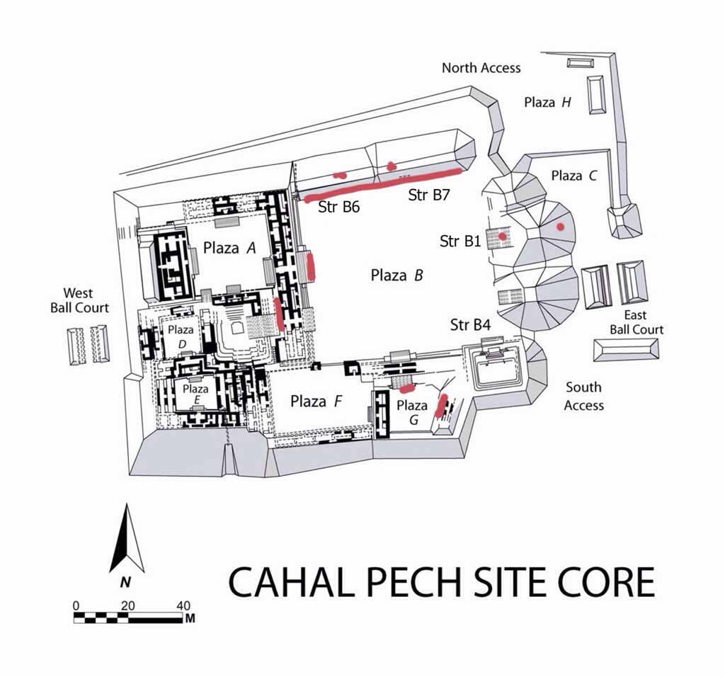
The Map of Cahal Pech. Credit: ambergriscaye.com
This little City is snug at the top of a mountain overlooking the towns of San Ignacio and Santa Elena, Cayo. The community has organised itself just around this “Place of the Ticks” as the name translates to English. This name was given to the site because when the researchers first started to work on it, it was the setting of a cattle grazing field and naturally, the ticks.
Cahal Pech is also one of the oldest Maya cities organised in Belize…since 1200BC.
EL PILAR (The Water Hole)

Map created by Raphael Guerra
CARACOL (Snail)
“Ox Witz a”, the Place of Three Hills – its better known as Caracol. Certainly the name today was given to it because of the roads (especially in 1938) when one would have to go there at a snail-pace. It is the largest Maya City in Belize. It hosts up to 3,000 buildings which would make it about the same size of the great city of Tikal (The Place of Voices) in Guatemala.
Caracol had up to 28 Kings that could be counted (maybe even more) but the city was notorious in middle part of the 500’sAD when for example, it helped Calakmul ( a site in Mexico) defeat Tikal.
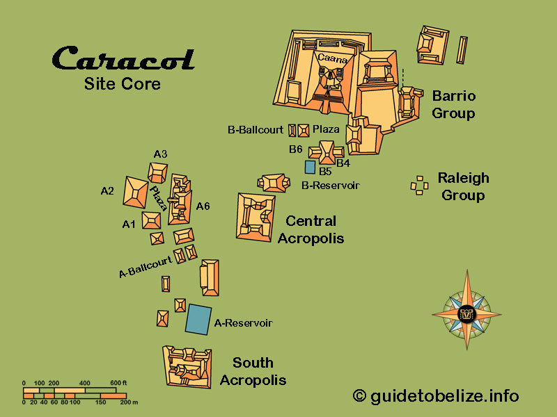
Map created by Raphael Guerra
XUNANTUNICH (Stone Lady)
This classic period site os one of the most visited site in Belize. A myth was the design of the name – the 4th name this site has acquired. In 2003, Dr. Jaime Awe, overseeing the Tourism Development Project in Belize, found a piece of a stela, excavating the Castillo that had a name in hieroglyphs which could possibly be the original name for the site: Kat Yatz Witz (Clay is the alms of the mountain) or shortened, Kat Witz, for Clay Mountain.

Map created by Raphael Guerra
ALTUN HA (Rock Stone Pond)
This is another one of Belize’s most visited sites – especially by Cruise Tourists who get transported to the site from Belize City. This site boasts the find of the largest inscribed jade piece in the Maya world. This jade piece weighed over 9 pounds and the art on it was the likeness of the Sun god, Kinich Ahau (the Lord of the day).

Map created by Raphael Guerra
LAMANAI (Submerged Crocodile)
This ancient city, located in Orange Walk (Northern Belize) is a popular site in the country (Cruise and overnight visitors). Lamanayan, is the original name and its one of the oldest sites in the country. In fact many cities were abandoned after 900AD and this ancient city was still going strong. In fact, it even has colonial architecture such as the remains of a Spanish Church and even a sugar cane mill.

Map Created by Raphael Guerra
CERROS (Hills)
What a beautiful little place – once a very basic village on one of the most absolutely gorgeous settings, the Corozal Bay, eventually, toward the last part of the pre classic period a king was chosen to manage this city that will control so much of the coastal trade.

Map Created by Raphael Guerra
LUBAANTUN (Fallen Stones)
This ancient Maya City is an interesting one. All other Maya cities, during their building, rubble fill rocks and cut stone blocks were brought together and secured by mortar – lime – limestone fired over 800 degrees fahrenheit turning it into dust, or cement. This City, interestingly had no such architectural organisation. The buildings were built solely, it seems, by placing rocks on top of each other in shaping the entire building.
While the above is fascinating, the “finding” of the Crystal Skull at this site really brought the city to the headlines of newspapers all over the world.
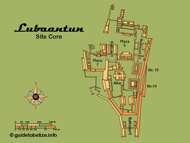
Map Created by Raphael Guerra
NIM LI PUNIT (Big Hat)
This Southern Belize site is impressive in that it is small and it hosted up to 26 stelae. “Big Hat” is the name translation from Kekchi, one of two Maya groups that make Toledo their homeland. The name comes from one of the art piece on a stele with an ancient Maya carved unto a stele with a enormous head dress.
Certainly to have that much stelae makes Nim Li Punit an important player in the social and political landscape of the ancient Maya. Something important made this city this prominent
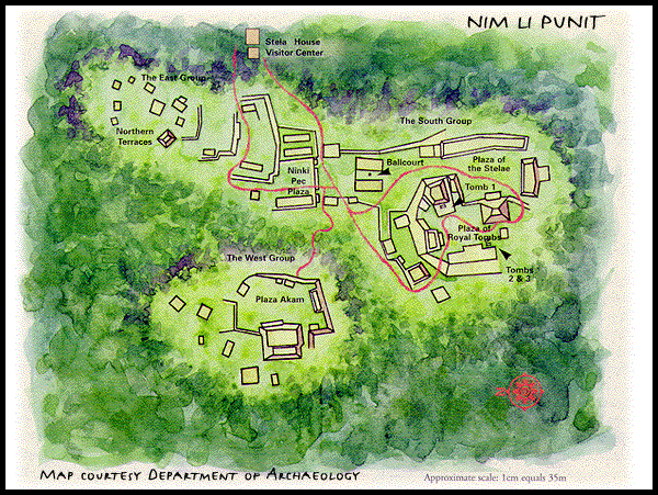
Maya Sites in Belize
![]() Print
Print ![]() PDF
PDF
![]() Email
Email