Tropical Storm Richard continues to struggle with dry air and wind shear, despite the fact that both of these influences have waned significantly today. However,
the storm is poised to begin a period of steady intensification that should take it to hurricane strength by Sunday. There have not been any hurricane hunter aircraft in Richard since late this morning, and we have to wait until 8pm tonight for the next mission to arrive. The closest buoy to Richard is
NOAA buoy 42057, which is about 80 miles north of the center. Winds at the buoy were 38 mph, gusting to 47 mph, at 3:43am EDT. Recent
satellite imagery shows that Richard has not changed much in organization today.
Water vapor satellite loops show considerable dry air to the west of Richard, and this dry air may cause some trouble for the storm over the next few days. The waters beneath Richard are very warm, 29°C.
 Figure 1.
 Afternoon satellite image of Richard.
Intensity forecast for RichardThe latest
SHIPS model forecast predicts that wind shear over the Western Caribbean will remain in the low range, 5 - 10 knots, Saturday through Monday. As the storm moves westwards on Saturday, it may draw close enough to coast of Honduras to hamper intensification. Assuming Richard avoids making landfall in Honduras, the light shear and warm waters that extend to great depth should allow Richard to intensify into a Category 1 hurricane by Sunday.
The 5pm NHC wind probability forecast is giving Richard a 7% chance of becoming a major Category 3+ hurricane. I believe the odds are higher, near 20%. The main inhibiting factor for intensification will be interaction with the north coast of Honduras, and the possibility of the dry air to the west of Richard getting wrapped into the core of the storm while it is trying to organize. A band of very strong upper-level winds associated with the jet stream will be over the Gulf of Mexico early next week, so it is likely that if Richard crosses into the Gulf of Mexico, the storm will be unable to intensify once it passes north of the latitude of the Florida Keys.
Track forecast for RichardThe latest set of 8am EDT (12Z) model runs are similar to the previous set of runs.
On Saturday, Richard will move west at an increasing rate of speed in response to a ridge of high pressure that is expected to build in over the Caribbean. This path will bring the center of Richard close to the northern coast of Honduras on Saturday and Sunday, resulting in very heavy rains of 3 - 7 inches along the coast. None of the models predict a more northwesterly path towards Cancun/Cozumel or the western tip of Cuba, and Florida is not at risk of Richard coming its way over the next five days.
The 5pm EDT NHC wind probability forecast is giving the highest odds for tropical storm-force winds at Guanaja in Honduras, at 70%. Belize City is next highest, at 65%, and the odds are 31% for Cozumel. If Richard never reaches hurricane strength, it may dissipate over the Yucatan Peninsula, as predicted by the NOGAPS and ECMWF models. If Richard does intensify into a hurricane, as predicted by the GFDL model, the storm may survive crossing the Yucatan, and emerge into the Gulf of Mexico on Tuesday. Very high wind shear associated with the jet stream is expected to be over the Gulf of Mexico next week, so if Richard begins moving north or northeast towards the U.S. Gulf Coast, dissipation before landfall is to be expected.
NAVY TRACK

LOVE FM
TROPICAL STORM RICHARD HEADS TOWARDS BELIZE
The entire coast of Belize is in the cone of uncertainty as Tropical Storm Richard has begun its westward track towards our area. Forecasters at the Belize Weather Bureau expect that on its current path, Tropical Storm conditions are likely to reach Belize by Sunday. Frank Tech is a senior forecaster with the National Meteorological Service.
Frank Tench Jr.; Forecaster
"I view the storms position and its current motion as a rick for the country and therefore and therefore a threat to our country this weekend. With the current projections suggesting that the storm will quite likely intensify to hurricane status during Sunday then we could be faces with at least a category one hurricane when it nears the coast of Belize quite like Sunday night or early Monday morning."
Tropical Storm Richard is located at latitude 16.2 degrees north and longitude 81.7 degrees west or about four hundred and forty miles east by south of Belize City. While the projections place Belize directly in Richard's way, Tench says there is the possibility that the projected path could shift.
Frank Tench
"Well if you notice the path is not just aligned but it is what's called a cone of probability and the further out beyond time in which you look at that probability the wider the cone of probability becomes. In effect it is saying the forecast becomes more reliable the further on you look at it. Beyond 72 hours then the range of possibilities extend much wider as far north as Cosumel and as far south as south of our border. That's the reason these forecasts are updated so frequently; three or four times per day and each time the forecast is updated the cone of probability gets modified. It is just a forecast, it's not something that's written in stone."
But just the same, Tench says weather conditions are favorable for the storm to intensify although it is harder to predict.
Frank Tench
"Intensity forecast are generally one of the hardest things to make an accurate forecast on so we could say intensification is possible but the level of intensification is still very difficult to forecast."
As Richard nears, the National Emergency Management Organization has issued its first public advisory, warning residents on the Cayes and along the coast who need to move to do so as early as possible. The Belizean public is advised to remain on high alert.
Frank Tench
"Maintain that high level of vigilance. Keep monitoring the reports and think about getting your emergency plan in place. If you have not activated it think about the window of opportunity you have to get that plan in place which to my mind would be no later than Saturday."
AMANDALA
 There is a new tropical system in the Caribbean this week that could threaten Belize as early as Sunday night. According to the National Meteorological Service, as of 9 p.m. tonight, Richard’s location was at 15.9° North Latitude and 80.5° West Longitude.
This roughly translates to its location being 240 miles south of the Grand Cayman Islands, or approximately 521 miles East Southeast of Belize City.
Its maximum sustained wind speed is 40 miles per hour, with a minimum central pressure of 1005 milibars moving south southeast at 2 miles per hour. Experts think that the system will make a gradual turn to the south southwest, and begin to head west.
According to most projected paths, the districts of Stann Creek, all the way up to Corozal, are under potential threat and we should monitor this system carefully.
Richard is expected to strengthen and may become a hurricane over the weekend, because as it moves toward the Yucatan Peninsula, conditions for development are more favorable. The National Meteorological Service expert told us Richard is next to stationary at this point.
According to the National Hurricane Center in Miami, if conditions are favorable, it is expected to reach maximum sustained winds of 60 miles per hour by Friday evening, and become a hurricane by Saturday evening.
CHANNEL 7
TS Richard Sets Sights On Belize
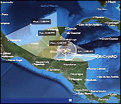 Are you ready for Hurricane Richard? Well you'd better be! The weather system that sits 409 miles southeast of Belize city is only a tropical Storm tonight, but the weather experts when the storm hits Belize - and they say this one will hit - it will be at least a category one storm.
At 6:00 pm, hurricane hunter aircraft found the storm moving west at 5 miles an hour with maximum sustained winds of 45 miles an hour.
This evening Monica Bodden spoke to Meteorologist Frank Tench - who discussed the forecast based on the 3:00 pm update:�
Frank Tench, Meteorologist
 "At 3 o' clock this afternoon Tropical Storm Richard was near latitude 16.2 degrees north and longitude 81.7 degrees west which is about 440 miles east by south of Belize City, 437 miles east by south of Dangriga and 432 miles east by south of San Pedro Ambergris Caye. The storm has strengthen a little bit since this morning, maximum sustain are near 45 miles per hour and its moving a little faster moving west at 5 miles per hour, still very slow but a bit faster that it has been moving the last few days. The current projection does have the storm likely to make a impact of some part of the coastline late Sunday night or early Sunday morning and intensification into a hurricane strength is quite like to occur during Sunday, most likely Sunday afternoon. Currently the storm has tropical storm force winds that extend 105 mile out from the center and if it intensifies further the radius of those tropical storm force winds will quite likely increase so it's a storm that we have to treat with a high degree of caution and my advice to the general Belizean public would be to be very vigilant and to monitor closely the reports being issued by radio and television this weekend."
At 6:00 pm - the latest forecast from The National Hurricane Center in Miami put the storm 409 miles southeast of Belize City moving west at 5 miles an hour with maximum winds of 45 miles an hour.
The Preliminary Phase and a Tropical Storm Watch was declared for the entire coast of Belize at 3:00 p.m. today.
NEMO is on 'HIGH ALERT' as it continues to monitor Tropical Storm Richard.
According to a NEMO advisory, "the public is being advised of further deteriorating weather conditions as Richard moves nearer to Belize.
People on the Cayes and along the coast who need to move are advised to do so early. "
It continues to say that:
"Public Officers are being asked to remain alert and be ready for deployment. All government vehicles must be fueled and parked at the Ministry of Works compound in their respective district."
CHANNEL 5
Will Tropical Storm or Hurricane Richard pass through Belize?
 So far this year we have been spared, but a tropical storm churning in the Western Caribbean could potentially spell trouble for the country. Tropical Storm Richard is displaying the same troubling pattern as Hurricane Mitch that loomed in front of Belize for days in 1999. Mitch didn't directly hit Belize but it caused enough damages which took years to recover from. At news time it is forecasted that Richard will become a hurricane by Sunday, worst yet, it's currently on a direct path to Belize. At six o'clock this evening, the storm was moving at five miles per hour with winds of over forty-five miles per hour. Richard is hovering in front of the Honduras/Nicaragua border some four hundred and forty miles east of Belize City. If it continues on this path, it is expected to rip through Belize early Monday morning as a strong category one hurricane with winds of up to eighty miles an hour. The entire nation is under watch at this time. News Five's Marion Ali reports.
Marion Ali, Reporting
At three o'clock this afternoon the plain red flag was hoisted, signifying the first alert in anticipation of Tropical Storm Richard. Richard's projected path has it crossing over Belize early Monday morning as a category one hurricane.
Dennis Gonguez, Chief Meteorologist
"The earlier track forecasts took it north of Belize into Mexico, however, the consensus of all the models now is that this system will impact Belize some way or the other. All of them are pointing through Belize and the tropical storm force winds extend a hundred and five miles out from the centre. So that's almost our entire coastline, so whichever of Belize it might make landfall, it might have impact on the entire coastline."
Marion Ali
"What is the worse-case scenario now?"

Dennis Gonguez
Dennis Gonguez
"A category one going directly through Belize City."
With this latest development, the National Emergency Management Organization is asking party fans and all Belizeans on a whole to include the airwaves a part of their weekend agenda as the storm inches closer to land. Richard poses the most serious threat to Belize this year. In the meantime, NEMO Coordinator, Noreen Fairweather, says coordinators countrywide are already on high alert.
Noreen Fairweather, Coordinator, NEMO
"All systems are in place, they have received this brief already in terms of what the storm is doing and all our contacts in terms of folks that look at transportation, the bus people, the people with boats, you name it, whatever it is that we need out there to mobilize people or to evacuate people are redoing those contacts again, ensuring that everybody that is part of the team and support the NEMO operations is alert and ready."

Noreen Fairweather
Fairweather says in the event the storm hits Belize, NEMO has pre-positioned supplies at its warehouses across the country in case there is a need for distribution to affected people.
Noreen Fairweather
"We have supplies on hand and we do have additional arrangements with the good and supplies providers in country in the event we need to tap into that over the long term, then those persons are there as well to give us that support."
While NEMO focuses on a more national approach, the northern coastal municipalities in most danger of Richard's wrath, Belize and Corozal, are already in action. Here in Belize City, the City Emergency Management Organization advises residents to be responsible when they go to the shelters.

Roger Espejo
Roger Espejo, CEMO Coordinator
"People have to be ready in terms of supplies for two to three days if it does come down to that and that is something very mundane something relatively easy to do. CEMO arranges logistics. CEMO opens shelters if needs be. In terms of supplies, if supplies are necessary. If the weather develops after three days and it comes on shore again and it gets out of hand and it becomes a larger storm, then CEMO does have a backup plan, absolutely."
But just in the event you would still like to venture elsewhere away from home to weather the storm, NEMO urges all to move early so as to avoid a bottleneck on the roadways. Marion Ali for News Five.
The shelters in Belize City are: All Saints Primary, Grace Primary, Queen's Square Primary, Salvation Army Primary, St. Ignatius Primary, St. John Vianney Primary, St. Martin de Porres Primary, Trinity Methodist Primary, Maud Williams High, Gwen Liz High, and Pallotti High. The shelters are capable of withstanding a storm with the strength of category two force winds.
Channel 5


 AmbergrisCaye.com






![[Linked Image]](http://www.nrlmry.navy.mil/atcf_web/image_archives/2010/al192010.10102306.gif)