1909 British Honduras Road & Lighthouse Plan This map was made in 1909. The interesting thing about this map is that it shows highways before they were established. The map also shows seventeen lighthouses. I don’t recall seeing lighthouses in some of those places. If all of those lighthouses were established, it would have made British Honduras a true haven for Balisies (French for beacon/lighthouses). The highways are interesting because most of our highways were built in the same locations that they were placed on this 1909 map. The Phillip Goldson bypass (circa 1960s) to the Maskal Road which was built after the Maskal Road (1920) was already on the map. The Boom Road was there. There was another road from Hattieville to Belize City but that was never constructed. The highway they were considering making two years ago from Cayo to Orange Walk is on the map. There is no Hummingbird Highway. Hummingbird must have been an afterthought. The road between La Democracia and Hope Creek we call the Coastal Road is not exactly a Coastal Road because it is not on the coast as such, but it seems the plan was to build a true coastal road from Belize City to Gales Point and then to Mullins River. They must have scrapped that plan after Hurricane Hattie disappeared Mullins River from the face of the map. I am not sure why they changed the boundaries of the Cayo and Stann Creek Districts. |

 |
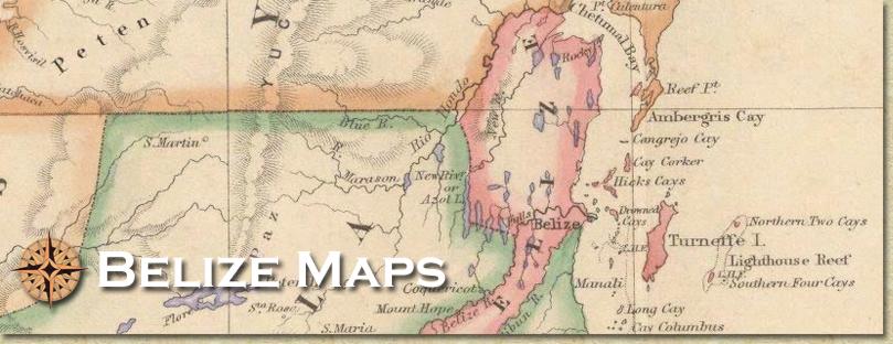
Maps of Belize and Ambergris Caye |
 |

|