General Situation:
Ambergris Caye: Conditions this morning by Elbert just before or after this post!
Belize NMS:
Present Condition: Mostly cloudy skies this morning. Mostly clear and windy in San Pedro. Moist and unstable conditions prevail over the country.
Advisories: None.
24-hour forecast:
Some cloudy spells with a few showers and isolated showers mostly over inland areas today with a slight decrease this afternoon. Then activity will increase over the south tonight while being isolated elsewhere.
Winds: SE, 10-20 kts Sea State:
Choppy
Waves: 3-5 ft.
Sea Surface Temperature (°f): 86
Outlook:
Generally isolated showers and isolated thunderstorms for Monday. Then some showers, a few thunderstorms and periods of rain will affect the country Monday night.
Sargassum Forecast from June 23 to June 30:
Satellite imagery continue to show high sargassum contents over our area and as a result the chances of sargassum landing on beaches across the country will remain high during the next few days. San Pedro has a high probability and a major impact.
Tropical Weather Outlook:
Tropical cyclone formation is not expected in the North Atlantic, the Caribbean Sea or the Gulf of Mexico during the next 48 hours.
Click for more...
Marine Conditions:
Live Beach Cam at Blue Water Grill
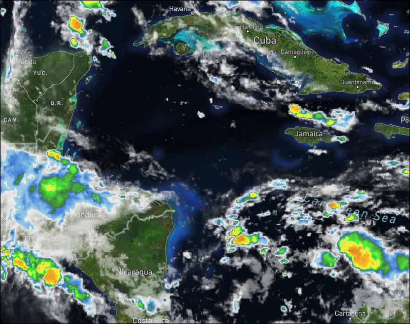
The Caribbean Sea
Convection over the Caribbean is primarily associated with
tropical waves. A relatively weak pressure
gradient spans the Caribbean Sea with moderate trades dominating.
The exception is over the SE Caribbean between 11N and 15N between
61W and 66W, where fresh to locally strong E winds are occurring.
The sea heights have been in the range of 3 feet to 5 feet in the
central and eastern sections, with 2 feet to 3 feet covering the
NW corner of the Caribbean Sea.
The monsoon trough extends from 10N74W in Colombia, to 11N85W in
northern Costa Rica, to beyond 10N90W in the eastern Pacific
Ocean. Scattered moderate convection is noted S of 15N and W of
75W.
The tropical wave currently south of Haiti will move westward
across the basin through Mon. This pattern will support moderate
to fresh trade winds over the south central Caribbean and off
Honduras early week, with gentle to moderate trade winds
elsewhere. Winds will increase and seas will build slightly in
most areas by the middle of next week as high pressure north of
the basin extends into the basin in the wake of the tropical wave.
Another tropical wave may approach the Lesser Antilles late in the
week.
For the North Atlantic...Caribbean Sea and the Gulf of Mexico:
The Atlantic basin remains mostly quiet with no organized tropical systems at this time. However, there are a couple of areas of concern in which we are monitoring for possible tropical development over the next few days.
The strong tropical wave that moved off the coast of Africa on Friday continues to move into an area less favorable for tropical development, though the threat for this to become a tropical depression is slightly up. Regardless, we will continue to watch this wave as it moves across the Atlantic, eventually reaching the Lesser Antilles around the middle of next week bringing breezy conditions with showers and thunderstorms.
In the long range, we continue to monitor for possible tropical development around the middle to end of next week in the far northwestern Caribbean Sea or southwestern Gulf of Mexico.
For further information on tropical conditions, check the daily Tropical Weather Outlook, click here.
The opinions and views expressed on this board are the subjective opinions of Ambergris Caye Message Board members and not of the Ambergris Caye Message Board its affiliates, or its employees.


 General Situation: