|
|
Joined: Oct 1999
Posts: 84,398
|
OP

|
Belize Weather Forecast: July 23, 2021


 General Situation:
Ambergris Caye: Conditions this morning by Elbert just before or after this post!
Belize NMS:
Present Condition: Partly cloudy this morning, less so in the far north. Clearing as the day goes on. Mostly clear in San Pedro. Generally fair weather prevails.
Advisories: None.
24-hour forecast:
Sunny today and partly cloudy skies tonight. Showers or thunderstorms will be isolated.
Winds: E-NE, 5-15 kts
Sea State:
Light Chop
Waves: 2-4 ft
Sea Surface Temperature (°f): 85
Outlook:
For Saturday and Saturday night is for only isolated showers.
Sargassum Forecast from July 20 to July 28:
There continues to be a medium chance of sargassum affecting beaches mainly over the northern parts of the country. San Pedro has a medium probability and a moderate impact.
Tropical Weather Outlook:
Tropical cyclone formation is not expected in the North Atlantic, the Caribbean Sea or the Gulf of Mexico within the next 48 hours.
Click for more...
Marine Conditions:

The Caribbean Sea
A Gale Warning is in effect for the south-central Caribbean. Fresh to strong trades prevail across most of the central
Caribbean to 80W, including the Windward Passage, and the Gulf of
Honduras, with fresh trades in the eastern Caribbean. Gentle to
moderate winds are found elsewhere. Seas are 7-11 ft in the
central Caribbean and 5-7 ft elsewhere, except for 2-4 ft south of
Cuba. Fresh to strong easterly trades are building in across the
NE Caribbean behind the tropical wave along 67W, and will bring
scattered afternoon convection to the area today.
High pressure centered across the central Atlantic extends W-SW
to central Florida and is combining with low pressure over N
Colombia to support fresh to strong E winds over the central
Caribbean. Gale force winds north of Colombia will end early this
morning. The pressure gradient south of the ridge will support fresh
to strong winds across the central Caribbean today. The ridge will
weaken west of 75W this afternoon through early next week as a
weak frontal system and low pressure move offshore of Georgia and
Florida and meander through the weekend, weakening the pressure
gradient across the basin.
| |
High |
Low |
| Coastal |
31° C
88° F
|
27° C
79° F
|
| Inland |
34° C
93° F
|
22° C
72° F
|
| Hills |
28° C
82° F
|
20° C
68° F
|
| TIDES: |
|
| High: 8:53 AM |
Low: 4:11 PM |
| High: 10:45 PM |
Low: 3:13 AM (Sat) |
| Sunrise: 5:29 AM |
Moonset: 4:49 AM |
| Sunset: 6:28 PM |
Moonrise: 6:31 PM |

Four Day Weather Outlook:

Winds:
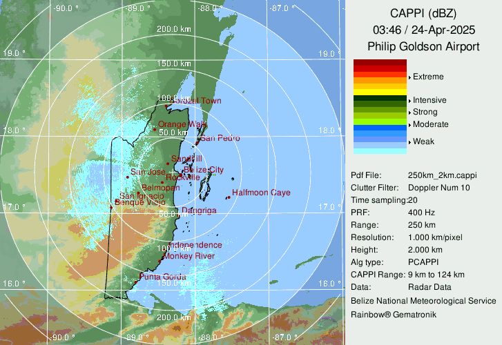
250 Km Radar Picture
(Time Label on picture is GMT. Local time is GMT-6 Hours)
For more information, check the Daily Tropical Weather Outlook.
Climate Prediction Center's Central America Hazards Outlook
Belize National Emergency Management Organization (NEMO)
Ambergris Caye:
https://www.wunderground.com/weather/bz/san-pedro
Philip S W Goldson International Airport:
https://www.wunderground.com/weather/bz/belize/MZBZ?cm_ven=localwx_today
Belmopan:
https://www.wunderground.com/weather/bz/belmopan/17.26%2C-88.78
Caye Caulker:
http://cayecaulkerweather.com/weatherdata/caye-caulker-belize-live-weather-data.htm

For the North Atlantic...Caribbean Sea and the Gulf of Mexico:
A disturbance over southeast Georgia may have a low chance of developing some tropical characteristics this weekend off the coast of the southeastern United States or far eastern Gulf of Mexico. With warm water and relatively low wind shear, conditions may just be conducive enough for some modest tropical development right near the coast. Regardless, heavy tropical downpours are expected to impact parts of the region through the weekend.
Otherwise, tropical development is not anticipated through at least the end of the week, mainly due to a broad area of Saharan dust over much of the Atlantic basin.
There are a few waves moving westward through the basin, but none of those waves show any signs of organizing.


For further information on tropical conditions, check the daily Tropical Weather Outlook, click here.
|
|
|
|
|
|
Joined: Oct 1999
Posts: 84,398
|
|
OP
|
Multiple tropical waves are tracking across the Atlantic Ocean basin, and will bring periodic (on/off) squally weather this weekend into mid-week next week, July 22-27, 2021. However, no cyclone formation is anticipated ![[Linked Image]](//Ambergriscaye.com/art8/220695589_4441822582537252_5162844964280288729_n.jpg)
|
|
|
|
|
Joined: Oct 1999
Posts: 84,398
|
|
OP
|
The Caribbean winds are now coming down from the NE and they have patches of significant clouds. There a a lot of high level cloud from the SW and other coming up from ITCZ activity over Honduras. Today Looks as if it will be mainly cloudy today, and patches of rain occurring through much of the day Tonight Probably continuing into the night ![[Linked Image]](//Ambergriscaye.com/art8/belmopanwx210723.jpg) Temperatures in Belmopan : (Coast usually cooler, hills even cooler) Last Night 26°C 78°F Yesterday max. 32°C 89°F Yesterday Rain 0.2 mm (0.01") Over Night Rain 0.4 mm (0.02")
|
|
|
|
|
Joined: Oct 1999
Posts: 84,398
|
|
OP
|
Present Condition: Mostly cloudy, including in San Pedro. A slightly moist northeasterly airflow prevails over the area. 24hr Forecast: Cloudy spells with a few showers and isolated thunderstorms mainly over the south. Elsewhere showers or thunderstorms will be isolated. Outlook: For Saturday afternoon to Sunday midday is for mostly fair and warm weather conditions to prevail. ![[Linked Image]](//Ambergriscaye.com/art8/dailywx210723b.jpg) ![[Linked Image]](//Ambergriscaye.com/art8/dailywx210723c.jpg) ![[Linked Image]](//Ambergriscaye.com/art8/dailywxB210723.jpg)
|
|
|
|
|
Joined: Oct 1999
Posts: 84,398
|
|
OP
|
Flood Forecast Report for today July 23, 2021
River Conditions
REGION 7 - Levels recorded today on the RIO HONDO at Blue Creek, San Antonio, San Roman, Santa Cruz and Douglas to the Coast are near normal and steady. On the NEW RIVER at Tower Hill and at Caledonia, levels are normal and steady.
REGION 9 - On the MACAL RIVER, reservoir levels at all BECOL facilities are below the spillways; and at San Ignacio, levels remain below the low-level bridge and steady. Levels on the MOPAN RIVER at Benque Viejo Town is near normal and steady.
Levels on the BELIZE RIVER at the Double Run is below normal and steady. The CROOKED TREE LAGOON remains below the causeway and increasing slowly.
REGION 11 - Levels recorded on the SIBUN RIVER at Freetown Sibun is below normal and rising. Levels on the SOUTHERN LAGOON near Gales Point Village is normal and steady. River levels in watersheds on the EASTERN SLOPES OF THE MAYAN MOUNTAINS is normal and steady. The SITTEE RIVER at Kendal Bridge is near normal levels. The Swasey and Bladen branches of the MONKEY RIVER is below normal. Levels on the DEEP RIVER at Medina Bank is below normal and decreasing. The RIO GRANDE at San Pedro Columbia is above normal and steady; and at Big Falls South, levels are above normal and receding. Levels on the MOHO RIVER at Blue Creek South and Jordan are above normal and receding. Levels on the TEMASH RIVER at Crique Sarco is above normal.
REGION 13 - On the SARSTOON RIVER, levels are above normal.
FLOOD FORECAST
REGION 7 - Levels on the RIO HONDO at Blue Creek, San Antonio, San Roman, Santa Cruz and Douglas to the Coast, are expected to increase to above normal levels. On the NEW RIVER at Tower Hill and at Caledonia, levels are expected to increase to above normal levels.
REGION 9 - On the MACAL RIVER, at all BECOL facilities, reservoir levels are expected to remain below the spillways; and at San Ignacio, levels are expected to remail below the low-level bridge. On the MOPAN RIVER at Benque Viejo Town, levels are expected to increase to above normal.
On the BELIZE RIVER at Double Run, increasing river levels is expected; and on the CROOKED TREE LAGOON, expected to remain below the causeway with minimal increase in levels.
REGION 11- On the SIBUN RIVER at Freetown Sibun, levels are expected to increase to above normal levels. On the SOUTHERN LAGOON near Gales Point Village, lagoon levels are expected to increase minimally. In the watersheds on the EASTERN SLOPES OF THE MAYAN MOUNTAINS river levels are expected to increase. The SITTEE RIVER at Kendal Bridge is expected to increase to above normal levels. On the Swasey and Bladen branches of the MONKEY RIVER, above normal levels are expected. On the RIO GRANDE at San Pedro Columbia and Big Falls South levels are expected to increase. On the MOHO RIVER at Blue Creek South and Jordan, above normal levels are expected to continue. On the TEMASH RIVER at Crique Sarco, above normal level is expected to continue.
REGIONS 13 - On the SARSTOON RIVER, levels are expected to remain at above normal levels.
THE NEXT FLOOD REPORT AND FORECAST WILL BE ISSUED ON JULY 26, 2021
|
|
|
|
S |
M |
T |
W |
T |
F |
S |
|
|
1
|
2
|
3
|
4
|
5
|
6
|
|
7
|
8
|
9
|
10
|
11
|
12
|
13
|
|
14
|
15
|
16
|
17
|
18
|
19
|
20
|
|
21
|
22
|
23
|
24
|
25
|
26
|
27
|
|
28
|
29
|
30
|
|
|
|
|
|
|
0 members (),
160
guests, and
0
robots. |
|
Key:
Admin,
Global Mod,
Mod
|
|
|
Forums44
Topics79,205
Posts500,031
Members20,471
| |
Most Online7,413
Nov 7th, 2021
|
|
|
|

![[Linked Image]](http://Ambergriscaye.com/art8/220695589_4441822582537252_5162844964280288729_n.jpg)
![[Linked Image]](http://Ambergriscaye.com/art8/belmopanwx210723.jpg)
![[Linked Image]](http://Ambergriscaye.com/art8/dailywx210723b.jpg)
![[Linked Image]](http://Ambergriscaye.com/art8/dailywx210723c.jpg)
![[Linked Image]](http://Ambergriscaye.com/art8/dailywxB210723.jpg)


