|
| 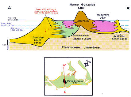 Rick Dunn and I collected and studied many soft-sediment cores from around the site to describe the geological history of the area. A representative cross section across the site shows the different layers of sediment that are present above the limestone bedrock. The windward (frontside) beach is relatively young, and in this area appears to have been deposited around 750 years ago. From 3800 to about 2000 years ago, when the site was islands surrounded by shallow water, the floor of the sea was covered by sands and muds much like those that exist offshore of Ambergris Caye today. Mangrove peat swamp deposits overlie these sediments, and are evidence that the coastal geography changed from open, shallow sea to restricted swamp about 1000 years ago. The presence of artifacts below present sea level, beneath the mangrove peats, indicates that the habitable area of the site was larger in the past than now; and that the Maya moved to progressively higher ground as sea level rose and the swamps encroached upon them. A diagrammatic history of deposition and coastal changes over the last 3800 years is shown below. 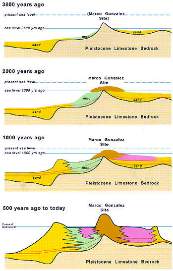 by Dr. S. J. Mazzullo, Department of Geology, Wichita State University, Wichita, Kansas |

|